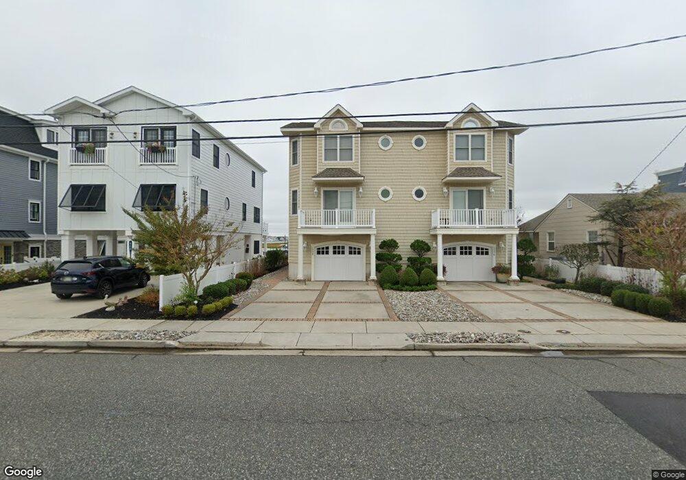
1778 Ocean Dr Unit A Avalon, NJ 08202
Estimated Value: $2,806,871 - $3,490,000
--
Bed
--
Bath
2,207
Sq Ft
$1,437/Sq Ft
Est. Value
About This Home
This home is located at 1778 Ocean Dr Unit A, Avalon, NJ 08202 and is currently estimated at $3,172,468, approximately $1,437 per square foot. 1778 Ocean Dr Unit A is a home located in Cape May County with nearby schools including Avalon Elementary School.
Ownership History
Date
Name
Owned For
Owner Type
Purchase Details
Closed on
Aug 13, 2011
Sold by
Sma Partners Llc
Bought by
Kelly Stephen E and Kelly Michelle M
Current Estimated Value
Home Financials for this Owner
Home Financials are based on the most recent Mortgage that was taken out on this home.
Original Mortgage
$992,000
Outstanding Balance
$651,620
Interest Rate
3.5%
Mortgage Type
Adjustable Rate Mortgage/ARM
Estimated Equity
$2,520,848
Purchase Details
Closed on
Oct 26, 2010
Sold by
Molino Santo
Bought by
Sma Partners Llc
Purchase Details
Closed on
Jan 26, 2004
Sold by
S M A Land Developers Llc
Bought by
Molino Santo
Purchase Details
Closed on
Jan 15, 2003
Sold by
Barker Ralph M
Bought by
Sma Land Developers Llc
Home Financials for this Owner
Home Financials are based on the most recent Mortgage that was taken out on this home.
Original Mortgage
$1,408,000
Interest Rate
5.91%
Create a Home Valuation Report for This Property
The Home Valuation Report is an in-depth analysis detailing your home's value as well as a comparison with similar homes in the area
Home Values in the Area
Average Home Value in this Area
Purchase History
| Date | Buyer | Sale Price | Title Company |
|---|---|---|---|
| Kelly Stephen E | $1,350,000 | Stewart Title Guaranty Co | |
| Sma Partners Llc | $400,000 | None Available | |
| Molino Santo | -- | Fidelity National Title Insu | |
| Sma Land Developers Llc | $1,100,000 | -- |
Source: Public Records
Mortgage History
| Date | Status | Borrower | Loan Amount |
|---|---|---|---|
| Open | Kelly Stephen E | $992,000 | |
| Previous Owner | Sma Land Developers Llc | $1,408,000 |
Source: Public Records
Tax History Compared to Growth
Tax History
| Year | Tax Paid | Tax Assessment Tax Assessment Total Assessment is a certain percentage of the fair market value that is determined by local assessors to be the total taxable value of land and additions on the property. | Land | Improvement |
|---|---|---|---|---|
| 2025 | $7,762 | $1,264,200 | $950,000 | $314,200 |
| 2024 | $7,762 | $1,264,200 | $950,000 | $314,200 |
| 2023 | $7,699 | $1,264,200 | $950,000 | $314,200 |
| 2022 | $7,181 | $1,264,200 | $950,000 | $314,200 |
| 2021 | $6,915 | $1,264,200 | $950,000 | $314,200 |
| 2020 | $6,650 | $1,264,200 | $950,000 | $314,200 |
| 2019 | $6,447 | $1,264,200 | $950,000 | $314,200 |
| 2018 | $6,169 | $1,264,200 | $950,000 | $314,200 |
| 2017 | $6,600 | $1,187,000 | $900,000 | $287,000 |
| 2016 | $6,529 | $1,187,000 | $900,000 | $287,000 |
| 2015 | $6,422 | $1,187,000 | $900,000 | $287,000 |
| 2014 | $6,350 | $1,187,000 | $900,000 | $287,000 |
Source: Public Records
Map
Nearby Homes
- 415 20th St
- 178 19th St
- 890 21st St
- 389 22nd St
- 440 21st St Unit South (B)
- 211 23rd St
- 128 16th St
- 503 20th St
- 279 13th St Unit C-6
- 279 13th St
- 297 24th St Unit 297
- 297 24th St
- 2425 Harbor Ave Unit 2425
- 431 24th St
- 174 23rd St
- 76 21st St W
- 161 24th St
- 212 25th St
- 212 25th St Unit East Unit
- 34 13th St W
- 1790 Ocean Dr
- 1776 Ocean Dr Unit B
- 1796 Ocean Dr
- 1752 Ocean Dr
- 1808 Ocean Dr
- 1777 Ocean Dr Unit B2
- 1777 Ocean Dr Unit A1
- 1777 Ocean Dr Unit B1
- 1777 Ocean Dr Unit 2B
- 1777 Ocean Dr Unit 2B
- 1777 Ocean Dr
- 1779 Ocean Dr Unit B4
- 1779 Ocean Dr Unit B1
- 1779 Ocean Dr Unit B3
- 1779 Ocean Dr Unit A2
- 1779 Ocean Dr Unit B2
- 1779 Ocean Dr Unit A1
- 1818 Ocean Dr
- 1719 Ocean Dr Unit 2
- 1719 Ocean Dr Unit 1