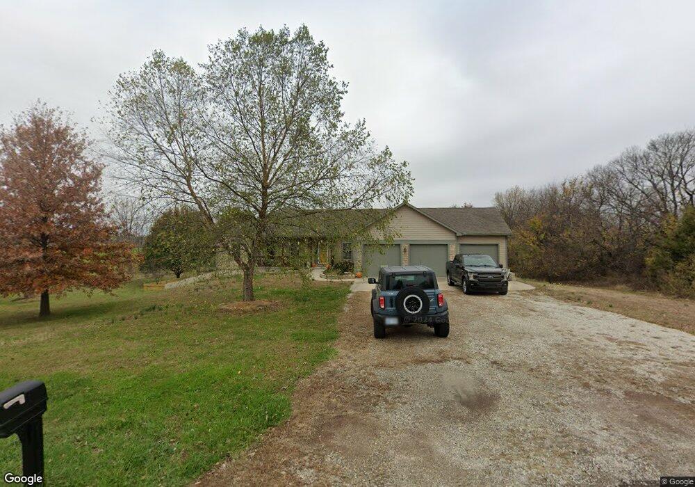
17789 189th St Tonganoxie, KS 66086
Estimated Value: $558,126 - $799,000
3
Beds
3
Baths
2,088
Sq Ft
$322/Sq Ft
Est. Value
About This Home
This home is located at 17789 189th St, Tonganoxie, KS 66086 and is currently estimated at $671,532, approximately $321 per square foot. 17789 189th St is a home located in Leavenworth County with nearby schools including Tonganoxie Elementary School, Tonganoxie Middle School, and Tonganoxie High School.
Ownership History
Date
Name
Owned For
Owner Type
Purchase Details
Closed on
May 9, 2008
Sold by
Himpel Arthur W and Himpel Mary E
Bought by
Barnett Michael H and Barnett Christy J
Current Estimated Value
Home Financials for this Owner
Home Financials are based on the most recent Mortgage that was taken out on this home.
Original Mortgage
$279,630
Outstanding Balance
$177,181
Interest Rate
5.89%
Mortgage Type
New Conventional
Estimated Equity
$494,351
Create a Home Valuation Report for This Property
The Home Valuation Report is an in-depth analysis detailing your home's value as well as a comparison with similar homes in the area
Home Values in the Area
Average Home Value in this Area
Purchase History
| Date | Buyer | Sale Price | Title Company |
|---|---|---|---|
| Barnett Michael H | $349,537 | Old Republic Title |
Source: Public Records
Mortgage History
| Date | Status | Borrower | Loan Amount |
|---|---|---|---|
| Open | Barnett Michael H | $279,630 |
Source: Public Records
Tax History Compared to Growth
Tax History
| Year | Tax Paid | Tax Assessment Tax Assessment Total Assessment is a certain percentage of the fair market value that is determined by local assessors to be the total taxable value of land and additions on the property. | Land | Improvement |
|---|---|---|---|---|
| 2025 | $6,865 | $63,097 | $13,870 | $49,227 |
| 2024 | $6,637 | $60,670 | $10,452 | $50,218 |
| 2023 | $6,637 | $58,903 | $9,877 | $49,026 |
| 2022 | $6,038 | $52,314 | $8,821 | $43,493 |
| 2021 | $5,416 | $46,345 | $7,251 | $39,094 |
| 2020 | $4,959 | $42,285 | $7,662 | $34,623 |
| 2019 | $4,719 | $40,940 | $7,087 | $33,853 |
| 2018 | $4,376 | $37,962 | $6,109 | $31,853 |
| 2017 | $4,411 | $37,962 | $6,109 | $31,853 |
| 2016 | $4,144 | $35,596 | $6,109 | $29,487 |
| 2015 | $3,924 | $33,849 | $6,109 | $27,740 |
| 2014 | $3,844 | $33,849 | $6,568 | $27,281 |
Source: Public Records
Map
Nearby Homes
- 18941 Ward Pkwy
- 0 State Avenue Evans Rd N A Unit HMS2514367
- 18171 198th St
- 17249 198th St
- 17894 169th St
- 16667 Orchard Rd
- RC Greenfield Plan at Stone Creek
- RC Keswick Plan at Stone Creek
- RC Mitchell Plan at Stone Creek
- RC Baltimore Plan at Stone Creek
- RC Cooper Plan at Stone Creek
- RC Armstrong Plan at Stone Creek
- RC Bridgeport Plan at Stone Creek
- RC Beaumont Plan at Stone Creek
- RC Pickett Plan at Stone Creek
- RC Somerville Plan at Stone Creek
- RC Cypress II Plan at Stone Creek
- 2134 Woodfield Dr
- 1940 E Finch Dr
- 2102 Brook Ridge Cir
- 17788 189th St
- 17774 190th St
- 17778 189th St
- 17779 189th St
- 18920 S Glenn Rd
- 17773 190th St
- 17730 189th St
- 18958 S Glenn Rd
- 18841 S Glenn Rd
- 18951 S Glenn Rd
- 18961 S Glenn Rd
- 18831 S Glenn Rd
- 17590 190th St
- 17590 188th Terrace
- 17651 190th St
- 17520 190th St
- 17560 188th Terrace
- 17530 188th Terrace
- 17492 190th St
- 17517 190th St