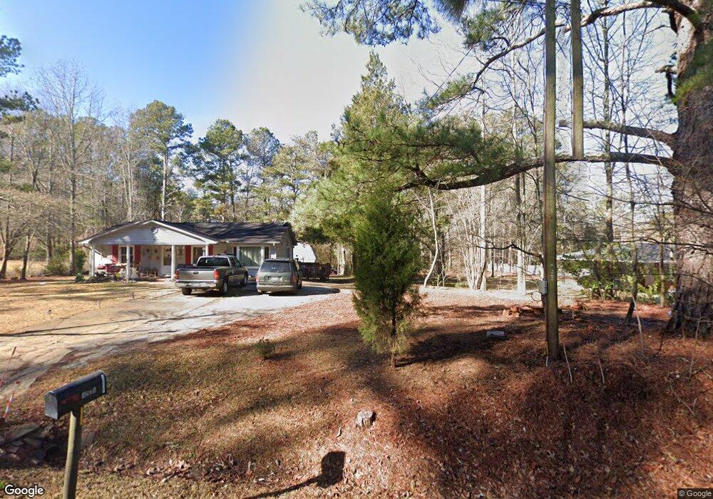
1779 S Flat Rock Rd Douglasville, GA 30134
Estimated Value: $242,000 - $279,000
3
Beds
2
Baths
1,277
Sq Ft
$204/Sq Ft
Est. Value
About This Home
This home is located at 1779 S Flat Rock Rd, Douglasville, GA 30134 and is currently estimated at $261,019, approximately $204 per square foot. 1779 S Flat Rock Rd is a home located in Douglas County with nearby schools including North Douglas Elementary School, Stewart Middle School, and Douglas County High School.
Ownership History
Date
Name
Owned For
Owner Type
Purchase Details
Closed on
Nov 25, 1997
Sold by
B & R Homes Inc
Bought by
Minter Brent R and Jones Michelle M
Current Estimated Value
Home Financials for this Owner
Home Financials are based on the most recent Mortgage that was taken out on this home.
Original Mortgage
$93,300
Outstanding Balance
$15,826
Interest Rate
7.26%
Mortgage Type
FHA
Estimated Equity
$245,193
Create a Home Valuation Report for This Property
The Home Valuation Report is an in-depth analysis detailing your home's value as well as a comparison with similar homes in the area
Home Values in the Area
Average Home Value in this Area
Purchase History
| Date | Buyer | Sale Price | Title Company |
|---|---|---|---|
| Minter Brent R | $94,900 | -- |
Source: Public Records
Mortgage History
| Date | Status | Borrower | Loan Amount |
|---|---|---|---|
| Open | Minter Brent R | $93,300 |
Source: Public Records
Tax History Compared to Growth
Tax History
| Year | Tax Paid | Tax Assessment Tax Assessment Total Assessment is a certain percentage of the fair market value that is determined by local assessors to be the total taxable value of land and additions on the property. | Land | Improvement |
|---|---|---|---|---|
| 2024 | $1,781 | $72,960 | $13,720 | $59,240 |
| 2023 | $1,781 | $72,960 | $13,720 | $59,240 |
| 2022 | $1,543 | $58,120 | $9,800 | $48,320 |
| 2021 | $1,333 | $47,480 | $9,800 | $37,680 |
| 2020 | $1,359 | $47,480 | $9,800 | $37,680 |
| 2019 | $1,267 | $46,480 | $9,800 | $36,680 |
| 2018 | $1,243 | $45,040 | $9,800 | $35,240 |
| 2017 | $1,160 | $40,080 | $9,000 | $31,080 |
| 2016 | $1,096 | $37,280 | $8,640 | $28,640 |
| 2015 | $1,076 | $36,000 | $8,640 | $27,360 |
| 2014 | $1,042 | $34,360 | $10,480 | $23,880 |
| 2013 | -- | $34,280 | $10,480 | $23,800 |
Source: Public Records
Map
Nearby Homes
- 1855 S Flat Rock Rd
- 6189 Cedar Mountain Rd
- 6470 Cedar Mountain Rd
- 7288 Emma
- 8523 Poston Place Lot 132
- 8518 Polston Place Lot 131
- 7254 Deering Ct Unit LOT 177
- 7254 Deering Ct
- 7252 Deering Ct
- 7252 Deering Ct Unit LOT 178
- 7475 Sydnee Ct
- River Birch Plan at Oakhurst Manor
- Sequoia Plan at Oakhurst Manor
- Biltmore Plan at Oakhurst Manor
- 7463 Kaley Ct
- 2203 S Flat Rock Rd
- 1415 N Flat Rock Rd
- 8465 Timberlane Dr
- 8005 Big Rock Dr
- 8072 Crystal Ln
- 1785 S Flat Rock Rd
- 1771 S Flat Rock Rd
- 1751 S Flat Rock Rd
- 6307 Cedar Mountain Rd
- 1793 S Flat Rock Rd
- 6337 Cedar Mountain Rd Unit 6337
- 6337 Cedar Mountain Rd
- 1799 S Flat Rock Rd
- 1768 S Flat Rock Rd
- 6357 Cedar Mountain Rd
- 6377 Cedar Mountain Rd
- 6960 Cedar Mountain Rd
- 1543 S Flat Rock Rd
- 6287 Cedar Mountain Rd
- 6389 Cedar Mountain Rd
- 1875 S Flat Rock Rd
- 6167 Cedar Mountain Rd
- 1870 S Flat Rock Rd
- 1685 Dorris Rd
- 1673 Dorris Rd