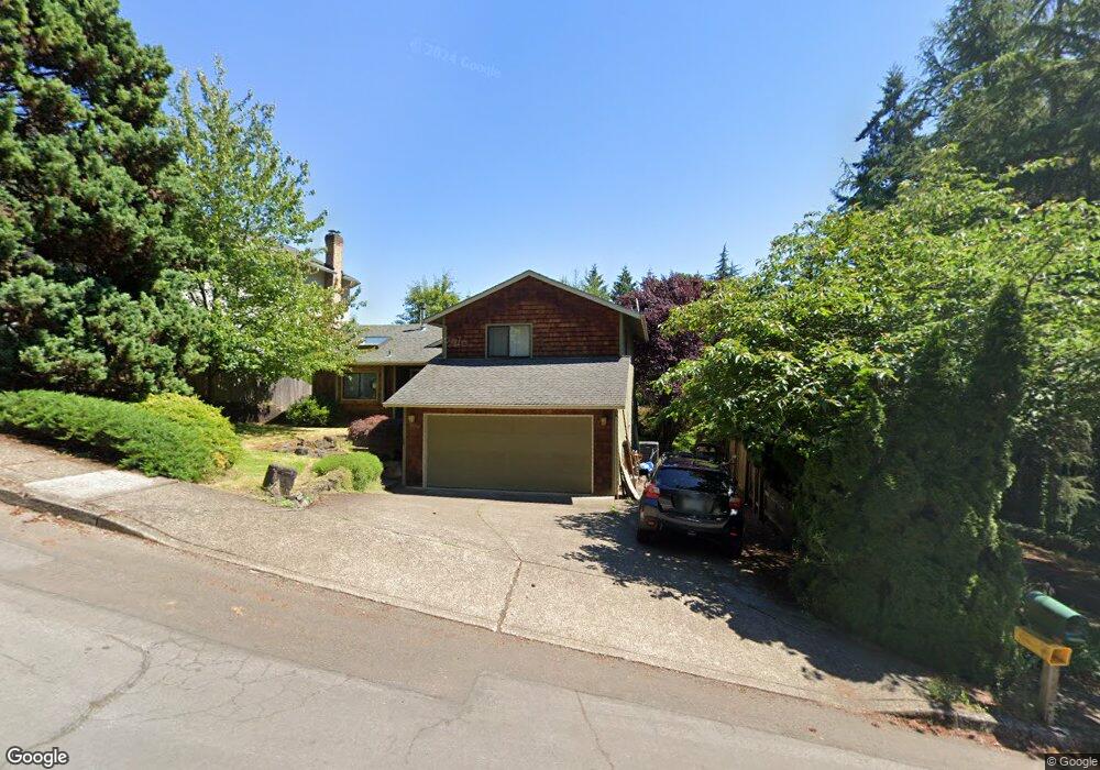
17795 Hillside Dr West Linn, OR 97068
Robinwood NeighborhoodEstimated Value: $647,000 - $759,000
3
Beds
3
Baths
1,584
Sq Ft
$446/Sq Ft
Est. Value
About This Home
This home is located at 17795 Hillside Dr, West Linn, OR 97068 and is currently estimated at $706,243, approximately $445 per square foot. 17795 Hillside Dr is a home located in Clackamas County with nearby schools including Cedaroak Park Primary School, West Linn High School, and Harmony Academy.
Ownership History
Date
Name
Owned For
Owner Type
Purchase Details
Closed on
May 19, 2016
Sold by
Pierce Izumi and Pierce Michael Welden
Bought by
Leonard Scott and Leonard Caitlin
Current Estimated Value
Home Financials for this Owner
Home Financials are based on the most recent Mortgage that was taken out on this home.
Original Mortgage
$382,500
Outstanding Balance
$302,872
Interest Rate
3.58%
Mortgage Type
New Conventional
Estimated Equity
$403,371
Purchase Details
Closed on
Mar 13, 2009
Sold by
Pierce Michael Welden
Bought by
Pierce Izumi and Pierce Michael Welden
Home Financials for this Owner
Home Financials are based on the most recent Mortgage that was taken out on this home.
Original Mortgage
$252,000
Interest Rate
5.14%
Mortgage Type
New Conventional
Purchase Details
Closed on
Jan 30, 2009
Sold by
Pierce Izumi and Pierce Michael Welden
Bought by
Pierce Michael Welden
Home Financials for this Owner
Home Financials are based on the most recent Mortgage that was taken out on this home.
Original Mortgage
$252,000
Interest Rate
5.14%
Mortgage Type
New Conventional
Purchase Details
Closed on
Jan 29, 2008
Sold by
Pierce Michael and Pierce Izumi
Bought by
Pierce Izumi and Pierce Michael Welden
Purchase Details
Closed on
Sep 7, 2006
Sold by
Smith Wallace E
Bought by
Pierce Michael and Pierce Izumi
Home Financials for this Owner
Home Financials are based on the most recent Mortgage that was taken out on this home.
Original Mortgage
$250,000
Interest Rate
6.67%
Mortgage Type
Purchase Money Mortgage
Purchase Details
Closed on
Dec 9, 2005
Sold by
Myer Michael E
Bought by
Smith Wallace E
Purchase Details
Closed on
Oct 13, 2003
Sold by
Platt Robert J and Platt Mary Catherine
Bought by
Myer Michael E
Home Financials for this Owner
Home Financials are based on the most recent Mortgage that was taken out on this home.
Original Mortgage
$188,000
Interest Rate
6.4%
Mortgage Type
Purchase Money Mortgage
Purchase Details
Closed on
Aug 23, 2002
Sold by
Behrens Calvin M
Bought by
Platt Robert J and Platt Mary Catherine
Create a Home Valuation Report for This Property
The Home Valuation Report is an in-depth analysis detailing your home's value as well as a comparison with similar homes in the area
Home Values in the Area
Average Home Value in this Area
Purchase History
| Date | Buyer | Sale Price | Title Company |
|---|---|---|---|
| Leonard Scott | $450,000 | Lawyers Title | |
| Pierce Izumi | -- | None Available | |
| Pierce Michael Welden | -- | Fidelity Natl Title Co Of Or | |
| Pierce Izumi | -- | None Available | |
| Pierce Michael | $455,000 | Chicago Title Insurance Co | |
| Smith Wallace E | $290,000 | Fidelity Natl Title Co Of Or | |
| Myer Michael E | $235,000 | Transnation | |
| Platt Robert J | $210,000 | Oregon Title Insurance Co |
Source: Public Records
Mortgage History
| Date | Status | Borrower | Loan Amount |
|---|---|---|---|
| Open | Leonard Scott | $382,500 | |
| Previous Owner | Pierce Michael Welden | $252,000 | |
| Previous Owner | Pierce Michael | $250,000 | |
| Previous Owner | Myer Michael E | $188,000 | |
| Closed | Myer Michael E | $47,000 |
Source: Public Records
Tax History Compared to Growth
Tax History
| Year | Tax Paid | Tax Assessment Tax Assessment Total Assessment is a certain percentage of the fair market value that is determined by local assessors to be the total taxable value of land and additions on the property. | Land | Improvement |
|---|---|---|---|---|
| 2025 | $7,367 | $382,297 | -- | -- |
| 2024 | $7,092 | $371,163 | -- | -- |
| 2023 | $7,092 | $360,353 | $0 | $0 |
| 2022 | $6,694 | $349,858 | $0 | $0 |
| 2021 | $6,306 | $339,668 | $0 | $0 |
| 2020 | $6,253 | $329,775 | $0 | $0 |
| 2019 | $5,988 | $320,170 | $0 | $0 |
| 2018 | $5,698 | $310,845 | $0 | $0 |
| 2017 | $5,517 | $301,791 | $0 | $0 |
| 2016 | $5,278 | $293,001 | $0 | $0 |
| 2015 | $4,960 | $284,467 | $0 | $0 |
| 2014 | $4,681 | $276,182 | $0 | $0 |
Source: Public Records
Map
Nearby Homes
- 1354 Skye Pkwy
- 1384 Celtic Ct
- 2455 College Hill Place
- 17833 Marylcreek Dr
- 1777 Skyland Dr
- 17634 Brookhurst Dr
- 2167 Marylwood Ct
- 1397 Skye Pkwy
- 17623 Brookhurst Dr
- 17514 Brookhurst Dr
- 2041 Marylhurst Dr
- 1611 Arran Ct
- 2636 Maria Ct
- 1321 Troon Dr
- 18194 Shady Hollow Way
- 3340 Arbor Dr
- 17900 Crestline Dr
- 18711 Willamette Dr
- 2147 Glenmorrie Ln
- 18300 S Whitten Ln
- 17765 Hillside Dr
- 17821 Hillside Dr
- 17725 Hillside Dr
- 18100 Upper Midhill Dr
- 18130 Upper Midhill Dr
- 17701 Hillside Drrelist
- 17701 Hillside Dr(relisted
- 17701 Hillside Dr(relist)
- 17887 Hillside Dr
- 18080 Upper Midhill Dr
- 17701 Hillside Dr
- 18150 Upper Midhill Dr
- 18040 Upper Midhlml#203546
- 18040 Upper Midhill Dr
- 18180 Upper Midhill Dr
- 17892 Hillside Dr
- 1358 Skye Pkwy
- 17922 Hillside Dr
- 17957 Hillside Dr
- 18127 Upper Midhill Dr