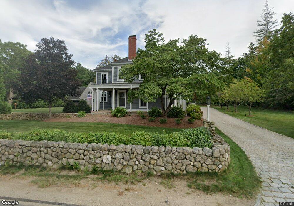
178 Broadway Hanover, MA 02339
Estimated Value: $1,165,000 - $1,478,000
6
Beds
4
Baths
4,342
Sq Ft
$300/Sq Ft
Est. Value
About This Home
This home is located at 178 Broadway, Hanover, MA 02339 and is currently estimated at $1,304,649, approximately $300 per square foot. 178 Broadway is a home located in Plymouth County with nearby schools including Hanover High School, Cadence Academy Preschool - Hanover, and The Master's Academy.
Ownership History
Date
Name
Owned For
Owner Type
Purchase Details
Closed on
Apr 7, 2008
Sold by
Frattasio Christopher and Frattasio Caroline N
Bought by
Frattasio Seth and Frattasio Elizabeth
Current Estimated Value
Purchase Details
Closed on
May 31, 2007
Sold by
Pettersen Bruce V and Pettersen Carol C
Bought by
Frattasio Seth and Frattasio Elizabeth
Create a Home Valuation Report for This Property
The Home Valuation Report is an in-depth analysis detailing your home's value as well as a comparison with similar homes in the area
Home Values in the Area
Average Home Value in this Area
Purchase History
| Date | Buyer | Sale Price | Title Company |
|---|---|---|---|
| Frattasio Seth | $132,342 | -- | |
| Frattasio Seth | $834,112 | -- |
Source: Public Records
Mortgage History
| Date | Status | Borrower | Loan Amount |
|---|---|---|---|
| Previous Owner | Frattasio Seth | $580,000 | |
| Previous Owner | Frattasio Seth | $450,000 |
Source: Public Records
Tax History
| Year | Tax Paid | Tax Assessment Tax Assessment Total Assessment is a certain percentage of the fair market value that is determined by local assessors to be the total taxable value of land and additions on the property. | Land | Improvement |
|---|---|---|---|---|
| 2025 | $13,179 | $1,067,100 | $348,200 | $718,900 |
| 2024 | $13,079 | $1,018,600 | $348,200 | $670,400 |
| 2023 | $13,482 | $999,400 | $317,900 | $681,500 |
| 2022 | $13,405 | $879,000 | $267,000 | $612,000 |
| 2021 | $3,126 | $827,600 | $243,900 | $583,700 |
| 2020 | $6,181 | $872,300 | $243,900 | $628,400 |
| 2019 | $12,627 | $769,500 | $243,900 | $525,600 |
| 2018 | $5,738 | $770,800 | $243,900 | $526,900 |
| 2017 | $12,590 | $762,100 | $248,700 | $513,400 |
| 2016 | $12,861 | $762,800 | $227,100 | $535,700 |
| 2015 | $10,761 | $666,300 | $246,700 | $419,600 |
Source: Public Records
Map
Nearby Homes
- 365 Broadway
- 70 River Rd
- 186 Elm St
- 33 1st Parish Ln
- 68 East St
- 172 Washington St
- 145 Brigantine Cir
- 60 Summer Path Way
- 75 Masthead Dr
- 26 Blake Ave
- 114 Graham Hill Dr
- 285 W Elm St
- 261 Washington St
- 51 Farmside Dr
- 269 Washington St Unit A1
- 422 River St
- 250 Center St
- 51 Cervelli Farm Dr
- 37 Dr
- 23 Cervelli Farm Dr
- 171 Broadway
- 168 Broadway
- 30 Church St
- 30 Church St
- 193 Broadway Unit 195
- 195 Broadway Unit 1
- 195 Broadway
- 24 Church St
- 24 Church St Unit 2
- 159 Broadway
- 31 Church St
- 208 Broadway
- 207 Broadway Unit 1
- 232 Washington St
- 209 Broadway Unit 2
- 209 Broadway Unit 3
- 209 Broadway
- 240 Washington St Unit 242
- 209 Washington St
- 186 Washington St
Your Personal Tour Guide
Ask me questions while you tour the home.