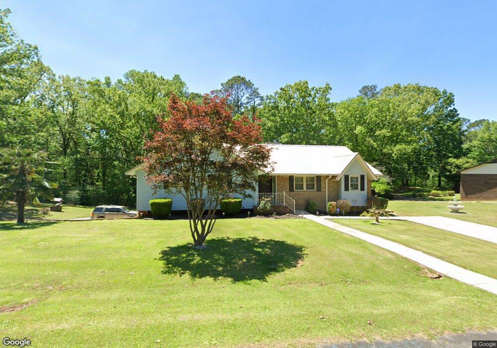
178 Cape Rd Bessemer, AL 35023
Estimated Value: $206,000 - $264,000
3
Beds
2
Baths
2,052
Sq Ft
$120/Sq Ft
Est. Value
About This Home
This home is located at 178 Cape Rd, Bessemer, AL 35023 and is currently estimated at $245,555, approximately $119 per square foot. 178 Cape Rd is a home located in Jefferson County with nearby schools including Hueytown Elementary School, Hueytown Primary School, and Hueytown Middle School.
Ownership History
Date
Name
Owned For
Owner Type
Purchase Details
Closed on
Oct 1, 2005
Sold by
United States Department Of Housing & Ur
Bought by
Edmond Donnie
Current Estimated Value
Home Financials for this Owner
Home Financials are based on the most recent Mortgage that was taken out on this home.
Original Mortgage
$89,600
Outstanding Balance
$47,807
Interest Rate
5.71%
Mortgage Type
New Conventional
Estimated Equity
$197,748
Purchase Details
Closed on
Apr 17, 2002
Sold by
Knight George J and Knight Betty P
Bought by
Moore Raymond Brian and Moore Margaret Christy
Home Financials for this Owner
Home Financials are based on the most recent Mortgage that was taken out on this home.
Original Mortgage
$143,744
Interest Rate
6.89%
Mortgage Type
FHA
Create a Home Valuation Report for This Property
The Home Valuation Report is an in-depth analysis detailing your home's value as well as a comparison with similar homes in the area
Home Values in the Area
Average Home Value in this Area
Purchase History
| Date | Buyer | Sale Price | Title Company |
|---|---|---|---|
| Edmond Donnie | $140,000 | None Available | |
| Moore Raymond Brian | $146,000 | -- |
Source: Public Records
Mortgage History
| Date | Status | Borrower | Loan Amount |
|---|---|---|---|
| Open | Edmond Donnie | $89,600 | |
| Previous Owner | Moore Raymond Brian | $143,744 |
Source: Public Records
Tax History Compared to Growth
Tax History
| Year | Tax Paid | Tax Assessment Tax Assessment Total Assessment is a certain percentage of the fair market value that is determined by local assessors to be the total taxable value of land and additions on the property. | Land | Improvement |
|---|---|---|---|---|
| 2024 | -- | $22,440 | -- | -- |
| 2022 | $0 | $22,430 | $3,500 | $18,930 |
| 2021 | $0 | $18,980 | $3,500 | $15,480 |
| 2020 | $0 | $17,320 | $3,500 | $13,820 |
| 2019 | $0 | $17,320 | $0 | $0 |
| 2018 | $969 | $17,000 | $0 | $0 |
| 2017 | $1,026 | $17,960 | $0 | $0 |
| 2016 | $963 | $16,900 | $0 | $0 |
| 2015 | $1,026 | $17,960 | $0 | $0 |
| 2014 | $989 | $16,920 | $0 | $0 |
| 2013 | $989 | $16,620 | $0 | $0 |
Source: Public Records
Map
Nearby Homes
- 198 Space Rd
- 105 Hielary Cir
- 140 Dee Hendrix Rd
- 135 Cape Rd
- 3016 Virginia Dr
- 3229 Edenburg Dr
- 3232 Virginia Dr
- 6291 Donaldson Dr Unit 124
- 2101 Windcroft Rd
- 3018 Lone Oak Rd
- 3273 Fieldale Dr
- 625 Dee Hendrix Rd Unit 625
- 2089 Edenwood Cir
- 3037 Lee Ann Dr Unit 27
- 3469 Virginia Dr
- 3515 Lone Oak Ln
- 3481 Virginia Dr
- 800 Dee Hendrix Rd
- 4824 15th Street Rd
- 6490 White Oak Ln