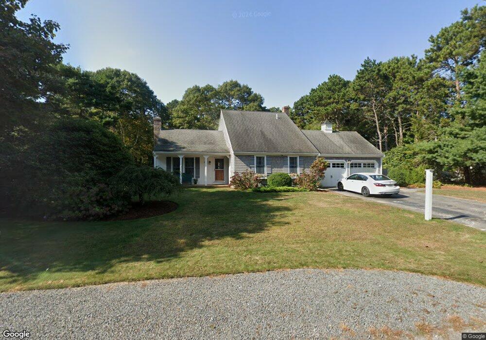
178 Captain Samadrus Rd Cotuit, MA 02635
Cotuit NeighborhoodEstimated Value: $801,254 - $868,000
4
Beds
3
Baths
1,801
Sq Ft
$465/Sq Ft
Est. Value
About This Home
This home is located at 178 Captain Samadrus Rd, Cotuit, MA 02635 and is currently estimated at $837,814, approximately $465 per square foot. 178 Captain Samadrus Rd is a home located in Barnstable County with nearby schools including West Villages Elementary School, Barnstable United Elementary School, and Barnstable Intermediate School.
Ownership History
Date
Name
Owned For
Owner Type
Purchase Details
Closed on
May 19, 2016
Sold by
Smith William C and Rizzico-Smith Cheryl L
Bought by
R William
Current Estimated Value
Purchase Details
Closed on
Jun 27, 2013
Sold by
Rudman Nathan T and Rudman Kathryn M
Bought by
Smith William C and Rizzico-Smith Cheryl L
Purchase Details
Closed on
Jun 1, 1999
Sold by
Harding David C and Evora Maxine C
Bought by
Rudman Nathan T and Rudman Kathryn M
Home Financials for this Owner
Home Financials are based on the most recent Mortgage that was taken out on this home.
Original Mortgage
$168,000
Interest Rate
6.82%
Mortgage Type
Purchase Money Mortgage
Purchase Details
Closed on
Oct 6, 1995
Sold by
Neves Donald R and Neves Olinda A
Bought by
Harding David C and Evora Maxine C
Home Financials for this Owner
Home Financials are based on the most recent Mortgage that was taken out on this home.
Original Mortgage
$132,000
Interest Rate
7.86%
Mortgage Type
Purchase Money Mortgage
Create a Home Valuation Report for This Property
The Home Valuation Report is an in-depth analysis detailing your home's value as well as a comparison with similar homes in the area
Home Values in the Area
Average Home Value in this Area
Purchase History
| Date | Buyer | Sale Price | Title Company |
|---|---|---|---|
| R William | -- | -- | |
| Smith William C | $408,500 | -- | |
| Rudman Nathan T | $210,000 | -- | |
| Harding David C | $165,000 | -- |
Source: Public Records
Mortgage History
| Date | Status | Borrower | Loan Amount |
|---|---|---|---|
| Previous Owner | Rudman Nathan T | $168,000 | |
| Previous Owner | Harding David C | $132,000 |
Source: Public Records
Tax History
| Year | Tax Paid | Tax Assessment Tax Assessment Total Assessment is a certain percentage of the fair market value that is determined by local assessors to be the total taxable value of land and additions on the property. | Land | Improvement |
|---|---|---|---|---|
| 2025 | $6,023 | $721,300 | $181,700 | $539,600 |
| 2024 | $5,443 | $690,700 | $181,700 | $509,000 |
| 2023 | $5,288 | $631,800 | $179,500 | $452,300 |
| 2022 | $5,259 | $508,600 | $127,700 | $380,900 |
| 2021 | $5,052 | $457,600 | $127,700 | $329,900 |
| 2020 | $5,075 | $433,400 | $127,700 | $305,700 |
| 2019 | $4,757 | $400,400 | $127,700 | $272,700 |
| 2018 | $2,946 | $379,200 | $140,000 | $239,200 |
| 2017 | $4,340 | $367,800 | $140,000 | $227,800 |
| 2016 | $4,244 | $368,700 | $140,900 | $227,800 |
| 2015 | $4,292 | $372,600 | $138,600 | $234,000 |
Source: Public Records
Map
Nearby Homes
- 602 Putnam Ave
- 426 Old Post Rd
- 135 Putnam Ave
- 564 Cotuit Bay Dr
- 564 Cotuit Bay Dr
- 804 Main St
- 835 Old Post Rd
- 15 Geraldine Rd
- 1597 Santuit-Newtown Rd
- 33 Oyster Place Rd
- 239 Oxford Dr
- 1456 Santuit-Newtown Rd
- 75 Bob White Run
- 71 Sand Point
- 43 Poponessett Rd
- 226 Dunrobin Rd
- 220 Dunrobin Rd
- 359 Baxter Neck Rd
- 70 Cape Dr Unit 14D
- 70 Cape Dr Unit 11D
- 190 Captain Samadrus Rd
- 164 Captain Samadrus Rd
- 190 Cap'N Samadrus Rd
- 177 Captain Samadrus Rd
- 191 Captain Samadrus Rd
- 191 Cap'N Samadrus Rd
- 10 Capn Carletons Rd
- 48 Captain Isaiah Rd
- 17 Captain Carltons Rd
- 10 Captain Carltons Rd
- 61 Cap'N Isiah's Rd
- 48 Captain Isiahs Rd
- 85 Captain Isiahs Rd
- 61 Captain Isiahs Rd
- 75 Captain Isiahs Rd
- 140 Captain Samadrus Rd
- 143 Captain Samadrus Rd
- 61 Captain Isaiah Rd
- 49 Cap'N Isiahs Rd
- 34 Captain Carltons Rd