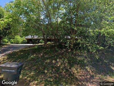
178 Hiawatha Rd Cornelia, GA 30531
Estimated Value: $270,000 - $291,025
3
Beds
2
Baths
1,810
Sq Ft
$155/Sq Ft
Est. Value
About This Home
This home is located at 178 Hiawatha Rd, Cornelia, GA 30531 and is currently estimated at $281,006, approximately $155 per square foot. 178 Hiawatha Rd is a home located in Habersham County with nearby schools including Cornelia Elementary School, Wilbanks Middle School, and Habersham Success Academy.
Ownership History
Date
Name
Owned For
Owner Type
Purchase Details
Closed on
Dec 30, 2016
Sold by
Hud & Housing Of Urban Dev
Bought by
Carrillo Alejandro Duran
Current Estimated Value
Home Financials for this Owner
Home Financials are based on the most recent Mortgage that was taken out on this home.
Original Mortgage
$88,000
Interest Rate
4.08%
Mortgage Type
New Conventional
Purchase Details
Closed on
Aug 9, 2016
Bought by
The Sec Of Housing & Urb
Create a Home Valuation Report for This Property
The Home Valuation Report is an in-depth analysis detailing your home's value as well as a comparison with similar homes in the area
Home Values in the Area
Average Home Value in this Area
Purchase History
| Date | Buyer | Sale Price | Title Company |
|---|---|---|---|
| Carrillo Alejandro Duran | $110,000 | -- | |
| The Sec Of Housing & Urb | $138,380 | -- |
Source: Public Records
Mortgage History
| Date | Status | Borrower | Loan Amount |
|---|---|---|---|
| Open | Carrillo Alejandro Duran | $221,200 | |
| Closed | Carrillo Alejandro Duran | $67,800 | |
| Closed | Carrillo Alejandro Duran | $88,000 | |
| Previous Owner | Barner John | $138,380 |
Source: Public Records
Tax History Compared to Growth
Tax History
| Year | Tax Paid | Tax Assessment Tax Assessment Total Assessment is a certain percentage of the fair market value that is determined by local assessors to be the total taxable value of land and additions on the property. | Land | Improvement |
|---|---|---|---|---|
| 2024 | -- | $93,372 | $8,448 | $84,924 |
| 2023 | $1,017 | $78,848 | $8,448 | $70,400 |
| 2022 | $1,373 | $66,824 | $6,336 | $60,488 |
| 2021 | $1,189 | $53,044 | $4,224 | $48,820 |
| 2020 | $1,139 | $46,332 | $4,224 | $42,108 |
| 2019 | $1,141 | $46,332 | $4,224 | $42,108 |
| 2018 | $1,133 | $46,332 | $4,224 | $42,108 |
| 2017 | $1,089 | $42,916 | $4,224 | $38,692 |
| 2016 | $1,068 | $102,420 | $3,168 | $37,800 |
| 2015 | $348 | $102,420 | $3,168 | $37,800 |
| 2014 | $344 | $100,590 | $3,168 | $37,068 |
| 2013 | -- | $40,236 | $3,168 | $37,068 |
Source: Public Records
Map
Nearby Homes
- 294 Hillcrest Heights
- 266 Short Ave
- 223 Dogwood Ave
- 175 Hillcrest St
- 0 Planters Pointe Terrace Unit 7497608
- 0 Planters Pointe Terrace Unit 10417403
- 0 Hwy 105 Unit 7583105
- 0 Hwy 105 Unit 10526381
- 0 Highway 105 Unit 10421143
- 0 Georgia 105
- 205 Crooked Pine Trail
- 237 Brookside St
- 610 Level Grove Rd
- 142 Galloway St
- 0 Highway 441 Bypass Unit 10519763
- 0 Highway 441 Bypass Unit 10428967
- 276 Arbor Gate Dr
- 262 Red Fox Hollow Dr
- 262 Red Fox Hollow Rd
- 182 Sugar Creek Dr
- 176 Hiawatha Rd
- 178 Hiawatha Rd
- 0 Hiawatha Rd Unit 7212333
- 0 Hiawatha Rd
- 195 Hiawatha Rd
- 226 Hiawatha Rd
- 167 Sequoyah Dr
- 0 Sequoyah Dr Unit LOT 9
- 0 Sequoyah Dr Unit LOT 9 3143784
- 0 Sequoyah Dr Unit 8924187
- 0 Sequoyah Dr Unit 3219180
- 0 Sequoyah Dr Unit 3237949
- 0 Sequoyah Dr Unit 7093528
- 0 Sequoyah Dr Unit 8474828
- 189 New St
- 194 New St
- 130 Sequoyah Dr
- 190 Highland Ave
- 170 Sequoyah Dr
- 184 Highland Ave
