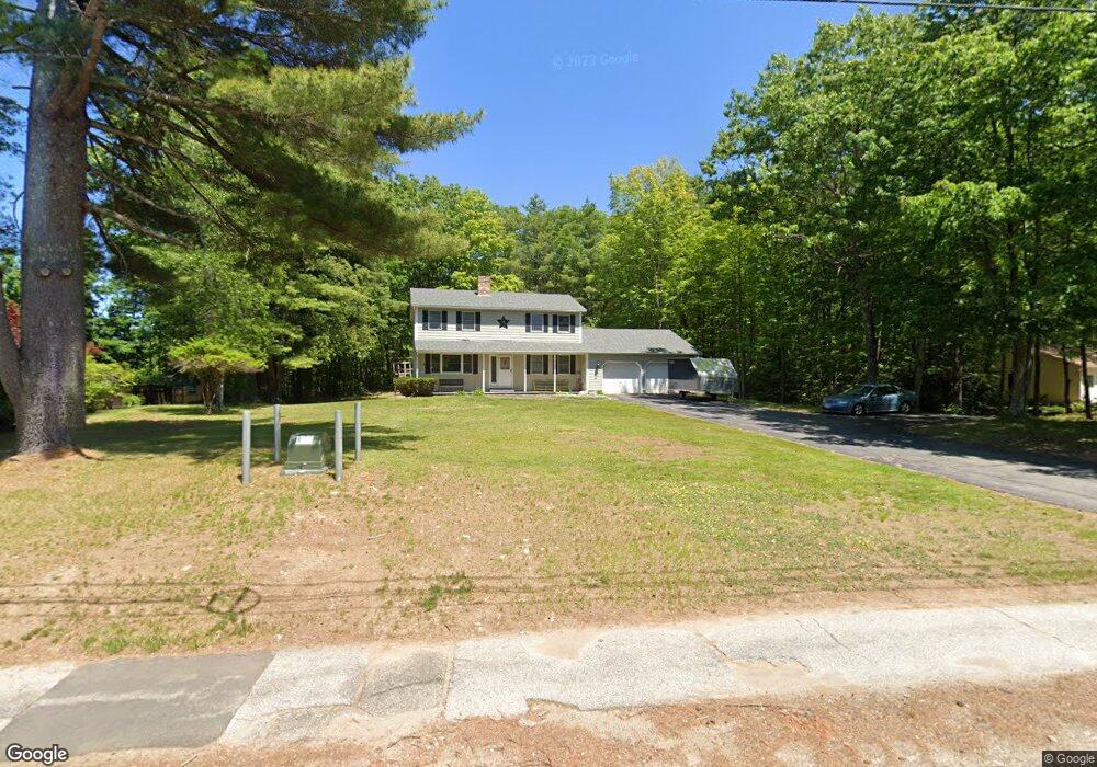
178 Maple St Somersworth, NH 03878
Estimated Value: $469,000 - $505,000
3
Beds
2
Baths
1,872
Sq Ft
$260/Sq Ft
Est. Value
About This Home
This home is located at 178 Maple St, Somersworth, NH 03878 and is currently estimated at $487,627, approximately $260 per square foot. 178 Maple St is a home with nearby schools including Maple Wood Elementary School, Somersworth High School, and Tri-City Christian Academy.
Ownership History
Date
Name
Owned For
Owner Type
Purchase Details
Closed on
Jun 22, 2018
Sold by
Labelle 3Rd Raymond E and Labelle Amy C
Bought by
Labelle 3Rd Raymond E and Labelle Amy C
Current Estimated Value
Purchase Details
Closed on
Oct 25, 2004
Sold by
Marquis David P and Marquis Arlene M
Bought by
Labelle 3Rd Raymond E and Labelle Amy C
Home Financials for this Owner
Home Financials are based on the most recent Mortgage that was taken out on this home.
Original Mortgage
$200,000
Interest Rate
5.85%
Mortgage Type
Purchase Money Mortgage
Create a Home Valuation Report for This Property
The Home Valuation Report is an in-depth analysis detailing your home's value as well as a comparison with similar homes in the area
Home Values in the Area
Average Home Value in this Area
Purchase History
| Date | Buyer | Sale Price | Title Company |
|---|---|---|---|
| Labelle 3Rd Raymond E | -- | -- | |
| Labelle 3Rd Raymond E | -- | -- | |
| Labelle 3Rd Raymond E | $250,000 | -- | |
| Labelle 3Rd Raymond E | $250,000 | -- |
Source: Public Records
Mortgage History
| Date | Status | Borrower | Loan Amount |
|---|---|---|---|
| Previous Owner | Labelle 3Rd Raymond E | $200,000 |
Source: Public Records
Tax History Compared to Growth
Tax History
| Year | Tax Paid | Tax Assessment Tax Assessment Total Assessment is a certain percentage of the fair market value that is determined by local assessors to be the total taxable value of land and additions on the property. | Land | Improvement |
|---|---|---|---|---|
| 2024 | $8,353 | $446,700 | $122,700 | $324,000 |
| 2023 | $7,738 | $264,100 | $59,400 | $204,700 |
| 2022 | $7,419 | $264,100 | $59,400 | $204,700 |
| 2021 | $7,271 | $264,100 | $59,400 | $204,700 |
| 2020 | $7,355 | $264,100 | $59,400 | $204,700 |
| 2019 | $7,205 | $264,100 | $59,400 | $204,700 |
| 2018 | $7,785 | $233,000 | $68,700 | $164,300 |
| 2017 | $7,713 | $233,100 | $68,700 | $164,400 |
| 2016 | $7,487 | $233,100 | $68,700 | $164,400 |
| 2015 | $7,517 | $233,100 | $68,700 | $164,400 |
| 2014 | $7,259 | $233,100 | $68,700 | $164,400 |
Source: Public Records
Map
Nearby Homes
- 18 Lenox Dr Unit C
- 29 Chadwick Ln
- 23A Birch Hill Ln Unit 23A
- 23B Birch Hill Ln Unit 23B
- 19B Birch Hill Ln Unit 19B
- 19A Birch Hill Ln Unit 19A
- 27B Birch Hill Ln Unit 27B
- 22B Birch Hill Ln Unit 22B
- 22A Birch Hill Ln Unit 22A
- 22 Indigo Hill Rd
- 178 High St
- 8 Myrtle St
- 301 Sherwood Glen
- 200 Sherwood Glen
- 229 Sherwood Glen
- 206 Sherwood Glen
- 159 W High St
- 23 Mount Vernon St
- 18 Grand St
- 203 New Hampshire 108
- 60 Cemetery Rd
- 180 Maple St
- 50 Cemetery Rd
- 48 Cemetery Rd
- 164 Maple St
- 46 Cemetery Rd
- 162 Maple St
- 44 Cemetery Rd
- 43 Cemetery Rd
- 49 Cemetery Rd
- 47 Cemetery Rd
- 160 Maple St
- lot 71 the Villages at Sunningdale St Unit 71
- lot 71 the Villages at Sunningdale St
- 45 Cemetery Rd
- 42 Cemetery Rd
- 158 Maple St
- 73 Bartlett Ave
- 69 Bartlett Ave
- 40 Cemetery Rd