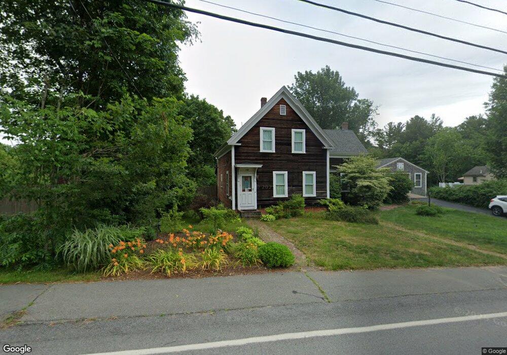
178 Walnut St Abington, MA 02351
Estimated Value: $573,000 - $598,000
4
Beds
3
Baths
1,731
Sq Ft
$340/Sq Ft
Est. Value
About This Home
This home is located at 178 Walnut St, Abington, MA 02351 and is currently estimated at $588,241, approximately $339 per square foot. 178 Walnut St is a home located in Plymouth County with nearby schools including Beaver Brook Elementary School, Abington Middle School, and Woodsdale School.
Ownership History
Date
Name
Owned For
Owner Type
Purchase Details
Closed on
Sep 1, 1985
Bought by
Martin James P and Martin Carol J
Current Estimated Value
Create a Home Valuation Report for This Property
The Home Valuation Report is an in-depth analysis detailing your home's value as well as a comparison with similar homes in the area
Home Values in the Area
Average Home Value in this Area
Purchase History
| Date | Buyer | Sale Price | Title Company |
|---|---|---|---|
| Martin James P | $120,000 | -- |
Source: Public Records
Mortgage History
| Date | Status | Borrower | Loan Amount |
|---|---|---|---|
| Open | Martin James P | $100,000 | |
| Closed | Martin James P | $92,700 | |
| Closed | Martin James P | $105,000 | |
| Closed | Martin James P | $20,000 |
Source: Public Records
Tax History
| Year | Tax Paid | Tax Assessment Tax Assessment Total Assessment is a certain percentage of the fair market value that is determined by local assessors to be the total taxable value of land and additions on the property. | Land | Improvement |
|---|---|---|---|---|
| 2025 | $6,574 | $503,400 | $268,900 | $234,500 |
| 2024 | $6,453 | $482,300 | $245,000 | $237,300 |
| 2023 | $6,505 | $457,800 | $223,300 | $234,500 |
| 2022 | $6,138 | $403,300 | $187,000 | $216,300 |
| 2021 | $8,459 | $349,500 | $170,900 | $178,600 |
| 2020 | $8,266 | $350,700 | $172,100 | $178,600 |
| 2019 | $5,662 | $325,600 | $165,200 | $160,400 |
| 2018 | $3,940 | $314,500 | $165,200 | $149,300 |
| 2017 | $5,951 | $292,700 | $165,200 | $127,500 |
| 2016 | $4,994 | $278,500 | $151,000 | $127,500 |
| 2015 | $4,724 | $277,900 | $151,000 | $126,900 |
Source: Public Records
Map
Nearby Homes
- 87 Summer St
- 135 Bank St
- 45 Bedford St
- 40 Bedford St
- 19 Bank St
- 9 Bank St
- 10 Bank St
- 99 Washington St
- 73 Block St
- 1142 Washington St
- 229 Washington Terrace
- 90 Washington Terrace
- 1190 Bedford St Unit G3
- 7 Carlys Way
- 608 Plymouth St
- 360 High St
- 333 Groveland St
- 291 Raynor Ave
- 353 Plymouth St
- 300 High St