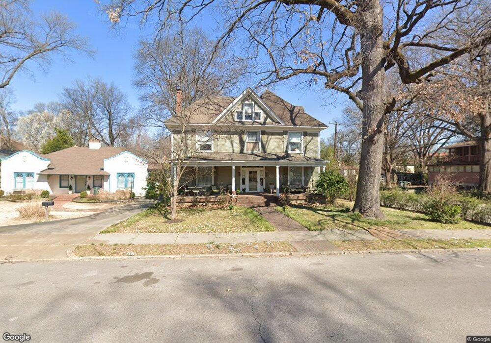
1780 Forrest Ave Memphis, TN 38112
Midtown Memphis NeighborhoodEstimated Value: $416,000 - $512,000
3
Beds
3
Baths
3,130
Sq Ft
$143/Sq Ft
Est. Value
About This Home
This home is located at 1780 Forrest Ave, Memphis, TN 38112 and is currently estimated at $447,507, approximately $142 per square foot. 1780 Forrest Ave is a home located in Shelby County with nearby schools including Snowden Elementary/Middle School, Central High School, and Crosstown High School.
Ownership History
Date
Name
Owned For
Owner Type
Purchase Details
Closed on
Jul 30, 2010
Sold by
Dyson Benedict P and Ridgley Dyson Elizabeth A
Bought by
Barnett Robert B and Barnett Susan B
Current Estimated Value
Home Financials for this Owner
Home Financials are based on the most recent Mortgage that was taken out on this home.
Original Mortgage
$240,000
Outstanding Balance
$160,260
Interest Rate
4.74%
Mortgage Type
New Conventional
Estimated Equity
$287,247
Purchase Details
Closed on
Jun 1, 2005
Sold by
Land David Gregory and Land Sarah Gratz
Bought by
Dyson Benedict P and Ridgley Dyson Wlizabeth A
Home Financials for this Owner
Home Financials are based on the most recent Mortgage that was taken out on this home.
Original Mortgage
$247,600
Interest Rate
5.69%
Mortgage Type
Fannie Mae Freddie Mac
Create a Home Valuation Report for This Property
The Home Valuation Report is an in-depth analysis detailing your home's value as well as a comparison with similar homes in the area
Home Values in the Area
Average Home Value in this Area
Purchase History
| Date | Buyer | Sale Price | Title Company |
|---|---|---|---|
| Barnett Robert B | $300,000 | Realty Title & Escrow Co | |
| Dyson Benedict P | $309,500 | -- |
Source: Public Records
Mortgage History
| Date | Status | Borrower | Loan Amount |
|---|---|---|---|
| Open | Barnett Robert B | $240,000 | |
| Previous Owner | Dyson Benedict P | $247,600 | |
| Closed | Dyson Benedict P | $46,425 |
Source: Public Records
Tax History Compared to Growth
Tax History
| Year | Tax Paid | Tax Assessment Tax Assessment Total Assessment is a certain percentage of the fair market value that is determined by local assessors to be the total taxable value of land and additions on the property. | Land | Improvement |
|---|---|---|---|---|
| 2025 | $3,492 | $122,650 | $19,425 | $103,225 |
| 2024 | $3,492 | $103,000 | $13,275 | $89,725 |
| 2023 | $6,274 | $103,000 | $13,275 | $89,725 |
| 2022 | $6,274 | $103,000 | $13,275 | $89,725 |
| 2021 | $6,348 | $103,000 | $13,275 | $89,725 |
| 2020 | $5,525 | $76,250 | $13,275 | $62,975 |
| 2019 | $5,525 | $76,250 | $13,275 | $62,975 |
| 2018 | $5,525 | $76,250 | $13,275 | $62,975 |
| 2017 | $3,134 | $76,250 | $13,275 | $62,975 |
| 2016 | $3,239 | $74,125 | $0 | $0 |
| 2014 | $3,239 | $74,125 | $0 | $0 |
Source: Public Records
Map
Nearby Homes
- 1817 N Parkway
- 1736 Forest Ave
- 1741 N Parkway
- 1731 Galloway Ave
- 1800 Autumn Ave
- 1810 Autumn Ave
- 1678 Forest Ave
- 579 N Evergreen St
- 1795 Tutwiler Ave
- 1818 Tutwiler Ave
- 1808 Tutwiler Ave
- 1624 N Parkway
- 1960 N Parkway Unit 1208
- 1960 N Parkway Unit 105
- 1960 N Parkway Unit 510
- 1960 N Parkway Unit 109
- 1960 N Parkway Unit 1106
- 1960 N Parkway Unit 1110
- 1960 N Parkway Unit 910
- 715 N Auburndale St
- 1772 Forest Ave
- 1772 Forrest Ave
- 1792 Forrest Ave
- 1792 Forest Ave Unit up
- 1766 Forrest Ave
- 1781 N Parkway
- 1796 Forrest Ave
- 1771 N Parkway
- 1756 Forrest Ave
- 540 Hawthorne St
- 1781 Forrest Ave
- 1765 N Parkway
- 1769 Forest Ave
- 1771 Forrest Ave
- 1793 Forrest Ave
- 1750 Forrest Ave
- 1755 N Parkway
- 1810 Forrest Ave
- 1755 Forrest Ave
- 1801 Forrest Ave