Estimated Value: $360,134 - $399,000
2
Beds
2
Baths
1,400
Sq Ft
$269/Sq Ft
Est. Value
About This Home
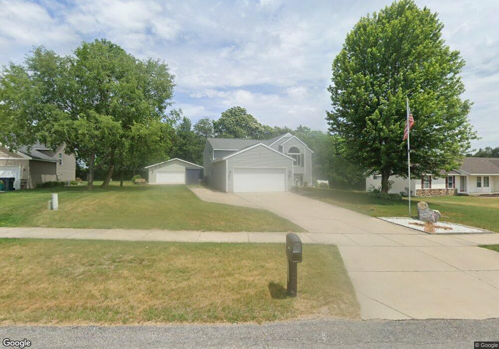
This home is located at 1781 Cuper Ave, Dorr, MI 49323 and is currently estimated at $377,034, approximately $269 per square foot. 1781 Cuper Ave is a home located in Allegan County with nearby schools including Wayland High School, Byron Center Charter School, and St. Stanislaus School.
Ownership History
Date
Name
Owned For
Owner Type
Purchase Details
Closed on
Nov 29, 2023
Sold by
Popma Brian L and Popma Rhonda L
Bought by
Popma Living Trust and Popma
Current Estimated Value
Purchase Details
Closed on
Apr 16, 2012
Sold by
Popma Brian L and Popma Rhonda L
Bought by
Popma Brian L and Popma Rhonda L
Purchase Details
Closed on
Jun 13, 2002
Sold by
West Lake Home Inc
Bought by
Popma Brian L and Popma Rhonda L
Purchase Details
Closed on
Apr 30, 2002
Sold by
Slater Enterprises Inc
Bought by
Westlake Homes Inc
Create a Home Valuation Report for This Property
The Home Valuation Report is an in-depth analysis detailing your home's value as well as a comparison with similar homes in the area
Home Values in the Area
Average Home Value in this Area
Purchase History
| Date | Buyer | Sale Price | Title Company |
|---|---|---|---|
| Popma Living Trust | -- | None Listed On Document | |
| Popma Living Trust | -- | None Listed On Document | |
| Popma Brian L | -- | None Available | |
| Popma Brian L | $139,400 | Beltline Title Agency Inc | |
| Westlake Homes Inc | $32,801 | Beltline Title Agency Inc |
Source: Public Records
Tax History Compared to Growth
Tax History
| Year | Tax Paid | Tax Assessment Tax Assessment Total Assessment is a certain percentage of the fair market value that is determined by local assessors to be the total taxable value of land and additions on the property. | Land | Improvement |
|---|---|---|---|---|
| 2025 | $2,956 | $171,900 | $36,000 | $135,900 |
| 2024 | $2,689 | $161,700 | $31,300 | $130,400 |
| 2023 | $2,755 | $138,600 | $26,700 | $111,900 |
| 2022 | $2,689 | $119,300 | $24,500 | $94,800 |
| 2021 | $2,528 | $109,000 | $20,700 | $88,300 |
| 2020 | $40 | $103,600 | $17,100 | $86,500 |
| 2019 | $2,406 | $103,500 | $16,000 | $87,500 |
| 2018 | $2,352 | $98,800 | $16,000 | $82,800 |
| 2017 | $0 | $90,700 | $16,000 | $74,700 |
| 2016 | $0 | $81,500 | $16,000 | $65,500 |
| 2015 | -- | $81,500 | $16,000 | $65,500 |
| 2014 | -- | $71,400 | $15,000 | $56,400 |
| 2013 | -- | $64,800 | $15,000 | $49,800 |
Source: Public Records
Map
Nearby Homes
- 1722 144th Ave
- 1341 142nd Ave
- 4312 Woodside Meadow Ct
- 4159 White Pine Dr
- 4087 Ronalds Rd
- 4101 White Pine Dr Unit 4
- 2081 142nd Ave
- 1659 Creek Side Ct
- Lot 11 Walnut Dale Dr
- 10591 Byron Center Ave SW
- 1069 108th St SW
- 4351 Hickory View Ct
- 10780 Windward Ave SW
- 10785 Windward Ave SW
- 10725 Windward Ave SW
- 10711 Windward Ave SW
- 4335 Tavistock Dr
- 136 100th St SW
- 737 100th St SW
- 4316 Sussex Place