Estimated Value: $216,000 - $281,000
--
Bed
1
Bath
828
Sq Ft
$292/Sq Ft
Est. Value
About This Home
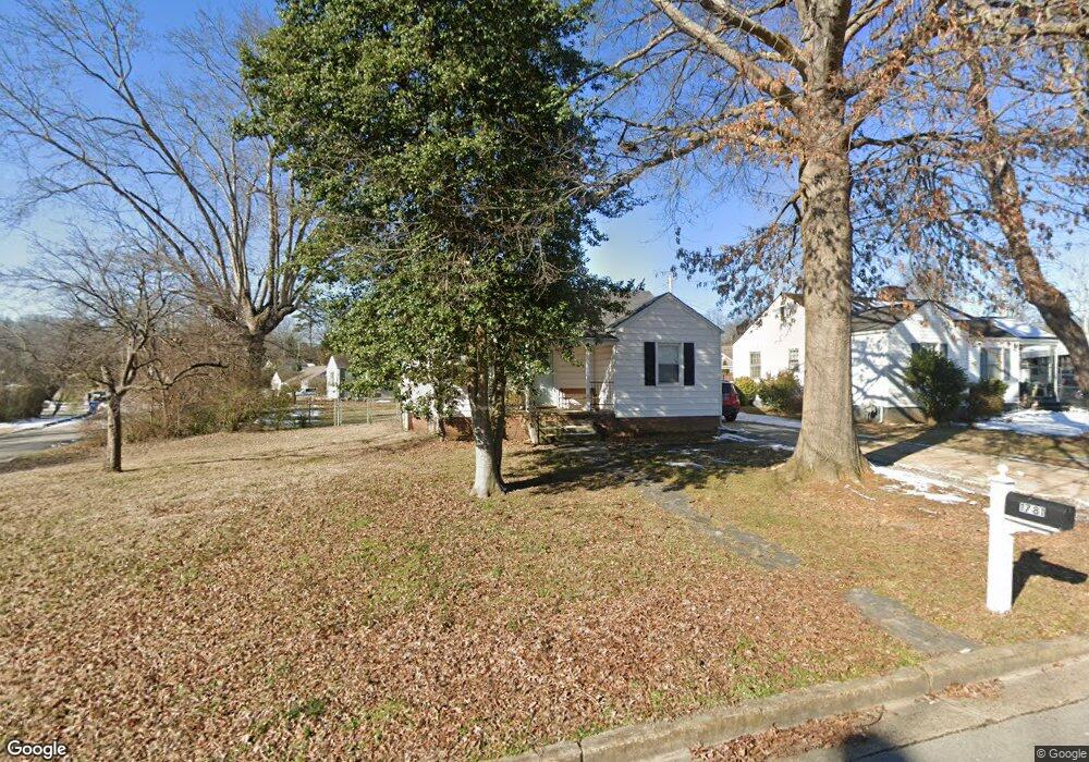
This home is located at 1781 Kettering Rd, Alcoa, TN 37701 and is currently estimated at $241,921, approximately $292 per square foot. 1781 Kettering Rd is a home located in Blount County with nearby schools including Alcoa Elementary School, Alcoa Middle School, and Alcoa High School.
Ownership History
Date
Name
Owned For
Owner Type
Purchase Details
Closed on
Jul 12, 2021
Sold by
Parker Karrie B
Bought by
Parker Stephen and Parker Kathy
Current Estimated Value
Purchase Details
Closed on
Mar 26, 2009
Sold by
Parker Stephen H
Bought by
Parker Joel
Purchase Details
Closed on
Feb 20, 2007
Sold by
Parker Joel C and Parker Stephen H
Bought by
Parker Stephen H and Parker Kathy H
Purchase Details
Closed on
Mar 2, 2005
Sold by
Roy Chaney E
Bought by
Parker Joel C
Purchase Details
Closed on
Feb 28, 2005
Sold by
Chaney Roy E
Bought by
Parker Joel C and Parker Stephen H
Purchase Details
Closed on
Jun 4, 2001
Sold by
Chaney Roy
Bought by
Roy Chaney
Purchase Details
Closed on
Oct 21, 1994
Sold by
Walden Carrie
Bought by
Chaney Roy E
Purchase Details
Closed on
Sep 2, 1950
Bought by
Walden Odis and Carrie Lee
Create a Home Valuation Report for This Property
The Home Valuation Report is an in-depth analysis detailing your home's value as well as a comparison with similar homes in the area
Home Values in the Area
Average Home Value in this Area
Purchase History
| Date | Buyer | Sale Price | Title Company |
|---|---|---|---|
| Parker Stephen | -- | -- | |
| Parker Joel | -- | -- | |
| Parker Stephen H | -- | -- | |
| Parker Joel C | $85,000 | -- | |
| Parker Joel C | $85,000 | -- | |
| Roy Chaney | $50,000 | -- | |
| Chaney Roy E | $47,000 | -- | |
| Walden Odis | -- | -- |
Source: Public Records
Tax History Compared to Growth
Tax History
| Year | Tax Paid | Tax Assessment Tax Assessment Total Assessment is a certain percentage of the fair market value that is determined by local assessors to be the total taxable value of land and additions on the property. | Land | Improvement |
|---|---|---|---|---|
| 2024 | $1,396 | $42,550 | $10,125 | $32,425 |
| 2023 | $1,396 | $42,550 | $10,125 | $32,425 |
| 2022 | $1,265 | $26,675 | $5,625 | $21,050 |
| 2021 | $1,265 | $26,675 | $5,625 | $21,050 |
| 2020 | $1,265 | $26,675 | $5,625 | $21,050 |
| 2019 | $1,265 | $26,675 | $5,625 | $21,050 |
| 2018 | $990 | $22,350 | $5,950 | $16,400 |
| 2017 | $990 | $22,350 | $5,950 | $16,400 |
| 2016 | $990 | $22,350 | $5,950 | $16,400 |
| 2015 | $919 | $22,350 | $5,950 | $16,400 |
| 2014 | $958 | $22,350 | $5,950 | $16,400 |
| 2013 | $958 | $23,325 | $0 | $0 |
Source: Public Records
Map
Nearby Homes
- 1765 N Wright Rd
- 1761 Dalton St
- 1852 Kettering Rd
- 1533 Springbrook Rd
- 1791 Ramsay St
- 1340 Dalton St
- 1321 Nobel St Unit E
- 947 Poplar St
- 0 N Wright Rd
- 946 Poplar St
- 960 Poplar St
- 966 Poplar St
- 1574 Tsuga Dr
- 1439 St Thomas Way
- 1420 St Thomas Way
- 1536 Tsuga Dr
- 1534 Tsuga Dr
- 1569 Ashwood Place
- 1439 Edenbridge Dr
- 2620 Marshall St
- 1787 Kettering Rd
- 853 Brewster St
- 1769 Kettering Rd
- 1791 Kettering Rd
- 874 Burroughs Rd
- 852 Brewster St
- 1763 Kettering Rd
- 1782 Kettering Rd
- 849 Brewster St
- 1786 Kettering Rd
- 868 Burroughs Rd
- 1776 Kettering Rd
- 1795 Kettering Rd
- 1790 Kettering Rd
- 1770 Kettering Rd
- 860 Burroughs Rd
- 1794 Kettering Rd
- 841 Brewster St
- 846 Brewster St
- 1753 Kettering Rd