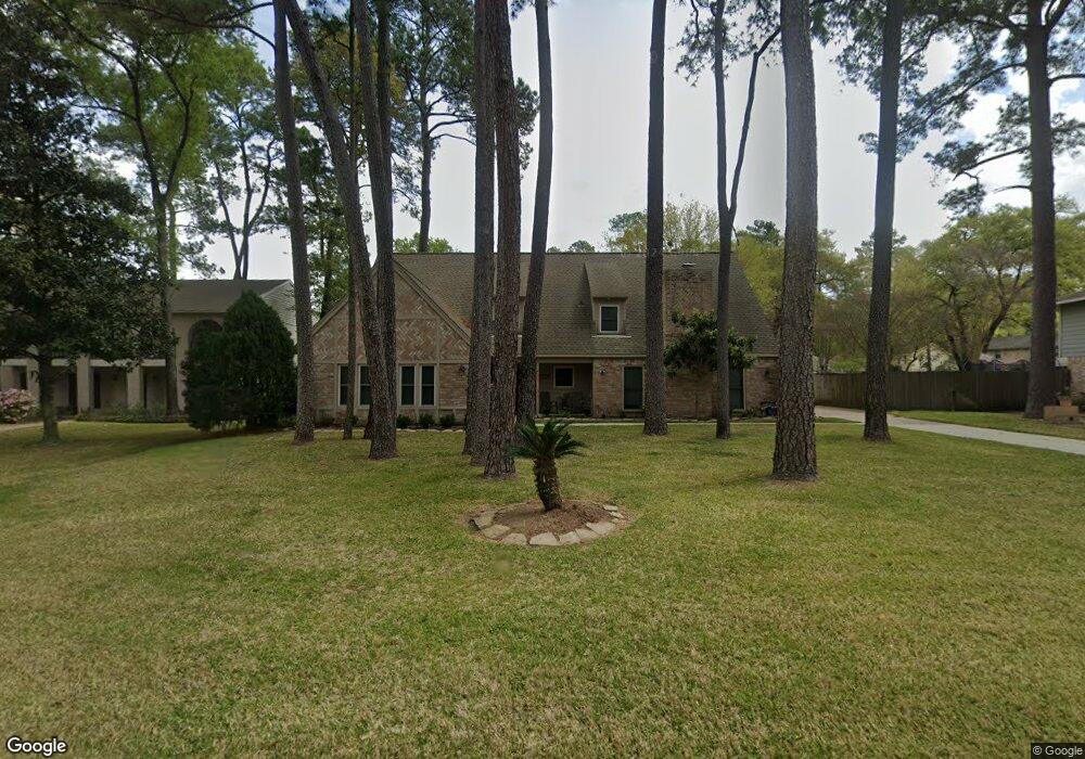
17810 Comoro Ln Spring, TX 77379
Estimated Value: $342,947 - $369,000
4
Beds
4
Baths
4,068
Sq Ft
$86/Sq Ft
Est. Value
About This Home
This home is located at 17810 Comoro Ln, Spring, TX 77379 and is currently estimated at $350,987, approximately $86 per square foot. 17810 Comoro Ln is a home located in Harris County with nearby schools including Theiss Elementary School, Doerre Intermediate School, and Klein High School.
Ownership History
Date
Name
Owned For
Owner Type
Purchase Details
Closed on
May 25, 1994
Sold by
Ivins Clarke H and Ivins Susan K
Bought by
Henry Kenneth E and Henry Peggy L
Current Estimated Value
Home Financials for this Owner
Home Financials are based on the most recent Mortgage that was taken out on this home.
Original Mortgage
$98,550
Interest Rate
8.45%
Mortgage Type
FHA
Create a Home Valuation Report for This Property
The Home Valuation Report is an in-depth analysis detailing your home's value as well as a comparison with similar homes in the area
Purchase History
| Date | Buyer | Sale Price | Title Company |
|---|---|---|---|
| Henry Kenneth E | -- | Commonwealth Land Title Co |
Source: Public Records
Mortgage History
| Date | Status | Borrower | Loan Amount |
|---|---|---|---|
| Closed | Henry Kenneth E | $98,550 |
Source: Public Records
Tax History
| Year | Tax Paid | Tax Assessment Tax Assessment Total Assessment is a certain percentage of the fair market value that is determined by local assessors to be the total taxable value of land and additions on the property. | Land | Improvement |
|---|---|---|---|---|
| 2025 | $1,471 | $285,262 | $67,100 | $218,162 |
| 2024 | $1,471 | $306,052 | $67,100 | $238,952 |
| 2023 | $1,471 | $298,196 | $67,100 | $231,096 |
| 2022 | $2,325 | $261,026 | $67,100 | $193,926 |
| 2021 | $5,064 | $226,770 | $35,614 | $191,156 |
| 2020 | $4,673 | $193,216 | $35,614 | $157,602 |
| 2019 | $4,962 | $197,811 | $35,614 | $162,197 |
| 2018 | $2,125 | $202,427 | $35,614 | $166,813 |
| 2017 | $5,087 | $202,427 | $35,614 | $166,813 |
| 2016 | $4,948 | $202,427 | $35,614 | $166,813 |
| 2015 | $3,690 | $202,427 | $35,614 | $166,813 |
| 2014 | $3,690 | $167,291 | $32,517 | $134,774 |
Source: Public Records
Map
Nearby Homes
- 7906 Beaufort Dr
- 8011 Beaufort Dr
- 8019 Beaufort Dr
- 7611 Theisswood Rd
- 17902 Fernbluff Dr
- 7610 Theisswood Rd
- 7914 Huddersfield Ct
- 7531 Ralick Ct
- 8131 Theisswood Rd
- 7930 Tizerton Ct
- 7711 Oxfordshire Dr
- 17511 Hidden Forest Cir
- 7510 Ralick Ct
- 17418 Wilton Park Ct
- 7502 Ralick Ct
- 8006 Northbridge Cir
- 17810 Clearlight Ln
- 7815 Wilton Park Dr
- 17318 Rothko Ln
- 17315 Rothko Ln
- 17802 Comoro Ln
- 17814 Comoro Ln
- 17807 Freida Ln
- 17811 Freida Ln
- 17811 Comoro Ln
- 17818 Comoro Ln
- 17807 Comoro Ln
- 17815 Freida Ln
- 17803 Comoro Ln
- 17815 Comoro Ln
- 17819 Comoro Ln
- 7907 Theisswood Rd
- 7911 Theisswood Rd
- 7903 Theisswood Rd
- 7915 Theisswood Rd
- 7911 Aleta Dr
- 7915 Aleta Dr
- 17806 Running Brook Ln
- 7903 Aleta Dr
- 17802 Freida Ln
Your Personal Tour Guide
Ask me questions while you tour the home.