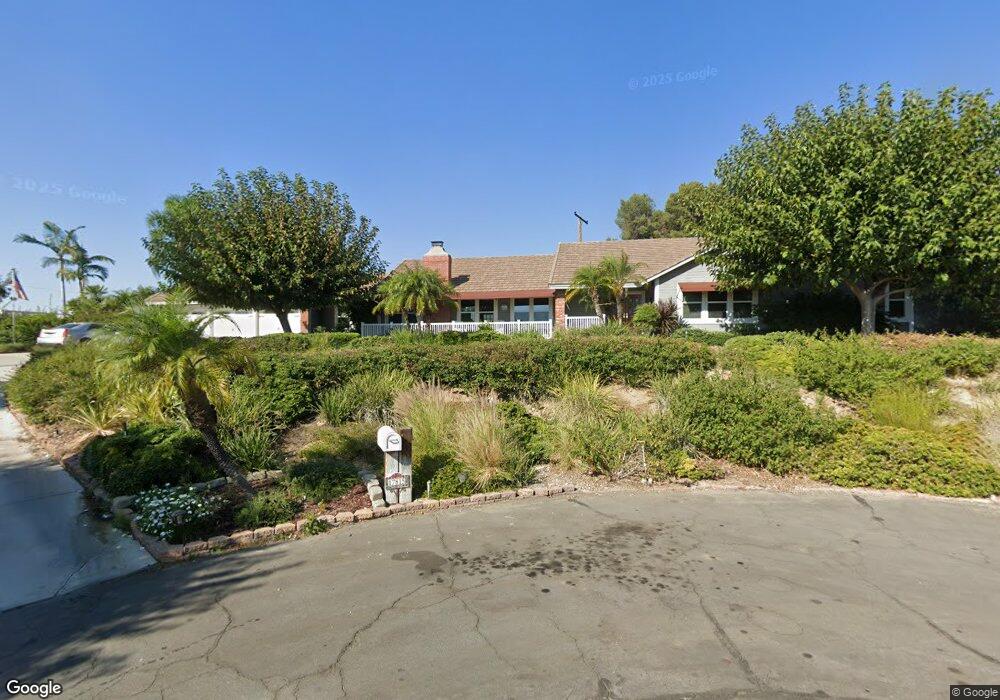
17815 Longview Cir Yorba Linda, CA 92886
Estimated Value: $1,632,000 - $2,149,000
4
Beds
3
Baths
3,078
Sq Ft
$609/Sq Ft
Est. Value
About This Home
This home is located at 17815 Longview Cir, Yorba Linda, CA 92886 and is currently estimated at $1,873,864, approximately $608 per square foot. 17815 Longview Cir is a home located in Orange County with nearby schools including Linda Vista Elementary School, Yorba Linda Middle School, and Friends Christian School.
Ownership History
Date
Name
Owned For
Owner Type
Purchase Details
Closed on
Jul 19, 2000
Sold by
Dennis K Thomas Family Lp
Bought by
Thomas Dennis K and Thomas Barbara J
Current Estimated Value
Purchase Details
Closed on
Oct 22, 1996
Sold by
Dennis Thomas and Dennis Barbara
Bought by
Dennis K Thomas Family Ltd Partnership
Purchase Details
Closed on
Jan 28, 1994
Sold by
Benson John A and Benson Medguel Rose
Bought by
Thomas Dennis K and Thomas Barbara J
Home Financials for this Owner
Home Financials are based on the most recent Mortgage that was taken out on this home.
Original Mortgage
$295,000
Interest Rate
7.21%
Create a Home Valuation Report for This Property
The Home Valuation Report is an in-depth analysis detailing your home's value as well as a comparison with similar homes in the area
Home Values in the Area
Average Home Value in this Area
Purchase History
| Date | Buyer | Sale Price | Title Company |
|---|---|---|---|
| Thomas Dennis K | -- | -- | |
| Dennis K Thomas Family Ltd Partnership | -- | -- | |
| Thomas Dennis K | $395,000 | Gateway Title |
Source: Public Records
Mortgage History
| Date | Status | Borrower | Loan Amount |
|---|---|---|---|
| Previous Owner | Thomas Dennis K | $295,000 |
Source: Public Records
Tax History Compared to Growth
Tax History
| Year | Tax Paid | Tax Assessment Tax Assessment Total Assessment is a certain percentage of the fair market value that is determined by local assessors to be the total taxable value of land and additions on the property. | Land | Improvement |
|---|---|---|---|---|
| 2025 | $7,878 | $699,645 | $272,285 | $427,360 |
| 2024 | $7,878 | $685,927 | $266,946 | $418,981 |
| 2023 | $7,738 | $672,478 | $261,712 | $410,766 |
| 2022 | $7,666 | $659,293 | $256,581 | $402,712 |
| 2021 | $7,530 | $646,366 | $251,550 | $394,816 |
| 2020 | $7,430 | $639,739 | $248,971 | $390,768 |
| 2019 | $7,173 | $627,196 | $244,090 | $383,106 |
| 2018 | $7,085 | $614,899 | $239,304 | $375,595 |
| 2017 | $6,971 | $602,843 | $234,612 | $368,231 |
| 2016 | $6,831 | $591,023 | $230,012 | $361,011 |
| 2015 | $6,749 | $582,146 | $226,557 | $355,589 |
| 2014 | $6,550 | $570,743 | $222,119 | $348,624 |
Source: Public Records
Map
Nearby Homes
- 5231 Highland Ave
- 17841 Buena Vista Ave
- 5141 Siesta Ln
- 17842 Caballo Dr
- 5661 Casa Loma Ave
- 18044 Burke Ln
- 5130 Webb Place
- 18083 Burke Ln
- 4891 Eureka Ave Unit 25
- 17781 Lerene Dr
- 4845 Eisenhower Ct
- 5152 Lakeview Ave
- 5992 Organza Dr
- 17225 Orange Blossom Ln
- 17967 Sun Hill Dr
- 1524 Larsen Ln
- 18571 Buena Vista Ave
- 1527 Evans Ln
- 6052 Candle Light Ln
- 17001 La Kenice Way
- 17805 Longview Cir
- 17810 Longview Cir
- 17800 Longview Cir
- 17825 Longview Cir
- 5315 Highland Ave
- 5411 Highland Ave
- 5392 Highland Ave
- 17822 Longview Dr
- 5307 Highland Ct
- 17831 Longview Dr
- 5305 Highland Ct
- 5300 Richfield Rd
- 17832 Longview Dr
- 5382 Highland Ave
- 17851 Longview Dr
- 5362 Richfield Rd
- 5303 Highland Ct
- 5300 Highland Ct
- 5301 Highland Ct
- 17762 Calgary Ave