NOT LISTED FOR SALE

17820 Mountain View Rd Sisters, OR 97759

Estimated Value: $662,779

83.7 Acres
$7,919 Price per Acre
3,645,972 Sq Ft Lot

Last Sold April 14, 2022

Last sale price $612,500

Est. 8% increase in value since last sale

Current estimated payment $3,509/month

606 Days on Market

Highlights

  • Horse Property
  • 83.7 Acre Lot
  • Wooded Lot
  • Sisters Elementary School Rated A-
  • Mountain View
  • Corner Lot

About This Lot

As of April 2022

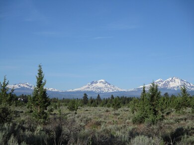
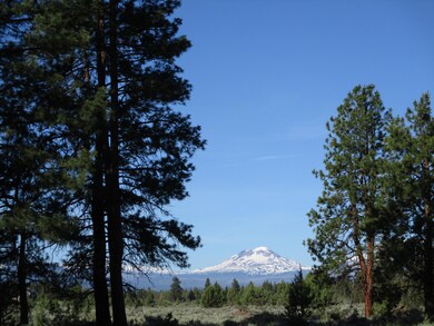
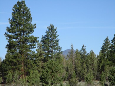
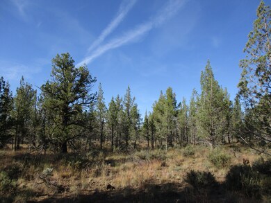
Mountain Views from this 83-acre parcel. Tree groves or open skies...choose your estate caliber homesite. Forest land borders one-half mile for added privacy. A water hook-up available if desired or drill your own. Horses, Hermits or Homebodies, a beautiful spot to create your custom dream. Eight miles to the Western town of Sisters.

Last Agent to Sell the Property

Carol Davis

Ponderosa Properties License #900200095 Listed on: 12/30/2021

Last Buyer's Agent

Dan Cook

Berkshire Hathaway HomeService License #200406146

Berkshire Hathaway HomeService

Property Details

Property Type

  • Land

Est. Annual Taxes

  • $5,613

Lot Details

  • 83.7 Acre Lot
  • Native Plants
  • Corner Lot
  • Wooded Lot
  • Additional Parcels
  • Property is zoned RR10, EFU, RR10, EFU

Property Views

  • Mountain
  • Territorial

Schools

  • Sisters Elementary School
  • Sisters Middle School
  • Sisters High School

Mobile Home

  • Mobile Home Allowed

Utilities

  • Septic Needed
  • Fiber Optics Available
  • Phone Available
  • Cable TV Available

Listing and Financial Details

  • Short Term Rentals Allowed
  • Assessor Parcel Number 167282, 167097, 167098, 162247

Community Details

Overview

  • No Home Owners Association
  • Clas Subdivision
  • Property is near a preserve or public land

Recreation

  • Horse Property

Property Details

Property Type

Land

Est. Annual Taxes

$5,613

Lot Details

0

Listing Details

  • Directions: North from Sisters on Locust St, turns into Camp Polk, straight onto Wilt, right on Buffalo, all the way to left on Mountain View. At end of pavement, go left onto gravel road. Property on the left.
  • Garage Yn: No
  • Lot Size Acres: 83.7
  • Prop. Type: Land
  • Property Sub Type: Residential Lots
  • Road Frontage Type: Shared Access
  • Road Surface Type: Gravel, Paved
  • Subdivision Name: CLAS
  • Co List Office Phone: 541-549-2002
  • MLS Status: Closed
  • General Property Information Elementary School: Sisters Elem
  • General Property Information Middle Or Junior School: Sisters Middle
  • General Property Information High School: Sisters High
  • General Property Information:Zoning2: RR10, EFU
  • General Property Information Senior Community YN: No
  • General Property Information Horse Property YN: Yes
  • General Property Information Manufactured Structure Allowed YN: Yes
  • General Property Information Audio Surveillance on Premises YN: No
  • Road Surface Type:Paved: Yes
  • View Territorial: Yes
  • Utilities:Cable Available: Yes
  • Utilities:Electricity Available: Yes
  • Utilities Fiber Optics Available: Yes
  • Utilities Phone Available: Yes
  • Water Source:Public: Yes
  • View Cascade Mountains: Yes
  • Location Tax and Legal:Tax Lot: 0
  • Location Tax and Legal:Tax Block: 0
  • Road Surface Type Gravel2: Yes
  • Sewer Septic Needed: Yes
  • Utilities:Electricity Connected: Yes
  • View:Mountain(s): Yes
  • Community Features Short Term Rentals Allowed: Yes
  • Lot Features Adjoins Public Lands: Yes
  • Sewer Perc Test Required: Yes
  • Special Features: None

Exterior Features

  • Lot Features: Adjoins Public Lands, Corner Lot, Native Plants, Wooded
  • View: Cascade Mountains, Mountain(s), Territorial
  • Fencing: None
  • Horse: Yes
  • Lot Features:Corner Lot: Yes
  • Lot Features:Native Plants: Yes
  • Lot Features:Wooded: Yes

Garage/Parking

  • General Property Information:Garage YN: No

Utilities

  • Sewer: Perc Test Required, Septic Needed
  • Water Source: Public, Other
  • Utilities: Cable Available, Electricity Available, Fiber Optics Available, Phone Available

Condo/Co-op/Association

  • Association: No
  • Community Features: Short Term Rentals Allowed
  • Senior Community: No

Association/Amenities

  • General Property Information:Association YN: No

Schools

  • Elementary School: Sisters Elem
  • High School: Sisters High
  • Middle Or Junior School: Sisters Middle

Lot Info

  • Additional Parcels Description: 141119A001500, 141120B002100, 141119A001600
  • Additional Parcels: Yes
  • Lot Size Sq Ft: 3645972.0
  • Parcel #: 167282, 167097, 167098, 162247
  • Irrigation Water Rights: No
  • Current Use: Vacant
  • ResoLotSizeUnits: Acres
  • Zoning Description: RR10, EFU
  • ResoLotSizeUnits: Acres

Tax Info

  • Tax Annual Amount: 5613.0
  • Tax Block: 0
  • Tax Lot: 0
  • Tax Map Number: 141117C000100
  • Tax Year: 2019

Ownership History

Date Name Owned For Owner Type

Purchase Details

Listed on
Dec 30, 2021
Closed on
Apr 14, 2022
Sold by
David Remund Ronald
Bought by
W Harrison Investments Llc
Seller's Agent
Carol Davis
Ponderosa Properties
Buyer's Agent
Dan Cook
Berkshire Hathaway HomeService
List Price
$980,000
Sold Price
$612,500
Premium/Discount to List
-$367,500
-37.5%
Current Estimated Value
$662,779

Home Financials for this Owner

Home Financials are based on the most recent Mortgage that was taken out on this home.
Estimated Appreciation
$50,279
Avg. Annual Appreciation
-0.68%

Purchase Details

Closed on
Nov 6, 2013
Sold by
Squaq Creek Canyon Recreational Estates
Bought by
Remund Ronald D and Ronald D Remund Revocable Living Trust
Source: Public Records

Range of Values:

Collateral Analytics

Collateral Analytics Collateral Analytics AVMs (Automated Valuation Model) employ a number of statistical approaches combined with neighborhood-specific comparable selection guarantees the most up-to-date and precise valuations.

Not Available

Collateral Analytics does not have data for the current month. Please view the chart for historical values.

ICE

ICE Mortgage Technology ICE Mortgage Technology’s AVM (Automated Valuation Model) is a state-of-the-art online residential property valuation tool that provides a quick and accurate estimate of the value of almost any home in the U.S.

Not Available

ICE Mortgage Technology does not have data for the current month. Please view the chart for historical values.

First American

First American First American Data & Analytics’ next-generation AVM combines unrivaled data assets with a blended ensemble of valuation models to produce highly accurate, reliable valuations you can trust.

Not Available

First American does not have data for the current month. Please view the chart for historical values.

Quantarium

Quantarium Quantarium’s valuation service, repeatedly proven the industry’s most accurate and comprehensive, is supercharged with a self-learning and auto-tuning AI engine that continually becomes smarter and more accurate as it processes daily inputs from the industry’s leading RE data lake.

Not Available

Quantarium does not have data for the current month. Please view the chart for historical values.

Average Value
Not Available
List Price
Sold Price
Create a Home Valuation Report for This Property
The Home Valuation Report is an in-depth analysis detailing your home's value as well as a comparison with similar homes in the area

Home Values in the Area

Source: Public Records

Average Home Value in this Area


Source: Public Records

Purchase History

Date Buyer Sale Price Title Company
W Harrison Investments Llc $612,500 First American Title
Remund Ronald D -- None Available
Source: Public Records

Property History

Date Event Price Change Sq Ft Price
04/14/2022 04/14/22 Sold $612,500 -37.5% --
02/22/2022 02/22/22 Pending -- -- --
06/26/2020 06/26/20 For Sale $980,000 -- --
Source: Oregon Datashare

Tax History Compared to Growth

Source: Public Records

Tax History

Year Tax Paid Tax Assessment Tax Assessment Total Assessment is a certain percentage of the fair market value that is determined by local assessors to be the total taxable value of land and additions on the property. Land Improvement
2024 $111 $4,804 $4,804 --
2023 $110 $4,804 $4,804 $0
2022 $83 $4,804 $0 $0
2021 $83 $4,804 $0 $0
2020 $79 $4,804 $0 $0
2019 $130 $4,804 $0 $0
2018 $128 $4,804 $0 $0
2017 $127 $4,804 $0 $0
2016 $135 $4,804 $0 $0
2015 $132 $4,804 $0 $0
2014 $116 $4,804 $0 $0
Source: Public Records

Agents Affiliated with this Home

  • Section Image
  • Section Image
See All Agents

Map

Source: Oregon Datashare

MLS Number: 220103712

Oregon Datashare

APN: 167282