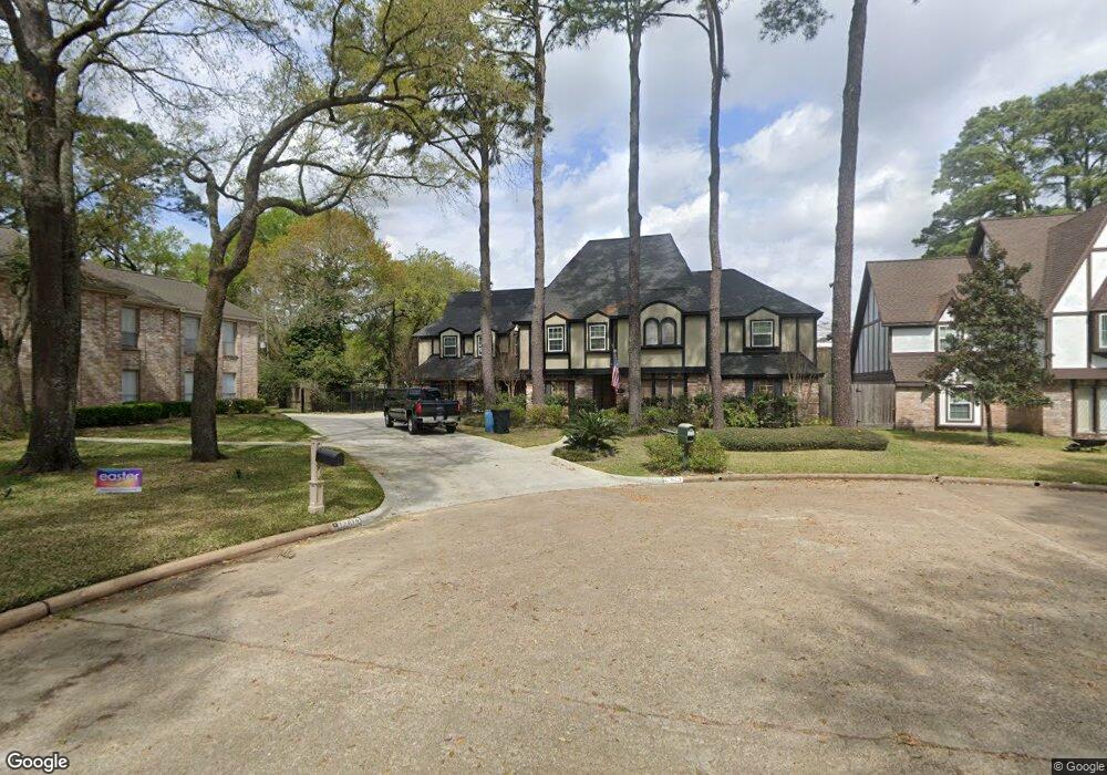
17823 Running Brook Ln Spring, TX 77379
Estimated Value: $489,000 - $540,670
4
Beds
4
Baths
3,978
Sq Ft
$129/Sq Ft
Est. Value
About This Home
This home is located at 17823 Running Brook Ln, Spring, TX 77379 and is currently estimated at $513,668, approximately $129 per square foot. 17823 Running Brook Ln is a home located in Harris County with nearby schools including Theiss Elementary School, Doerre Intermediate School, and Klein High School.
Ownership History
Date
Name
Owned For
Owner Type
Purchase Details
Closed on
Jun 16, 2014
Sold by
Roark Leslie
Bought by
Roark Sean Kevin and Roark Leslie
Current Estimated Value
Home Financials for this Owner
Home Financials are based on the most recent Mortgage that was taken out on this home.
Original Mortgage
$175,000
Outstanding Balance
$133,856
Interest Rate
4.35%
Mortgage Type
Purchase Money Mortgage
Estimated Equity
$379,812
Purchase Details
Closed on
Oct 4, 2005
Sold by
Graham Harold L and Graham Veranne
Bought by
Roark Leslie
Home Financials for this Owner
Home Financials are based on the most recent Mortgage that was taken out on this home.
Original Mortgage
$175,200
Interest Rate
5.73%
Mortgage Type
Purchase Money Mortgage
Purchase Details
Closed on
Aug 29, 1997
Sold by
Hoong Kuo Yuan and Hoong Chi Huei
Bought by
Graham Harold L and Graham Veranne
Create a Home Valuation Report for This Property
The Home Valuation Report is an in-depth analysis detailing your home's value as well as a comparison with similar homes in the area
Purchase History
| Date | Buyer | Sale Price | Title Company |
|---|---|---|---|
| Roark Sean Kevin | -- | Charter Title Co | |
| Roark Leslie | -- | Landamerica Commonwealth Lan | |
| Graham Harold L | -- | Stewart Title |
Source: Public Records
Mortgage History
| Date | Status | Borrower | Loan Amount |
|---|---|---|---|
| Open | Roark Sean Kevin | $175,000 | |
| Closed | Roark Leslie | $175,200 |
Source: Public Records
Tax History
| Year | Tax Paid | Tax Assessment Tax Assessment Total Assessment is a certain percentage of the fair market value that is determined by local assessors to be the total taxable value of land and additions on the property. | Land | Improvement |
|---|---|---|---|---|
| 2025 | $2,256 | $591,206 | $68,284 | $522,922 |
| 2024 | $2,256 | $590,016 | $68,284 | $521,732 |
| 2023 | $2,256 | $677,400 | $68,284 | $609,116 |
| 2022 | $7,593 | $521,369 | $68,284 | $453,085 |
| 2021 | $7,354 | $475,000 | $36,243 | $438,757 |
| 2020 | $6,965 | $459,789 | $36,243 | $423,546 |
| 2019 | $6,568 | $431,600 | $36,243 | $395,357 |
| 2018 | $2,712 | $238,000 | $36,243 | $201,757 |
| 2017 | $5,981 | $238,000 | $36,243 | $201,757 |
| 2016 | $5,981 | $238,000 | $36,243 | $201,757 |
| 2015 | $4,598 | $286,914 | $36,243 | $250,671 |
| 2014 | $4,598 | $200,594 | $33,092 | $167,502 |
Source: Public Records
Map
Nearby Homes
- 8019 Beaufort Dr
- 7906 Beaufort Dr
- 8011 Beaufort Dr
- 7914 Huddersfield Ct
- 8131 Theisswood Rd
- 7930 Tizerton Ct
- 17902 Fernbluff Dr
- 7611 Theisswood Rd
- 7610 Theisswood Rd
- 17511 Hidden Forest Cir
- 8006 Northbridge Cir
- 7531 Ralick Ct
- 8022 Democracy Ct
- 7711 Oxfordshire Dr
- 8207 Colonial Oaks Ln
- 8027 Danette Ct
- 17418 Wilton Park Ct
- 7510 Ralick Ct
- 7715 Goldengrove Dr
- 7502 Ralick Ct
- 17819 Running Brook Ln
- 17822 Running Brook Ln
- 17815 Running Brook Ln
- 17818 Running Brook Ln
- 17814 Running Brook Ln
- 7919 Aleta Dr
- 17815 Comoro Ln
- 17819 Comoro Ln
- 17814 Theiss Mail Route Rd
- 17807 Running Brook Ln
- 17806 Theiss Mail Route Rd
- 17810 Theiss Mail Route Rd
- 17802 Theiss Mail Route Rd
- 17903 Wind Trace Ln
- 17907 Wind Trace Ln
- 7915 Aleta Dr
- 17806 Running Brook Ln
- 7919 Aylesbury Ln
- 7915 Aylesbury Ln
- 17738 Theiss Mail Route Rd
Your Personal Tour Guide
Ask me questions while you tour the home.