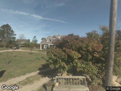
1783 Corn Neck Rd Block Island, RI 02807
Estimated Value: $1,551,959 - $2,429,000
3
Beds
3
Baths
2,430
Sq Ft
$852/Sq Ft
Est. Value
About This Home
This home is located at 1783 Corn Neck Rd, Block Island, RI 02807 and is currently estimated at $2,069,490, approximately $851 per square foot. 1783 Corn Neck Rd is a home with nearby schools including Block Island School.
Ownership History
Date
Name
Owned For
Owner Type
Purchase Details
Closed on
Dec 9, 2020
Sold by
Mcgarry Carol
Bought by
Mcgarry Mcgarry-Schofield S and Mcgarry Todd
Current Estimated Value
Home Financials for this Owner
Home Financials are based on the most recent Mortgage that was taken out on this home.
Original Mortgage
$390,000
Interest Rate
2.8%
Mortgage Type
Balloon
Purchase Details
Closed on
Aug 27, 2012
Sold by
Mcgarry Carol A
Bought by
Mcgarry-Schofield S M and Mcgarry Todd
Create a Home Valuation Report for This Property
The Home Valuation Report is an in-depth analysis detailing your home's value as well as a comparison with similar homes in the area
Home Values in the Area
Average Home Value in this Area
Purchase History
| Date | Buyer | Sale Price | Title Company |
|---|---|---|---|
| Mcgarry Mcgarry-Schofield S | -- | None Available | |
| Mcgarry-Schofield S M | -- | -- |
Source: Public Records
Mortgage History
| Date | Status | Borrower | Loan Amount |
|---|---|---|---|
| Open | Mcgarry Sean J | $10,000 | |
| Open | Mcgarry Todd | $300,000 | |
| Closed | Mcgarry Sean J | $300,000 | |
| Closed | Mcgarry Todd | $390,000 | |
| Previous Owner | Mcgarry Sean | $150,000 |
Source: Public Records
Tax History Compared to Growth
Tax History
| Year | Tax Paid | Tax Assessment Tax Assessment Total Assessment is a certain percentage of the fair market value that is determined by local assessors to be the total taxable value of land and additions on the property. | Land | Improvement |
|---|---|---|---|---|
| 2024 | $5,903 | $1,069,300 | $462,900 | $606,400 |
| 2023 | $6,437 | $1,069,300 | $462,900 | $606,400 |
| 2022 | $4,830 | $682,160 | $410,960 | $271,200 |
| 2021 | $6,621 | $988,160 | $822,640 | $165,520 |
| 2020 | $6,285 | $988,160 | $822,640 | $165,520 |
| 2019 | $6,087 | $988,160 | $822,640 | $165,520 |
| 2018 | $5,855 | $1,001,280 | $822,640 | $178,640 |
| 2017 | $5,868 | $1,001,280 | $822,640 | $178,640 |
| 2016 | $5,727 | $1,001,280 | $822,640 | $178,640 |
| 2015 | $6,943 | $1,260,000 | $1,028,300 | $231,700 |
| 2014 | $6,728 | $1,260,000 | $1,028,300 | $231,700 |
| 2013 | $6,565 | $1,260,000 | $1,028,300 | $231,700 |
Source: Public Records
Map
Nearby Homes
- 721 Corn Neck Rd
- 681 Corn Neck Rd
- 72 W Side Rd Unit 6
- 0 W Side Rd Unit 1376234
- 1194 Center Rd
- 0 Off West Side Rd Unit 1366047
- 1501 Beacon Hill Rd
- 10 Dunn Town Rd
- 1557 W Side Rd
- 959 Dories Cove Rd
- 244 Spring St
- 0 Old Center Rd
- 1627 Old Mill Rd
- 0 Southeast Rd Unit 1381406
- 1455 Payne Rd
- 1661 Sand Pond Rd
- 0 Pilot Hill Rd
- 1632 Lakeside Dr
- 0 Mohegan Trail
- 142 Green Hill Ocean Dr
- 1783 Corn Neck Rd
- 1736 Corn Neck Rd
- 736 Corn Neck Rd
- 1146 Corn Neck Rd
- 735 Corn Neck Rd
- 733 Corn Neck Rd
- 739 Corn Neck Rd
- 734 Corn Neck Rd
- 1143 Corn Neck Rd
- 1709 Corn Neck Rd
- 4 Off Corn Neck Rd
- 741 Corn Neck Rd
- 742 Corn Neck Rd
- 1077 Corn Neck Rd
- 1703 Corn Neck Rd
- 1746 Corn Neck Rd
- 1033 Corn Neck Rd
- 1160 Corn Neck Rd
- 732 Corn Neck Rd
- 743 Corn Neck Rd