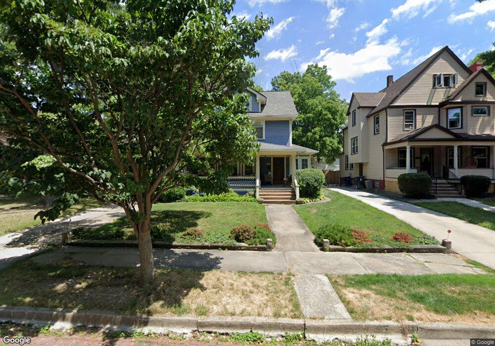
1783 Middlehurst Rd Cleveland, OH 44118
Estimated Value: $265,000 - $281,000
5
Beds
2
Baths
1,876
Sq Ft
$146/Sq Ft
Est. Value
About This Home
This home is located at 1783 Middlehurst Rd, Cleveland, OH 44118 and is currently estimated at $273,443, approximately $145 per square foot. 1783 Middlehurst Rd is a home located in Cuyahoga County with nearby schools including Boulevard Elementary School, Roxboro Middle School, and Cleveland Heights High School.
Ownership History
Date
Name
Owned For
Owner Type
Purchase Details
Closed on
Oct 20, 1981
Sold by
Woda Roy
Bought by
Woda Roy and Woda Elizabeth M
Current Estimated Value
Purchase Details
Closed on
Apr 14, 1978
Sold by
Martin Colin
Bought by
Woda Roy
Purchase Details
Closed on
Jul 1, 1977
Sold by
Cronin Mary Ann
Bought by
Martin Colin
Purchase Details
Closed on
Apr 27, 1976
Sold by
Cronin Daniel D and M A
Bought by
Cronin Mary Ann
Purchase Details
Closed on
Jan 1, 1975
Bought by
Cronin Daniel D and M A
Create a Home Valuation Report for This Property
The Home Valuation Report is an in-depth analysis detailing your home's value as well as a comparison with similar homes in the area
Home Values in the Area
Average Home Value in this Area
Purchase History
| Date | Buyer | Sale Price | Title Company |
|---|---|---|---|
| Woda Roy | -- | -- | |
| Woda Roy | $45,000 | -- | |
| Martin Colin | $28,000 | -- | |
| Cronin Mary Ann | -- | -- | |
| Cronin Daniel D | -- | -- |
Source: Public Records
Tax History Compared to Growth
Tax History
| Year | Tax Paid | Tax Assessment Tax Assessment Total Assessment is a certain percentage of the fair market value that is determined by local assessors to be the total taxable value of land and additions on the property. | Land | Improvement |
|---|---|---|---|---|
| 2024 | $6,776 | $89,810 | $17,500 | $72,310 |
| 2023 | $5,692 | $61,540 | $14,600 | $46,940 |
| 2022 | $5,708 | $61,530 | $14,600 | $46,940 |
| 2021 | $5,592 | $61,530 | $14,600 | $46,940 |
| 2020 | $5,412 | $54,920 | $13,020 | $41,900 |
| 2019 | $5,113 | $156,900 | $37,200 | $119,700 |
| 2018 | $5,026 | $54,920 | $13,020 | $41,900 |
| 2017 | $5,215 | $52,540 | $13,900 | $38,640 |
| 2016 | $5,205 | $52,540 | $13,900 | $38,640 |
| 2015 | $4,503 | $52,540 | $13,900 | $38,640 |
| 2014 | $4,503 | $48,650 | $12,880 | $35,770 |
Source: Public Records
Map
Nearby Homes
- 2940 Somerton Rd
- 14269 Superior Rd
- 14265 Superior Rd
- 1890 Woodward Ave
- 1725 Preyer Ave
- 3048 Euclid Heights Blvd
- 1635 Hillcrest Rd
- 3007 Edgehill Rd
- 3115 Lincoln Blvd
- 1645 Cumberland Rd
- 1602 Hillcrest Rd
- 1676 Glenmont Rd
- 1695 Lee Rd
- 2759 Hampshire Rd Unit 3
- 1901 Parkway Dr
- 3054 E Overlook Rd
- 1935 Coventry Rd
- 14450 Superior Rd
- 3165 Oak Rd
- 1650 Coventry Rd
- 1787 Middlehurst Rd
- 1779 Middlehurst Rd
- 1793 Middlehurst Rd
- 1773 Middlehurst Rd
- 1782 Radnor Rd
- 1799 Middlehurst Rd
- 1788 Radnor Rd
- 1778 Radnor Rd
- 1769 Middlehurst Rd
- 1772 Radnor Rd
- 1792 Radnor Rd
- 1805 Middlehurst Rd
- 1782 Middlehurst Rd
- 1764 Radnor Rd
- 1798 Radnor Rd
- 1772 Middlehurst Rd
- 1788 Middlehurst Rd
- 1760 Radnor Rd
- 2964 Hampshire Rd
- 1809 Middlehurst Rd