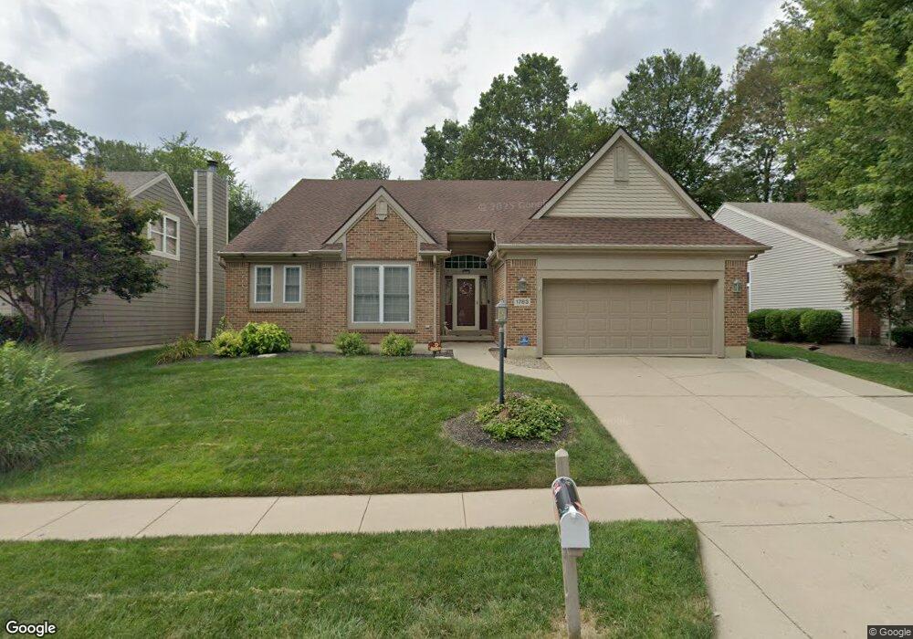
1783 Silverado Dr Bellbrook, OH 45305
Estimated Value: $327,215 - $385,000
3
Beds
2
Baths
1,998
Sq Ft
$180/Sq Ft
Est. Value
About This Home
This home is located at 1783 Silverado Dr, Bellbrook, OH 45305 and is currently estimated at $360,054, approximately $180 per square foot. 1783 Silverado Dr is a home located in Greene County with nearby schools including Stephen Bell Elementary School, Bell Creek Intermediate School, and Bellbrook Middle School.
Ownership History
Date
Name
Owned For
Owner Type
Purchase Details
Closed on
Mar 6, 2002
Sold by
Powell Richard W and Powell Elizabeth D
Bought by
Gibson John C and The John C Gibson Revocable Living Trust
Current Estimated Value
Home Financials for this Owner
Home Financials are based on the most recent Mortgage that was taken out on this home.
Original Mortgage
$50,000
Interest Rate
7.11%
Purchase Details
Closed on
Jan 20, 1995
Sold by
Tom Peebles Bldrs Inc
Bought by
Powell Richard W and Powell D
Home Financials for this Owner
Home Financials are based on the most recent Mortgage that was taken out on this home.
Original Mortgage
$147,200
Interest Rate
8%
Mortgage Type
New Conventional
Create a Home Valuation Report for This Property
The Home Valuation Report is an in-depth analysis detailing your home's value as well as a comparison with similar homes in the area
Home Values in the Area
Average Home Value in this Area
Purchase History
| Date | Buyer | Sale Price | Title Company |
|---|---|---|---|
| Gibson John C | $185,000 | Midwest Abstract Company | |
| Powell Richard W | $184,000 | -- |
Source: Public Records
Mortgage History
| Date | Status | Borrower | Loan Amount |
|---|---|---|---|
| Closed | Gibson John C | $50,000 | |
| Previous Owner | Powell Richard W | $147,200 | |
| Closed | Gibson John C | $12,500 |
Source: Public Records
Tax History
| Year | Tax Paid | Tax Assessment Tax Assessment Total Assessment is a certain percentage of the fair market value that is determined by local assessors to be the total taxable value of land and additions on the property. | Land | Improvement |
|---|---|---|---|---|
| 2025 | $4,940 | $98,090 | $23,430 | $74,660 |
| 2024 | $4,940 | $98,090 | $23,430 | $74,660 |
| 2023 | $4,871 | $98,090 | $23,430 | $74,660 |
| 2022 | $4,480 | $76,320 | $15,620 | $60,700 |
| 2021 | $4,531 | $76,320 | $15,620 | $60,700 |
| 2020 | $3,875 | $76,320 | $15,620 | $60,700 |
| 2019 | $3,875 | $65,510 | $8,600 | $56,910 |
| 2018 | $3,881 | $65,510 | $8,600 | $56,910 |
| 2017 | $3,656 | $65,510 | $8,600 | $56,910 |
| 2016 | $3,656 | $60,600 | $8,600 | $52,000 |
| 2015 | $3,597 | $60,600 | $8,600 | $52,000 |
| 2014 | $3,319 | $60,600 | $8,600 | $52,000 |
Source: Public Records
Map
Nearby Homes
- 4236 Apple Branch Dr
- 4232 Apple Branch Dr
- 4264 Apple Branch Dr
- 4206 Sugar Point Way
- 4214 N Golden Clove Bend
- 4345 Sweet Maple Ln Unit 2-B
- 4208 N Golden Clove Bend
- 4220 Golden Clove Bend
- 4252 Apple Branch Dr Unit 55-201
- 4228 Apple Branch Dr Unit 55-204
- 4242 Apple Branch Dr
- 4218 N Golden Clove Bend
- 4218 Golden Clove Bend
- 1641 Honey Tree Place Unit 29-303
- 2585 Hingham Ln
- 1860 Bledsoe Dr
- 4272 Apple Branch Dr Unit 54-102
- 2520 Hingham Ln
- 4242 Apple Branch Dr Unit 55-102
- 4236 Apple Branch Dr Unit 55-103
- 1789 Silverado Dr
- 1777 Silverado Dr
- 1793 Silverado Dr
- 1771 Silverado Dr
- 1799 Silverado Dr
- 1765 Silverado Dr
- 1784 Silverado Dr
- 1776 Silverado Dr
- 1790 Silverado Dr
- 1805 Silverado Dr
- 4367 Napa Valley Dr
- 1796 Silverado Dr
- 1751 Silverado Dr
- 1802 Silverado Dr
- 1811 Silverado Dr
- 4374 Napa Valley Dr
- 4361 Napa Valley Dr
- 1808 Silverado Dr
- 4366 Napa Valley Dr
- 1817 Silverado Dr
Your Personal Tour Guide
Ask me questions while you tour the home.