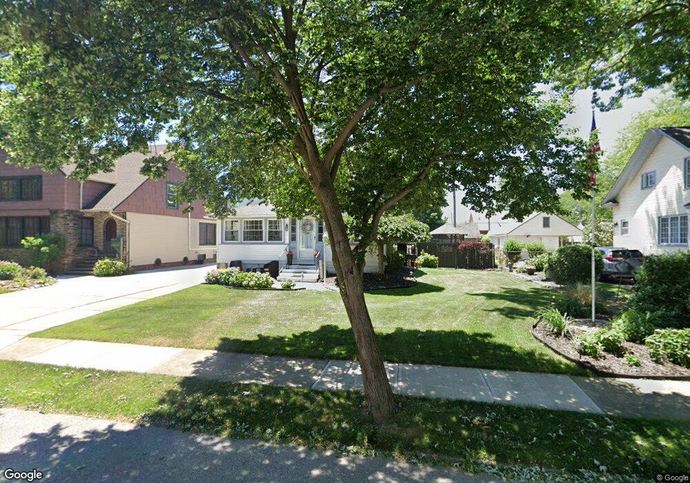
17838 Landseer Rd Cleveland, OH 44119
North Collinwood NeighborhoodEstimated Value: $182,000 - $236,000
4
Beds
2
Baths
1,850
Sq Ft
$117/Sq Ft
Est. Value
About This Home
This home is located at 17838 Landseer Rd, Cleveland, OH 44119 and is currently estimated at $216,773, approximately $117 per square foot. 17838 Landseer Rd is a home located in Cuyahoga County with nearby schools including Bolton, Andrew J. Rickoff School, and Anton Grdina School.
Ownership History
Date
Name
Owned For
Owner Type
Purchase Details
Closed on
Apr 2, 1998
Sold by
Miller Robert A
Bought by
Miller Diana M
Current Estimated Value
Purchase Details
Closed on
Jun 28, 1996
Sold by
Castanet Leigh A
Bought by
Miller Robert A and Miller Diana M
Home Financials for this Owner
Home Financials are based on the most recent Mortgage that was taken out on this home.
Original Mortgage
$75,000
Interest Rate
7%
Mortgage Type
New Conventional
Purchase Details
Closed on
May 26, 1994
Sold by
Easterbrook Robert D
Bought by
Castanet Leigh Anne
Purchase Details
Closed on
Sep 14, 1992
Sold by
Hodgins Raymond
Bought by
Easterbrook Robert D
Purchase Details
Closed on
Oct 9, 1987
Sold by
Tesic Mike M
Bought by
Hodgins Raymond
Purchase Details
Closed on
Jun 26, 1978
Sold by
Moore Ronald L and C L
Bought by
Tesic Mike M
Purchase Details
Closed on
Jan 1, 1975
Bought by
Moore Ronald L and C L
Create a Home Valuation Report for This Property
The Home Valuation Report is an in-depth analysis detailing your home's value as well as a comparison with similar homes in the area
Home Values in the Area
Average Home Value in this Area
Purchase History
| Date | Buyer | Sale Price | Title Company |
|---|---|---|---|
| Miller Diana M | -- | -- | |
| Miller Robert A | $115,000 | -- | |
| Castanet Leigh Anne | -- | -- | |
| Easterbrook Robert D | $81,000 | -- | |
| Hodgins Raymond | $57,500 | -- | |
| Tesic Mike M | $55,000 | -- | |
| Moore Ronald L | -- | -- |
Source: Public Records
Mortgage History
| Date | Status | Borrower | Loan Amount |
|---|---|---|---|
| Previous Owner | Miller Robert A | $75,000 |
Source: Public Records
Tax History Compared to Growth
Tax History
| Year | Tax Paid | Tax Assessment Tax Assessment Total Assessment is a certain percentage of the fair market value that is determined by local assessors to be the total taxable value of land and additions on the property. | Land | Improvement |
|---|---|---|---|---|
| 2024 | $4,376 | $66,745 | $12,635 | $54,110 |
| 2023 | $3,345 | $44,100 | $9,660 | $34,440 |
| 2022 | $3,326 | $44,100 | $9,660 | $34,440 |
| 2021 | $3,292 | $44,100 | $9,660 | $34,440 |
| 2020 | $3,340 | $38,680 | $8,470 | $30,210 |
| 2019 | $3,089 | $110,500 | $24,200 | $86,300 |
| 2018 | $2,942 | $38,680 | $8,470 | $30,210 |
| 2017 | $2,829 | $34,310 | $7,600 | $26,710 |
| 2016 | $2,807 | $34,310 | $7,600 | $26,710 |
| 2015 | $3,421 | $34,310 | $7,600 | $26,710 |
| 2014 | $3,421 | $30,630 | $6,790 | $23,840 |
Source: Public Records
Map
Nearby Homes
- 17930 Rosecliff Rd
- 17710 Crestland Rd
- 18225 Landseer Rd
- 17812 E Park Dr
- 18715 Mohawk Ave
- 18806 Mohawk Ave
- 18606 Cherokee Ave
- 18111 Marcella Rd
- 17610 Wildwood Ln Unit 315
- 19326 Tyronne Ave
- 19400 Meredith Ave
- 19450 Naumann Ave
- 17639 Wildwood Ln Unit 17639
- 17633 Wildwood Ln Unit 311
- 130 E 191st St
- 18404 Neff Rd
- 18707 Shawnee Ave
- 165 E 192nd St
- 19511 Muskoka Ave
- 19409 Cherokee Ave
- 17902 Landseer Rd
- 17830 Landseer Rd
- 17825 Windward Rd
- 17910 Landseer Rd
- 17824 Landseer Rd
- 17817 Windward Rd
- 17831 Windward Rd
- 17837 Landseer Rd
- 17901 Landseer Rd
- 17835 Windward Rd
- 17831 Landseer Rd
- 17914 Landseer Rd
- 17813 Windward Rd
- 17909 Landseer Rd
- 17839 Windward Rd
- 17818 Landseer Rd
- 17827 Landseer Rd
- 17915 Landseer Rd
- 17920 Landseer Rd
- 17823 Landseer Rd