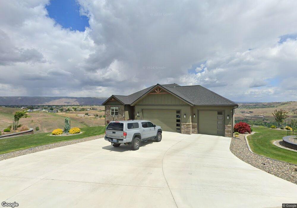
1784 Marshall Ct Unit Sunrise at River's B Clarkston, WA 99403
Estimated Value: $753,584 - $865,000
--
Bed
--
Bath
--
Sq Ft
0.58
Acres
About This Home
This home is located at 1784 Marshall Ct Unit Sunrise at River's B, Clarkston, WA 99403 and is currently estimated at $805,646. 1784 Marshall Ct Unit Sunrise at River's B is a home located in Asotin County with nearby schools including Asotin Elementary School and Asotin Junior/Senior High School.
Ownership History
Date
Name
Owned For
Owner Type
Purchase Details
Closed on
Oct 11, 2020
Sold by
Appleford Jeff and Appleford Marilyn
Bought by
Foraker Larry L and Foraker Yvonne
Current Estimated Value
Home Financials for this Owner
Home Financials are based on the most recent Mortgage that was taken out on this home.
Original Mortgage
$507,600
Outstanding Balance
$451,483
Interest Rate
2.9%
Mortgage Type
New Conventional
Estimated Equity
$354,163
Purchase Details
Closed on
Mar 5, 2019
Sold by
Jolly James B
Bought by
Appleford Jeff and Appleford Marilyn
Purchase Details
Closed on
Feb 19, 2007
Sold by
Poe Asphalt Paving Inc Corp
Bought by
Jolly James B
Create a Home Valuation Report for This Property
The Home Valuation Report is an in-depth analysis detailing your home's value as well as a comparison with similar homes in the area
Home Values in the Area
Average Home Value in this Area
Purchase History
| Date | Buyer | Sale Price | Title Company |
|---|---|---|---|
| Foraker Larry L | $636,500 | Alliance Title & Escrow | |
| Appleford Jeff | $65,000 | Alliance Title & Escrow | |
| Jolly James B | $75,000 | None Available |
Source: Public Records
Mortgage History
| Date | Status | Borrower | Loan Amount |
|---|---|---|---|
| Open | Foraker Larry L | $507,600 |
Source: Public Records
Tax History Compared to Growth
Tax History
| Year | Tax Paid | Tax Assessment Tax Assessment Total Assessment is a certain percentage of the fair market value that is determined by local assessors to be the total taxable value of land and additions on the property. | Land | Improvement |
|---|---|---|---|---|
| 2025 | $5,114 | $465,976 | $60,976 | $405,000 |
| 2023 | $5,114 | $465,976 | $60,976 | $405,000 |
| 2022 | $5,396 | $465,976 | $60,976 | $405,000 |
| 2021 | $5,158 | $465,976 | $60,976 | $405,000 |
| 2020 | $2,955 | $465,976 | $60,976 | $405,000 |
| 2019 | $689 | $64,000 | $64,000 | $0 |
| 2018 | $829 | $64,000 | $64,000 | $0 |
| 2017 | $743 | $64,000 | $64,000 | $0 |
| 2016 | $743 | $64,000 | $64,000 | $0 |
| 2015 | $74 | $64,000 | $64,000 | $0 |
| 2013 | $753 | $64,000 | $64,000 | $0 |
Source: Public Records
Map
Nearby Homes
- 3307 Michael Dr
- 3305 Michael Dr
- 3315 Michael Dr
- 1785 River Canyon Dr
- 1771 River Canyon Dr
- 1780 Cherry St
- 1501 Arkenstone Court Lot 1
- 3820 Pleasant View Dr
- 3725 Nicklaus Dr
- 3733 and 3731 Swallows Nest Ct
- 3775 Swallows Nest Ct
- 3650 Riverside Dr
- 1705 Swallows Nest Loop
- 3560 Quailridge Dr
- 2289 Chukar Dr
- 2275 Chukar Dr
- 2285 Chukar Dr
- 2308 Chukar Ct
- Lot 10 Cactus Ln Unit 10
- Lot 10 Cactus Ln
- 1784 Marshall Ct
- 1782 Marshall Ct
- 3308 Michael Dr
- 3306 Michael Dr
- 1783 Marshall Ct
- 1783 Marshall Ct Unit 19
- 1785 Marshall Ct
- 1786 Marshall Ct
- 3304 Michael Dr
- 3312 Michael Dr
- 1782 River Canyon Dr
- 1784 River Canyon Dr
- 1780 River Canyon Dr
- 1786 River Canyon Dr
- 3316 Michael Dr
- 3309 Michael Dr
- 3311 Michael Dr
- 3302 Michael Dr
- 3313 Michael Dr
- 1788 River Canyon Dr