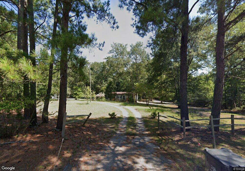
1784 Powell Rd Augusta, GA 30909
Belair NeighborhoodEstimated Value: $86,110 - $250,000
3
Beds
2
Baths
1,152
Sq Ft
$140/Sq Ft
Est. Value
About This Home
This home is located at 1784 Powell Rd, Augusta, GA 30909 and is currently estimated at $161,028, approximately $139 per square foot. 1784 Powell Rd is a home located in Richmond County with nearby schools including Johnson Magnet, Westside High School, and Greater Augusta Christian Academy.
Ownership History
Date
Name
Owned For
Owner Type
Purchase Details
Closed on
Jan 8, 2025
Sold by
Dailey George M
Bought by
Dailey George M
Current Estimated Value
Purchase Details
Closed on
Sep 14, 2001
Sold by
Rau Ivey H
Bought by
Dailey George M and Booth Betty Diane
Home Financials for this Owner
Home Financials are based on the most recent Mortgage that was taken out on this home.
Original Mortgage
$52,250
Interest Rate
6.89%
Create a Home Valuation Report for This Property
The Home Valuation Report is an in-depth analysis detailing your home's value as well as a comparison with similar homes in the area
Home Values in the Area
Average Home Value in this Area
Purchase History
| Date | Buyer | Sale Price | Title Company |
|---|---|---|---|
| Dailey George M | -- | -- | |
| Dailey George M | $55,000 | -- |
Source: Public Records
Mortgage History
| Date | Status | Borrower | Loan Amount |
|---|---|---|---|
| Previous Owner | Dailey George M | $52,250 |
Source: Public Records
Tax History
| Year | Tax Paid | Tax Assessment Tax Assessment Total Assessment is a certain percentage of the fair market value that is determined by local assessors to be the total taxable value of land and additions on the property. | Land | Improvement |
|---|---|---|---|---|
| 2025 | $711 | $10,839 | $1,711 | $9,128 |
| 2024 | $711 | $10,643 | $1,711 | $8,932 |
| 2023 | $605 | $9,985 | $1,711 | $8,274 |
| 2022 | $614 | $10,825 | $1,711 | $9,114 |
| 2021 | $468 | $10,120 | $1,546 | $8,574 |
| 2020 | $465 | $10,115 | $1,546 | $8,569 |
| 2019 | $481 | $10,285 | $1,546 | $8,739 |
| 2018 | $228 | $7,019 | $1,546 | $5,473 |
| 2017 | $380 | $7,041 | $1,546 | $5,495 |
| 2016 | $380 | $7,129 | $1,546 | $5,584 |
| 2015 | $384 | $7,228 | $1,546 | $5,682 |
Source: Public Records
Map
Nearby Homes
- 4128 Powell Mill Rd
- 3950 Barrett St
- 1609 Orange Ave
- 3018, 3020 Carswell Dr
- 3195 Waverly Ln
- 3908 Carolyn St
- 3920 Carolyn St
- 3201 Waverly Ln
- 3194 Waverly Ln
- 2083 Willhaven Dr
- 2082 Willhaven Dr
- 2767 Huntcliffe Dr
- 2771 Huntcliffe Dr
- 3934 Grape Ave
- 2912 Wellington St
- 6035 Clifford St
- 2789 Huntcliffe Dr
- 1506 Weaver Dr
- 1001 Hay Meadow Dr
- 997 Hay Meadow Dr
- 1780 Powell Rd
- 1786 Powell Rd
- 1790 Powell Rd
- 0 Powell Rd
- 1901 Powell Rd
- 1779 Powell Rd
- 1799 Powell Rd
- 1774 Powell Rd
- 1771 Powell Rd
- 1809 Powell Rd
- 1788 Powell Rd
- 1736 Powell Rd
- 1742 Powell Rd
- 1721 Lincoln Ave
- 1740 Powell Rd
- 1714 Orange Ave
- 4020 Powell Mill Rd
- 1821 Powell Rd
- 1715 Lincoln Ave
- 1819 Powell Rd
Your Personal Tour Guide
Ask me questions while you tour the home.