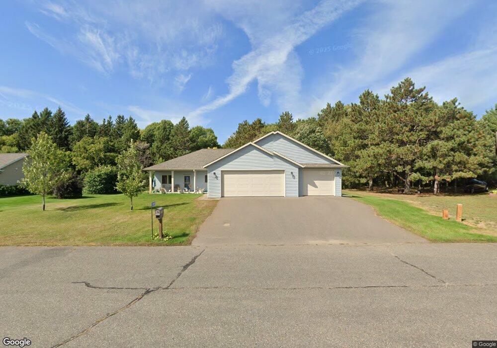
17859 Carter Ln Little Falls, MN 56345
Estimated Value: $365,000 - $411,000
3
Beds
3
Baths
1,820
Sq Ft
$209/Sq Ft
Est. Value
About This Home
This home is located at 17859 Carter Ln, Little Falls, MN 56345 and is currently estimated at $380,752, approximately $209 per square foot. 17859 Carter Ln is a home located in Morrison County with nearby schools including Little Falls Senior High School, Mary of Lourdes School, and Mary of Lourdes Elementary.
Ownership History
Date
Name
Owned For
Owner Type
Purchase Details
Closed on
Mar 30, 2018
Bought by
Kern Darrold Darrold and Kern Connie Connie
Current Estimated Value
Home Financials for this Owner
Home Financials are based on the most recent Mortgage that was taken out on this home.
Original Mortgage
$100,000
Outstanding Balance
$85,978
Interest Rate
4.43%
Mortgage Type
New Conventional
Estimated Equity
$294,774
Create a Home Valuation Report for This Property
The Home Valuation Report is an in-depth analysis detailing your home's value as well as a comparison with similar homes in the area
Home Values in the Area
Average Home Value in this Area
Purchase History
| Date | Buyer | Sale Price | Title Company |
|---|---|---|---|
| Kern Darrold Darrold | $265,200 | -- | |
| Kern Darrold J | $265,206 | None Available |
Source: Public Records
Mortgage History
| Date | Status | Borrower | Loan Amount |
|---|---|---|---|
| Open | Kern Darrold J | $100,000 | |
| Open | Kern Darrold Darrold | $265,207 |
Source: Public Records
Tax History Compared to Growth
Tax History
| Year | Tax Paid | Tax Assessment Tax Assessment Total Assessment is a certain percentage of the fair market value that is determined by local assessors to be the total taxable value of land and additions on the property. | Land | Improvement |
|---|---|---|---|---|
| 2025 | $3,964 | $336,400 | $45,000 | $291,400 |
| 2024 | $3,590 | $300,000 | $45,000 | $255,000 |
| 2023 | $4,440 | $273,800 | $28,000 | $245,800 |
| 2022 | $3,446 | $314,400 | $28,000 | $286,400 |
| 2021 | $3,436 | $241,300 | $27,000 | $214,300 |
| 2020 | $3,240 | $535,900 | $81,000 | $454,900 |
| 2019 | $952 | $217,600 | $27,000 | $190,600 |
| 2018 | $576 | $81,700 | $27,000 | $54,700 |
| 2017 | $578 | $27,000 | $27,000 | $0 |
| 2016 | $550 | $0 | $0 | $0 |
| 2014 | $582 | $0 | $0 | $0 |
| 2013 | $582 | $0 | $0 | $0 |
Source: Public Records
Map
Nearby Homes
- 14978 Taylor Dr
- 14970 Mary Beth Ln
- Lot 25 Edmund St
- Lot 26 Edmund St
- Lot 23 Edmund St
- Lot 21 Grace Ln
- Lot 19 Walker Ln
- Lot 18 Walker Ln
- Lot 17 Walker Ln
- Block 3 Lot 2 Weston Cir
- Block 3 Lot 1 Weston Cir
- Block 3 Lot 5 Weston Cir
- 17639 Gayle Dr
- Lot 12 Weston Cir
- Block 2 Lot 3 Weston Cir
- Block 2 Lot 2 Weston Cir
- 14755 Ryan St
- 18606 Riverwood Dr
- 18791 Grouse Rd
- 16941 Grove St
- 17877 Carter Ln
- Lot 15 Carter Ln
- 17892 Riverwood Dr
- Lot 18 Carter Ln
- Lot 20 Taylor Dr
- Lot 14 Carter Ln
- 17894 Riverwood Dr
- 14934 Taylor Dr
- 17829 Carter Ln
- 17898 Carter Ln
- 17892 Carter Ln
- Lot 17 Carter Ln
- 17862 Riverwood Dr
- 14941 Taylor Dr
- Lot 19 Taylor Dr
- 17974 Riverwood Dr
- 14963 Taylor Dr
- 17800 Carter Ln
- 17846 Riverwood Dr
- 14922 John L Dr