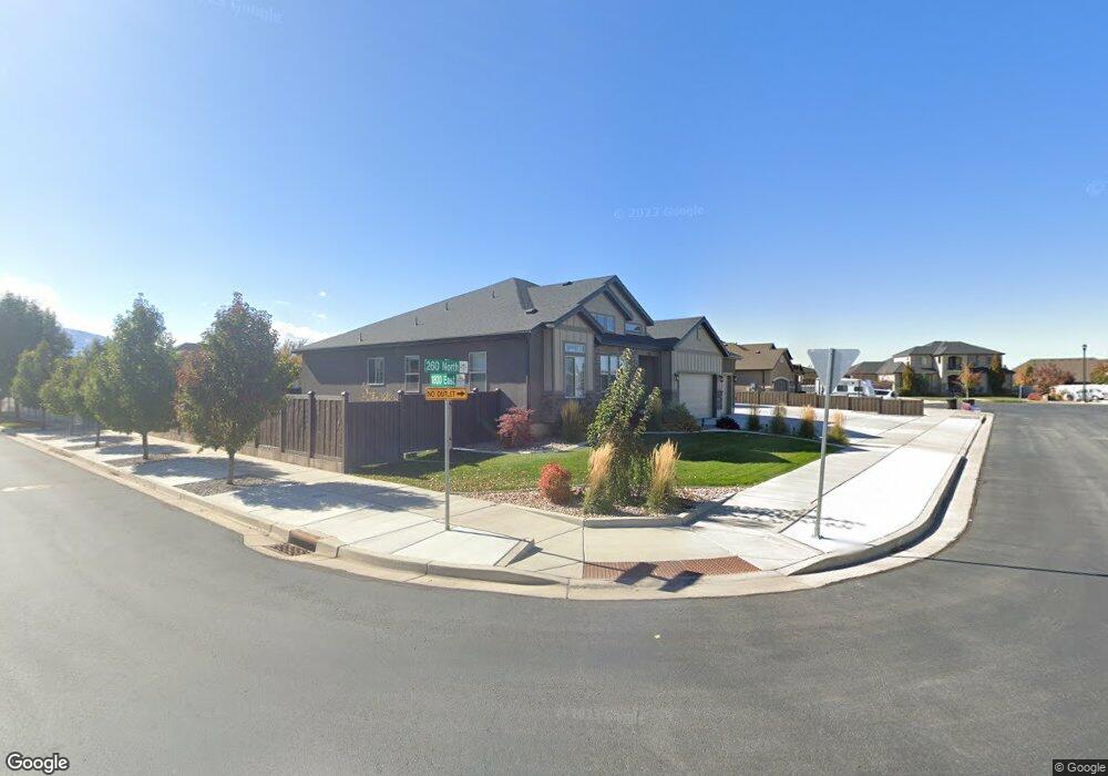
1786 E 260 N Unit BORDE Spanish Fork, UT 84660
Estimated Value: $888,000 - $1,069,000
6
Beds
5
Baths
6,502
Sq Ft
$153/Sq Ft
Est. Value
About This Home
This home is located at 1786 E 260 N Unit BORDE, Spanish Fork, UT 84660 and is currently estimated at $992,131, approximately $152 per square foot. 1786 E 260 N Unit BORDE is a home located in Utah County with nearby schools including Sierra Bonita Elementary School, Diamond Fork Junior High School, and Mapleton Junior High School.
Ownership History
Date
Name
Owned For
Owner Type
Purchase Details
Closed on
Jul 29, 2024
Sold by
Mitchell Kooper and Mitchell Lauren S
Bought by
Jarrett Randy Michael and Jarrett Melissa Sherry
Current Estimated Value
Home Financials for this Owner
Home Financials are based on the most recent Mortgage that was taken out on this home.
Original Mortgage
$731,250
Outstanding Balance
$723,101
Interest Rate
6.95%
Mortgage Type
New Conventional
Estimated Equity
$269,030
Purchase Details
Closed on
Jul 2, 2021
Sold by
Mitchell Kooper and Mitchell Lauren S
Bought by
Mitchell Kooper and Mitchell Lauren S
Home Financials for this Owner
Home Financials are based on the most recent Mortgage that was taken out on this home.
Original Mortgage
$345,000
Interest Rate
2.9%
Mortgage Type
Commercial
Purchase Details
Closed on
Jul 31, 2017
Sold by
Salisbury Developers Inc
Bought by
Mithcell Kooper and Walker Lauren S
Home Financials for this Owner
Home Financials are based on the most recent Mortgage that was taken out on this home.
Original Mortgage
$305,120
Interest Rate
3.9%
Mortgage Type
New Conventional
Purchase Details
Closed on
Mar 15, 2013
Sold by
Salisbury Land Llc
Bought by
Salisbury Developers Inc
Home Financials for this Owner
Home Financials are based on the most recent Mortgage that was taken out on this home.
Original Mortgage
$327,300
Interest Rate
4.46%
Mortgage Type
Purchase Money Mortgage
Create a Home Valuation Report for This Property
The Home Valuation Report is an in-depth analysis detailing your home's value as well as a comparison with similar homes in the area
Home Values in the Area
Average Home Value in this Area
Purchase History
| Date | Buyer | Sale Price | Title Company |
|---|---|---|---|
| Jarrett Randy Michael | -- | None Listed On Document | |
| Mitchell Kooper | -- | Key Land Title | |
| Mithcell Kooper | -- | Cottonwood Title Ins Agency | |
| Salisbury Developers Inc | -- | Provo Land Title Co |
Source: Public Records
Mortgage History
| Date | Status | Borrower | Loan Amount |
|---|---|---|---|
| Open | Jarrett Randy Michael | $731,250 | |
| Previous Owner | Mitchell Kooper | $345,000 | |
| Previous Owner | Mithcell Kooper | $305,120 | |
| Previous Owner | Salisbury Developers Inc | $327,300 |
Source: Public Records
Tax History Compared to Growth
Tax History
| Year | Tax Paid | Tax Assessment Tax Assessment Total Assessment is a certain percentage of the fair market value that is determined by local assessors to be the total taxable value of land and additions on the property. | Land | Improvement |
|---|---|---|---|---|
| 2025 | $3,808 | $514,470 | $263,200 | $672,200 |
| 2024 | $3,808 | $392,480 | $0 | $0 |
| 2023 | $3,519 | $363,110 | $0 | $0 |
| 2022 | $3,434 | $347,490 | $0 | $0 |
| 2021 | $2,931 | $474,500 | $157,200 | $317,300 |
| 2020 | $2,724 | $428,800 | $142,900 | $285,900 |
| 2019 | $2,386 | $395,100 | $133,900 | $261,200 |
| 2018 | $2,299 | $368,100 | $122,500 | $245,600 |
| 2017 | $1,376 | $118,400 | $0 | $0 |
| 2016 | $1,203 | $102,100 | $0 | $0 |
| 2015 | $1,217 | $102,100 | $0 | $0 |
| 2014 | $1,213 | $102,100 | $0 | $0 |
Source: Public Records
Map
Nearby Homes
- 882 N 1650 E Unit 265
- 858 N 1650 E Unit 266
- 857 N 1650 E Unit 267
- 1495 E 400 N
- 1005 E 260 N Unit 20
- 593 N 2040 E
- 2264 E 320 N Unit 43
- 2232 E 320 N Unit 45
- 2318 E 320 N Unit 1
- 2302 E 320 N Unit 41
- 2248 E 320 N Unit 44
- 2282 E 320 N Unit 42
- 2281 E 320 N Unit 39
- 2265 E 320 N
- 2303 E 320 N Unit 40
- 125 N 1430 E
- 663 N 2040 E
- 1455 E 100 S
- 2597 E 360 N Unit 16
- 1025 E 360 N Unit 5
- 1786 E 260 N
- 1786 E 260 N Unit WESTWO
- 1754 E 260 N Unit 316F
- 1775 E 200 N
- 1785 E 260 N
- 242 N 1800 E
- 218 N 1800 E
- 1753 E 260 N Unit 319F
- 282 N 1800 E Unit DREXEL
- 1738 E 260 N Unit 317F
- 1733 E 200 N
- 1792 E 200 N
- 1776 E 200 N Unit 109
- 1737 E 260 N
- 198 N 1800 E
- 1782 E 320 N Unit 321G
- 1756 E 320 N Unit MORRIS
- 1756 E 200 N
- 253 N 1880 E
- 306 N 1800 E