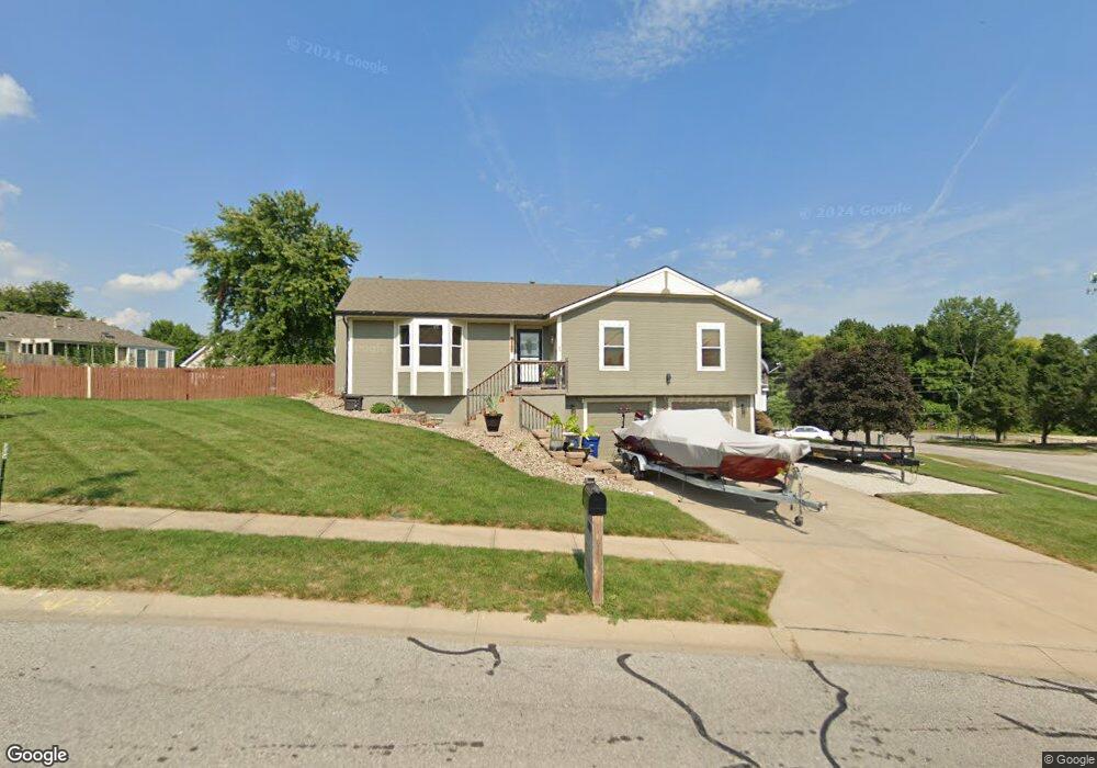
1787 Ray St Liberty, MO 64068
Estimated Value: $318,170 - $338,000
3
Beds
3
Baths
1,235
Sq Ft
$264/Sq Ft
Est. Value
About This Home
This home is located at 1787 Ray St, Liberty, MO 64068 and is currently estimated at $325,793, approximately $263 per square foot. 1787 Ray St is a home located in Clay County with nearby schools including Manor Hill Elementary School, Liberty Middle School, and Liberty High School.
Ownership History
Date
Name
Owned For
Owner Type
Purchase Details
Closed on
Aug 13, 2008
Sold by
Ollier Daniel J and Ollier Marlene A
Bought by
Alley Neil T
Current Estimated Value
Home Financials for this Owner
Home Financials are based on the most recent Mortgage that was taken out on this home.
Original Mortgage
$151,875
Outstanding Balance
$100,119
Interest Rate
6.42%
Mortgage Type
FHA
Estimated Equity
$225,674
Purchase Details
Closed on
Mar 8, 2001
Sold by
Three Js Construction Llc
Bought by
Ollier Daniel J and Ollier Marlene A
Home Financials for this Owner
Home Financials are based on the most recent Mortgage that was taken out on this home.
Original Mortgage
$128,750
Interest Rate
7.19%
Mortgage Type
VA
Create a Home Valuation Report for This Property
The Home Valuation Report is an in-depth analysis detailing your home's value as well as a comparison with similar homes in the area
Home Values in the Area
Average Home Value in this Area
Purchase History
| Date | Buyer | Sale Price | Title Company |
|---|---|---|---|
| Alley Neil T | -- | Metropolitan Title & Escrow | |
| Ollier Daniel J | -- | Thomson Title Corporation |
Source: Public Records
Mortgage History
| Date | Status | Borrower | Loan Amount |
|---|---|---|---|
| Open | Alley Neil T | $151,875 | |
| Previous Owner | Ollier Daniel J | $128,750 |
Source: Public Records
Tax History
| Year | Tax Paid | Tax Assessment Tax Assessment Total Assessment is a certain percentage of the fair market value that is determined by local assessors to be the total taxable value of land and additions on the property. | Land | Improvement |
|---|---|---|---|---|
| 2025 | $2,773 | $41,440 | -- | -- |
| 2024 | $2,773 | $36,060 | -- | -- |
| 2023 | $2,820 | $36,060 | $0 | $0 |
| 2022 | $2,607 | $32,910 | $0 | $0 |
| 2021 | $2,587 | $32,908 | $7,220 | $25,688 |
| 2020 | $2,591 | $30,950 | $0 | $0 |
| 2019 | $2,590 | $30,950 | $0 | $0 |
Source: Public Records
Map
Nearby Homes
- 516 Sharon Dr
- 1829 White Tail Ln
- 1705 Johnston St
- 1515 Trumpet Ct
- 1010 Wellington Way
- 1955 Birmingham Rd
- 1856 Arbor Trail
- 1829 Green Meadow Dr
- 1836 Green Meadow Dr
- 822 Sherrill Ave
- 2600 Magnolia Ave
- 1985 Longview Dr
- 1916 Longview Dr
- 1989 Longview Dr
- 1849 Arbor Trail
- 1845 Arbor Trail
- 806 Galveston Dr
- 819 S Main St
- 1975 Harvest Rd
- 1979 Harvest Rd
Your Personal Tour Guide
Ask me questions while you tour the home.