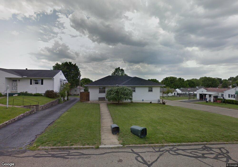
1789 Marrose Dr Lancaster, OH 43130
Estimated Value: $308,789 - $390,000
3
Beds
3
Baths
1,695
Sq Ft
$203/Sq Ft
Est. Value
About This Home
This home is located at 1789 Marrose Dr, Lancaster, OH 43130 and is currently estimated at $343,697, approximately $202 per square foot. 1789 Marrose Dr is a home located in Fairfield County with nearby schools including Tarhe Elementary School, General Sherman Junior High School, and Lancaster High School.
Ownership History
Date
Name
Owned For
Owner Type
Purchase Details
Closed on
Jun 23, 2005
Sold by
Ruff Michael D and Ruff Stacy L
Bought by
Anderson Kenneth D
Current Estimated Value
Home Financials for this Owner
Home Financials are based on the most recent Mortgage that was taken out on this home.
Original Mortgage
$160,650
Interest Rate
5.87%
Mortgage Type
Fannie Mae Freddie Mac
Purchase Details
Closed on
Oct 7, 2002
Sold by
Stevenson Cordelia A
Bought by
Ruff Michael D and Ruff Stacy L
Purchase Details
Closed on
Feb 1, 1993
Sold by
Fisher Dolores J
Bought by
Fisher Dolores J
Create a Home Valuation Report for This Property
The Home Valuation Report is an in-depth analysis detailing your home's value as well as a comparison with similar homes in the area
Home Values in the Area
Average Home Value in this Area
Purchase History
| Date | Buyer | Sale Price | Title Company |
|---|---|---|---|
| Anderson Kenneth D | $178,500 | Lawyers Title Agency Of Lanc | |
| Ruff Michael D | $125,000 | -- | |
| Fisher Dolores J | -- | -- |
Source: Public Records
Mortgage History
| Date | Status | Borrower | Loan Amount |
|---|---|---|---|
| Closed | Anderson Kenneth D | $160,650 |
Source: Public Records
Tax History Compared to Growth
Tax History
| Year | Tax Paid | Tax Assessment Tax Assessment Total Assessment is a certain percentage of the fair market value that is determined by local assessors to be the total taxable value of land and additions on the property. | Land | Improvement |
|---|---|---|---|---|
| 2024 | $7,700 | $85,650 | $8,140 | $77,510 |
| 2023 | $3,115 | $85,650 | $8,140 | $77,510 |
| 2022 | $3,128 | $85,650 | $8,140 | $77,510 |
| 2021 | $2,292 | $58,800 | $8,140 | $50,660 |
| 2020 | $2,305 | $58,800 | $8,140 | $50,660 |
| 2019 | $2,088 | $58,800 | $8,140 | $50,660 |
| 2018 | $1,877 | $43,760 | $8,140 | $35,620 |
| 2017 | $1,879 | $50,240 | $8,140 | $42,100 |
| 2016 | $1,830 | $50,240 | $8,140 | $42,100 |
| 2015 | $1,815 | $48,360 | $8,140 | $40,220 |
| 2014 | $1,729 | $48,360 | $8,140 | $40,220 |
| 2013 | $1,729 | $48,360 | $8,140 | $40,220 |
Source: Public Records
Map
Nearby Homes
- 189 Berkeley Dr
- 319 Greenfield Ave
- 0 Wacker Dr Unit 225036189
- 1511 N Columbus St
- 260 Scott Dr
- 226 Whittier Dr S
- 603 Edgewood Ave
- 0 Marks Ave Unit 225036443
- 1318 Graf St
- 1190 N Columbus St
- 1000 Goodwin Ave
- 953 Garfield Ave
- 936 Harrison Ave
- 315 Park St
- 2213 Rolling Hills St
- 100 Wilson Ave
- 844 Washington Ave
- 222 Park St
- 1707 River Valley N Cir
- 2195 Olde Ridge Ct
- 1785 Marrose Dr
- 1776 Glenmar Dr
- 1781 Marrose Dr
- 1803 Marrose Dr
- 1770 Glenmar Dr
- 1802 Glenmar Dr
- 1790 Marrose Dr
- 1775 Marrose Dr
- 1764 Glenmar Dr
- 1788 Marrose Dr
- 1808 Glenmar Dr
- 1802 Marrose Dr
- 1782 Marrose Dr
- 1769 Marrose Dr
- 1815 Marrose Dr
- 1758 Glenmar Dr
- 1808 Marrose Dr
- 1776 Marrose Dr
- 1814 Glenmar Dr
- 1775 Glenmar Dr