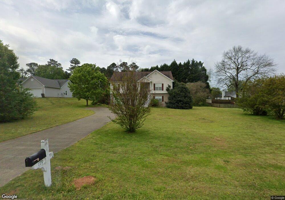
179 Cole Cir Unit 1 Bethlehem, GA 30620
Estimated Value: $314,548 - $352,000
--
Bed
2
Baths
1,624
Sq Ft
$208/Sq Ft
Est. Value
About This Home
This home is located at 179 Cole Cir Unit 1, Bethlehem, GA 30620 and is currently estimated at $338,137, approximately $208 per square foot. 179 Cole Cir Unit 1 is a home located in Barrow County with nearby schools including Yargo Elementary School, Haymon-Morris Middle School, and Apalachee High School.
Ownership History
Date
Name
Owned For
Owner Type
Purchase Details
Closed on
Apr 30, 1998
Sold by
Cottonwood Builders
Bought by
Mckenzie Jeri R and Mckenzie Faye L
Current Estimated Value
Home Financials for this Owner
Home Financials are based on the most recent Mortgage that was taken out on this home.
Original Mortgage
$56,000
Outstanding Balance
$10,875
Interest Rate
7.03%
Mortgage Type
New Conventional
Estimated Equity
$327,262
Purchase Details
Closed on
Aug 1, 1997
Sold by
C G S Development In
Bought by
Cottonwood Builders
Purchase Details
Closed on
Jul 9, 1996
Bought by
C G S Development In
Create a Home Valuation Report for This Property
The Home Valuation Report is an in-depth analysis detailing your home's value as well as a comparison with similar homes in the area
Home Values in the Area
Average Home Value in this Area
Purchase History
| Date | Buyer | Sale Price | Title Company |
|---|---|---|---|
| Mckenzie Jeri R | $111,900 | -- | |
| Cottonwood Builders | $36,000 | -- | |
| C G S Development In | $678,600 | -- |
Source: Public Records
Mortgage History
| Date | Status | Borrower | Loan Amount |
|---|---|---|---|
| Open | Mckenzie Jeri R | $56,000 |
Source: Public Records
Tax History Compared to Growth
Tax History
| Year | Tax Paid | Tax Assessment Tax Assessment Total Assessment is a certain percentage of the fair market value that is determined by local assessors to be the total taxable value of land and additions on the property. | Land | Improvement |
|---|---|---|---|---|
| 2024 | $1,006 | $102,873 | $26,800 | $76,073 |
| 2023 | $609 | $103,273 | $26,800 | $76,473 |
| 2022 | $744 | $85,990 | $22,400 | $63,590 |
| 2021 | $640 | $79,590 | $16,000 | $63,590 |
| 2020 | $552 | $64,337 | $16,000 | $48,337 |
| 2019 | $575 | $64,337 | $16,000 | $48,337 |
| 2018 | $530 | $61,537 | $13,200 | $48,337 |
| 2017 | $1,578 | $54,182 | $13,200 | $40,982 |
| 2016 | $432 | $47,547 | $13,200 | $34,347 |
| 2015 | $439 | $47,947 | $13,200 | $34,747 |
| 2014 | $341 | $41,614 | $6,468 | $35,146 |
| 2013 | -- | $39,054 | $6,468 | $32,586 |
Source: Public Records
Map
Nearby Homes
- 209 Angie Way
- 303 Ron Dr
- 1111 Otis Dr
- 758 Clarence Edwards Rd
- 1129 Loganville Hwy
- 1024 Lyndhurst Ln
- 190 Lokeys Ln
- 0 Jb Owens Unit 7552902
- 0 Jb Owens Unit 7552891
- 0 Jb Owens Unit LOT 2 - 2.09 ACRES
- 0 Jb Owens Unit LOT 3 - 2.01 ACRES
- 1164 Otis Dr
- 720 Westbury Ct
- 738 Worth Ct
- 724 Westbury Dr
- 236 Vision St
- 176 Market St
- 575 Mackinaw Dr
- 14 Smithwood Dr
- 713 Carl Bethlehem Rd
- 183 Cole Cir
- 770 Brookelynn Trace
- 774 Brookelynn Trace
- 185 Cole Cir
- 776 Brookelynn Trace
- 178 Cole Cir
- 184 Cole Cir
- 174 Cole Cir Unit 1
- 171 Cole Cir
- 187 Cole Cir
- 0 Cole Cir Unit 7162432
- 0 Cole Cir Unit 8467353
- 0 Cole Cir Unit 8004179
- 0 Cole Cir Unit 7149712
- 0 Cole Cir Unit 8895316
- 0 Cole Cir Unit 3227608
- 778 Brookelynn Trace
- 778 Brookelyn Trace
- 535 Harvey Lokey Rd
- 186 Cole Cir Unit 1