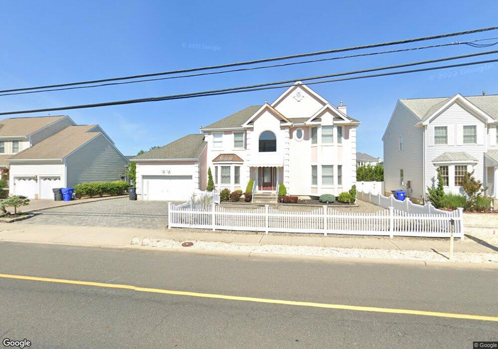
179 Highway 35 S Mantoloking, NJ 08738
Estimated Value: $1,792,000 - $3,934,000
5
Beds
4
Baths
3,738
Sq Ft
$797/Sq Ft
Est. Value
About This Home
This home is located at 179 Highway 35 S, Mantoloking, NJ 08738 and is currently estimated at $2,979,392, approximately $797 per square foot. 179 Highway 35 S is a home located in Ocean County with nearby schools including Emma Havens Young Elementary School, Lake Riviera Middle School, and Brick Township High School.
Ownership History
Date
Name
Owned For
Owner Type
Purchase Details
Closed on
Mar 24, 2021
Sold by
Degiacomo Holdings Llc
Bought by
Degiacomo Mark
Current Estimated Value
Home Financials for this Owner
Home Financials are based on the most recent Mortgage that was taken out on this home.
Original Mortgage
$450,000
Outstanding Balance
$404,747
Interest Rate
2.9%
Mortgage Type
New Conventional
Estimated Equity
$2,574,645
Purchase Details
Closed on
Sep 13, 2018
Sold by
Serio Ralph M
Bought by
Degiacomo Holdings Llc
Purchase Details
Closed on
Nov 18, 2002
Purchase Details
Closed on
Jun 24, 1998
Sold by
Horizon 2000 Development Corp
Bought by
Serio Ralph M and Serio Susan M
Home Financials for this Owner
Home Financials are based on the most recent Mortgage that was taken out on this home.
Original Mortgage
$285,000
Interest Rate
7.04%
Create a Home Valuation Report for This Property
The Home Valuation Report is an in-depth analysis detailing your home's value as well as a comparison with similar homes in the area
Home Values in the Area
Average Home Value in this Area
Purchase History
| Date | Buyer | Sale Price | Title Company |
|---|---|---|---|
| Degiacomo Mark | -- | Acres Land Title Agency Inc | |
| Degiacomo Mark | -- | Land Title | |
| Degiacomo Holdings Llc | $1,100,000 | Wfg National Title Insurance | |
| -- | -- | -- | |
| Serio Ralph M | $468,713 | -- |
Source: Public Records
Mortgage History
| Date | Status | Borrower | Loan Amount |
|---|---|---|---|
| Open | Degiacomo Mark | $450,000 | |
| Closed | Degiacomo Mark | $450,000 | |
| Previous Owner | Serio Ralph M | $285,000 |
Source: Public Records
Tax History Compared to Growth
Tax History
| Year | Tax Paid | Tax Assessment Tax Assessment Total Assessment is a certain percentage of the fair market value that is determined by local assessors to be the total taxable value of land and additions on the property. | Land | Improvement |
|---|---|---|---|---|
| 2025 | $32,215 | $1,247,200 | $681,800 | $565,400 |
| 2024 | $30,619 | $1,247,200 | $681,800 | $565,400 |
| 2023 | $30,220 | $1,247,200 | $681,800 | $565,400 |
| 2022 | $30,220 | $1,247,200 | $681,800 | $565,400 |
| 2021 | $29,584 | $1,247,200 | $681,800 | $565,400 |
| 2020 | $29,209 | $1,247,200 | $681,800 | $565,400 |
| 2019 | $27,346 | $1,187,400 | $681,800 | $505,600 |
| 2018 | $26,717 | $1,187,400 | $681,800 | $505,600 |
| 2017 | $25,992 | $1,187,400 | $681,800 | $505,600 |
| 2016 | $25,862 | $1,187,400 | $681,800 | $505,600 |
| 2015 | $25,185 | $1,187,400 | $681,800 | $505,600 |
| 2014 | $24,983 | $1,187,400 | $681,800 | $505,600 |
Source: Public Records
Map
Nearby Homes
- 304 Schooner Ln
- 150 Sunset Ln
- 122 Squan Beach Dr
- 233 Curtis Point Dr
- 275 Curtis Point Dr
- 308 Cove Dr
- 1519 Runyon Ln
- 366 Highway 35 N
- 438 Highway 35 N Unit 1304
- 1318 Ocean Ave
- 12 Shell Rd
- 1207 Ocean Ave
- 515 New Jersey 35
- 1201 Ocean Ave
- 545 Route 35
- 254 Harbor Ct
- 1097 Barnegat Ln
- 64 W Granada Dr
- 108 Rochester Dr
- 45 W Granada Dr
- 175 Highway 35 S
- 183 Highway 35 S
- 171 Highway 35 S
- 187 Highway 35 N
- 187 Highway 35 N
- 179 Highway 35 N
- 179 Route 35 N
- 167 Highway 35 S
- 183 Highway 35 N
- 175 Highway 35 N
- 191 Highway 35 S
- 171 Highway 35 N
- 128 Bay Ave
- 124 Bay Ave
- 102 Bay Ave
- 154 Bay Ave S
- 191 Highway 35 N
- 191 Highway 35 N
- 195 Route 35 S
- 195 Highway 35 S