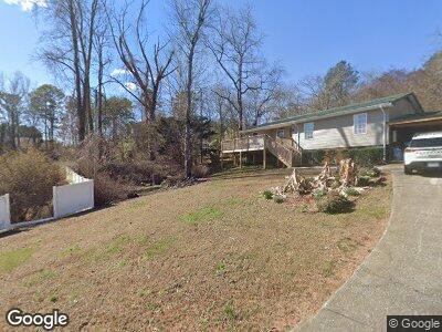
179 Hungry Valley Way Dalton, GA 30720
Estimated Value: $86,000 - $238,000
--
Bed
2
Baths
1,210
Sq Ft
$121/Sq Ft
Est. Value
About This Home
This home is located at 179 Hungry Valley Way, Dalton, GA 30720 and is currently estimated at $146,423, approximately $121 per square foot. 179 Hungry Valley Way is a home located in Whitfield County with nearby schools including Westside Elementary School, Westside Middle School, and Northwest Whitfield County High School.
Ownership History
Date
Name
Owned For
Owner Type
Purchase Details
Closed on
Jul 10, 2020
Sold by
Ellis Peggy Louise
Bought by
Ellis Michael L and Ellis Connie C
Current Estimated Value
Home Financials for this Owner
Home Financials are based on the most recent Mortgage that was taken out on this home.
Original Mortgage
$26,850
Outstanding Balance
$17,042
Interest Rate
3.2%
Mortgage Type
New Conventional
Estimated Equity
$120,347
Purchase Details
Closed on
Feb 23, 2005
Sold by
Not Provided
Bought by
Ellis Peggy Louise and Ellis Lamar
Purchase Details
Closed on
Jun 25, 1993
Sold by
Joyce Flossie Vandora
Bought by
Ellis Peggy Louise
Create a Home Valuation Report for This Property
The Home Valuation Report is an in-depth analysis detailing your home's value as well as a comparison with similar homes in the area
Home Values in the Area
Average Home Value in this Area
Purchase History
| Date | Buyer | Sale Price | Title Company |
|---|---|---|---|
| Ellis Michael L | $33,600 | -- | |
| Ellis Peggy Louise | -- | -- | |
| Ellis Peggy Louise | -- | -- |
Source: Public Records
Mortgage History
| Date | Status | Borrower | Loan Amount |
|---|---|---|---|
| Open | Ellis Michael L | $26,850 | |
| Previous Owner | Ellis Peggy Louise | $75,000 |
Source: Public Records
Tax History Compared to Growth
Tax History
| Year | Tax Paid | Tax Assessment Tax Assessment Total Assessment is a certain percentage of the fair market value that is determined by local assessors to be the total taxable value of land and additions on the property. | Land | Improvement |
|---|---|---|---|---|
| 2024 | $405 | $24,612 | $4,170 | $20,442 |
| 2023 | $405 | $13,472 | $4,378 | $9,094 |
| 2022 | $495 | $16,777 | $4,378 | $12,399 |
| 2021 | $529 | $16,777 | $4,378 | $12,399 |
| 2020 | $529 | $16,777 | $4,378 | $12,399 |
| 2019 | $529 | $16,777 | $4,378 | $12,399 |
| 2018 | $0 | $16,777 | $4,378 | $12,399 |
| 2017 | $0 | $16,777 | $4,378 | $12,399 |
| 2016 | $0 | $15,655 | $4,378 | $11,277 |
| 2014 | -- | $15,655 | $4,378 | $11,277 |
| 2013 | -- | $15,655 | $4,378 | $11,276 |
Source: Public Records
Map
Nearby Homes
- 00 Shugart Rd
- 2204 Old Ivy Way
- 2204 Old Ivy Way Unit 3
- 137 Lisa Ln
- 1202 Covie Dr
- 1230 Covie Dr
- 1315 Walston St
- 302 Davidson Dr
- 0 Battleline Dr Unit 120625
- 116 Battleline Dr
- 108/109 Battleline Dr
- 432 Castle Rd
- 1903 Rena Ln
- 1101 Manly St
- 1006 Willowdale Rd NW Unit 2
- 2309 Ravine Way
- 209 Kenemer Cir
- Tract 2 Willowdale Rd Unit TRACT 2
- 906 Sierra Place
- 1521 Ashton Woods Way Unit 11
- 179 Hungry Valley Way
- 801 N Tibbs Rd
- 140 Hungry Valley Way
- 807 N Tibbs Rd
- 807 N Tibbs Rd
- 805 N Tibbs Rd Unit 73,74,75
- 805 N Tibbs Rd Unit 73-75
- 804 N Tibbs Rd
- 813 N Tibbs Rd
- 2125 Arbordale Place
- 816 N Tibbs Rd
- 284 Park Canyon Dr
- 284 Park Canyon Dr
- 2200 Park Canyon Dr
- 284 Park Canyon Dr Unit 10B
- 284 Park Canyon Dr Unit 8B
- 284 Park Canyon Dr Unit 7B
- 284 Park Canyon Dr Unit 9A
- 284 Park Canyon Dr Unit 7B
- 284 Park Canyon Dr Unit 10B