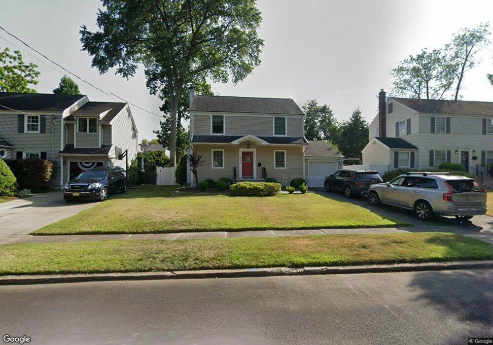
179 Kensington Rd River Edge, NJ 07661
Estimated Value: $860,000 - $1,080,000
4
Beds
3
Baths
2,144
Sq Ft
$448/Sq Ft
Est. Value
About This Home
This home is located at 179 Kensington Rd, River Edge, NJ 07661 and is currently estimated at $960,952, approximately $448 per square foot. 179 Kensington Rd is a home located in Bergen County with nearby schools including Cherry Hill School, River Dell Middle School, and River Dell Regional High School.
Ownership History
Date
Name
Owned For
Owner Type
Purchase Details
Closed on
Jan 7, 2021
Sold by
Smith Patrick and Smith Amanda
Bought by
Singh Christopher and Corrales Christine
Current Estimated Value
Home Financials for this Owner
Home Financials are based on the most recent Mortgage that was taken out on this home.
Original Mortgage
$620,000
Outstanding Balance
$553,255
Interest Rate
2.7%
Mortgage Type
New Conventional
Estimated Equity
$407,697
Purchase Details
Closed on
Apr 26, 2018
Sold by
Keltic Home & Developers
Bought by
Smith Patrick and Smith Amanda
Home Financials for this Owner
Home Financials are based on the most recent Mortgage that was taken out on this home.
Original Mortgage
$528,000
Interest Rate
4.44%
Mortgage Type
Purchase Money Mortgage
Purchase Details
Closed on
Oct 14, 2016
Sold by
Englesig Lc
Bought by
Sigma Associates Lc
Create a Home Valuation Report for This Property
The Home Valuation Report is an in-depth analysis detailing your home's value as well as a comparison with similar homes in the area
Home Values in the Area
Average Home Value in this Area
Purchase History
| Date | Buyer | Sale Price | Title Company |
|---|---|---|---|
| Singh Christopher | $775,000 | Fidelity National Ttl Ins Co | |
| Singh Christopher | $775,000 | Fidelity National Title | |
| Smith Patrick | $660,000 | -- | |
| Sigma Associates Lc | -- | None Available |
Source: Public Records
Mortgage History
| Date | Status | Borrower | Loan Amount |
|---|---|---|---|
| Open | Singh Christopher | $620,000 | |
| Closed | Singh Christopher | $620,000 | |
| Previous Owner | Smith Patrick | $528,000 |
Source: Public Records
Tax History Compared to Growth
Tax History
| Year | Tax Paid | Tax Assessment Tax Assessment Total Assessment is a certain percentage of the fair market value that is determined by local assessors to be the total taxable value of land and additions on the property. | Land | Improvement |
|---|---|---|---|---|
| 2025 | $14,326 | $646,300 | $323,000 | $323,300 |
| 2024 | $13,968 | $361,300 | $176,000 | $185,300 |
| 2023 | $13,368 | $361,300 | $176,000 | $185,300 |
| 2022 | $13,368 | $361,300 | $176,000 | $185,300 |
| 2021 | $13,104 | $361,300 | $176,000 | $185,300 |
| 2020 | $12,898 | $361,300 | $176,000 | $185,300 |
| 2019 | $12,530 | $361,300 | $176,000 | $185,300 |
| 2018 | $10,986 | $323,600 | $176,000 | $147,600 |
| 2017 | $10,879 | $323,600 | $176,000 | $147,600 |
| 2016 | $10,634 | $323,600 | $176,000 | $147,600 |
| 2015 | $10,410 | $323,600 | $176,000 | $147,600 |
| 2014 | $10,430 | $323,600 | $176,000 | $147,600 |
Source: Public Records
Map
Nearby Homes
- 215 Kensington Rd
- 168 Voorhis Ave
- 276 Greenway Terrace
- 421 Lafayette Ave
- 378 Windsor Rd
- 302 Howland Ave
- 12 Gainesborough Terrace Unit 1B
- 212 Lozier Terrace
- 293 Bogert Rd Unit 1A
- 1 Sipporta Ln
- 150 Village Cir E
- 255 Bogert Rd Unit 2A
- 81 Eastbrook Dr
- 189 Forest Ave Unit 409
- 189 Forest Ave Unit 303
- 42 Howland Ave
- 222 Zabriskie Place
- 122 Village Cir E
- 712 6th Ave
- 214 Zabriskie Place
- 175 Kensington Rd
- 183 Kensington Rd
- 180 Dorchester Rd
- 184 Dorchester Rd
- 176 Dorchester Rd
- 171 Kensington Rd
- 452 Elm Ave
- 180 Kensington Rd
- 172 Dorchester Rd
- 444 Elm Ave
- 176 Kensington Rd
- 184 Kensington Rd
- 167 Kensington Rd
- 172 Kensington Rd
- 464 Elm Ave
- 168 Dorchester Rd
- 168 Kensington Rd
- 163 Kensington Rd
- 164 Dorchester Rd
- 453 Elm Ave