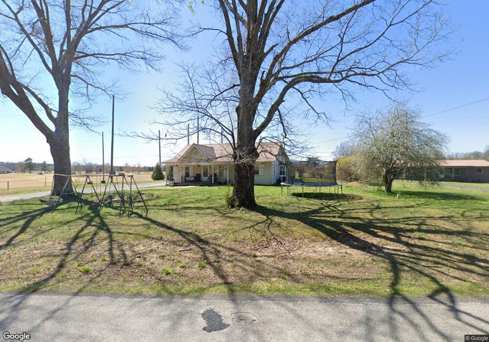
179 Pete Sain Rd Manchester, TN 37355
Estimated Value: $237,130 - $484,000
--
Bed
3
Baths
2,507
Sq Ft
$151/Sq Ft
Est. Value
About This Home
This home is located at 179 Pete Sain Rd, Manchester, TN 37355 and is currently estimated at $379,283, approximately $151 per square foot. 179 Pete Sain Rd is a home located in Coffee County with nearby schools including East Coffee Elementary School, Coffee County Middle School, and Coffee County Central High School.
Ownership History
Date
Name
Owned For
Owner Type
Purchase Details
Closed on
Mar 9, 2017
Sold by
Garner Deborah N
Bought by
Garner Stephen S
Current Estimated Value
Purchase Details
Closed on
Mar 23, 2007
Sold by
Garner Samuel Stephen
Bought by
Garner Deborah N and Garner Stephen
Purchase Details
Closed on
Jul 24, 2000
Sold by
Garner Samuel Stephen
Bought by
Mcafee Ivan W and Mcafee Brenda
Purchase Details
Closed on
Nov 25, 1988
Create a Home Valuation Report for This Property
The Home Valuation Report is an in-depth analysis detailing your home's value as well as a comparison with similar homes in the area
Home Values in the Area
Average Home Value in this Area
Purchase History
| Date | Buyer | Sale Price | Title Company |
|---|---|---|---|
| Garner Stephen S | -- | -- | |
| Garner Deborah N | -- | -- | |
| Mcafee Ivan W | -- | -- | |
| -- | $36,000 | -- |
Source: Public Records
Tax History Compared to Growth
Tax History
| Year | Tax Paid | Tax Assessment Tax Assessment Total Assessment is a certain percentage of the fair market value that is determined by local assessors to be the total taxable value of land and additions on the property. | Land | Improvement |
|---|---|---|---|---|
| 2024 | $927 | $39,750 | $1,750 | $38,000 |
| 2023 | $927 | $39,750 | $0 | $0 |
| 2022 | $927 | $39,750 | $1,750 | $38,000 |
| 2021 | $839 | $28,600 | $1,050 | $27,550 |
| 2020 | $839 | $28,600 | $1,050 | $27,550 |
| 2019 | $839 | $28,600 | $1,050 | $27,550 |
| 2018 | $839 | $28,600 | $1,050 | $27,550 |
| 2017 | $768 | $23,525 | $3,200 | $20,325 |
| 2016 | $768 | $23,525 | $3,200 | $20,325 |
| 2015 | $768 | $23,525 | $3,200 | $20,325 |
| 2014 | $768 | $23,529 | $0 | $0 |
Source: Public Records
Map
Nearby Homes
- 667 Pete Sain Rd
- 300 Willow Brook Dr
- 363 Willow Brook Dr
- 7807 McMinnville Hwy Unit 7807
- 0 Pete Sain Rd
- 2498 Sp Anderson Rd
- 0 Ramsey Rd
- 2635 Pete Sain Rd
- 670 Old McMinnville Hwy
- 837 Circle Dr
- 781 Circle Dr
- 4282 McMinnville Hwy Unit 4270
- 105 Barbara Spears Rd
- 0 Hickerson Rd
- 1270 Taylor Rd
- 0 Rock Rd
- 231 Tom Johnson Rd
- 3313 McMinnville Hwy
- 499 Ridgewood Dr
- 0 Mcafee Rd
- 209 Pete Sain Rd
- 148 Pete Sain Rd
- 124 Pete Sain Rd
- 269 Pete Sain Rd
- 100 Pete Sain Rd
- 274 Pete Sain Rd
- 80 Pete Sain Rd
- 6989 McMinnville Hwy Unit 6989
- 45 Pete Sain Rd
- 315 Pete Sain Rd
- 7001 McMinnville Hwy Unit 7001
- 346 Pete Sain Rd
- 355 Pete Sain Rd
- 6936 McMinnville Hwy
- 7039 McMinnville Hwy
- 6954 McMinnville Hwy Unit 6954
- 30 Hillcrest Villa Rd
- 51 Hillcrest Villa Rd
- 413 Pete Sain Rd
- 98 Crouch Rd