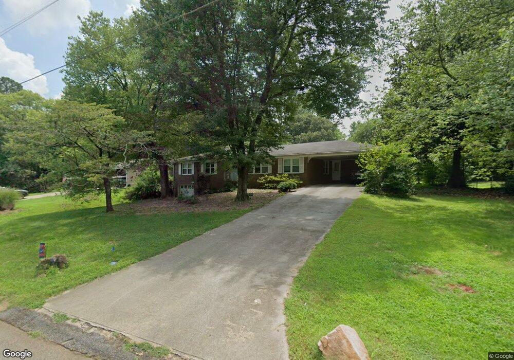
1790 Kinridge Rd Marietta, GA 30062
Eastern Marietta NeighborhoodEstimated Value: $375,354 - $440,000
3
Beds
2
Baths
1,686
Sq Ft
$234/Sq Ft
Est. Value
About This Home
This home is located at 1790 Kinridge Rd, Marietta, GA 30062 and is currently estimated at $394,089, approximately $233 per square foot. 1790 Kinridge Rd is a home located in Cobb County with nearby schools including Kincaid Elementary School, Simpson Middle School, and Sprayberry High School.
Ownership History
Date
Name
Owned For
Owner Type
Purchase Details
Closed on
Aug 3, 2018
Sold by
Carter
Bought by
Buis Tristan and Buis Emily
Current Estimated Value
Home Financials for this Owner
Home Financials are based on the most recent Mortgage that was taken out on this home.
Original Mortgage
$228,000
Outstanding Balance
$197,596
Interest Rate
4.5%
Mortgage Type
New Conventional
Estimated Equity
$196,493
Purchase Details
Closed on
May 9, 2006
Sold by
Carter Donald
Bought by
Carter Eleanor Q R
Create a Home Valuation Report for This Property
The Home Valuation Report is an in-depth analysis detailing your home's value as well as a comparison with similar homes in the area
Home Values in the Area
Average Home Value in this Area
Purchase History
| Date | Buyer | Sale Price | Title Company |
|---|---|---|---|
| Buis Tristan | $240,000 | -- | |
| Carter Eleanor Q R | -- | -- |
Source: Public Records
Mortgage History
| Date | Status | Borrower | Loan Amount |
|---|---|---|---|
| Open | Buis Tristan | $228,000 |
Source: Public Records
Tax History Compared to Growth
Tax History
| Year | Tax Paid | Tax Assessment Tax Assessment Total Assessment is a certain percentage of the fair market value that is determined by local assessors to be the total taxable value of land and additions on the property. | Land | Improvement |
|---|---|---|---|---|
| 2025 | $3,672 | $152,496 | $38,000 | $114,496 |
| 2024 | $3,348 | $137,416 | $38,000 | $99,416 |
| 2023 | $2,608 | $128,312 | $32,000 | $96,312 |
| 2022 | $2,520 | $98,448 | $26,800 | $71,648 |
| 2021 | $2,520 | $98,448 | $26,800 | $71,648 |
| 2020 | $2,428 | $94,248 | $24,800 | $69,448 |
| 2019 | $2,018 | $75,500 | $16,000 | $59,500 |
| 2018 | $2,291 | $75,500 | $16,000 | $59,500 |
| 2017 | $2,184 | $75,964 | $14,000 | $61,964 |
| 2016 | $1,682 | $58,488 | $14,000 | $44,488 |
| 2015 | $1,723 | $58,488 | $14,000 | $44,488 |
| 2014 | $1,586 | $53,388 | $0 | $0 |
Source: Public Records
Map
Nearby Homes
- 1780 Kinridge Rd
- 1822 Hasty Rd
- 1972 Granite Mill Rd
- 2252 Carefree Cir Unit 3
- 1900 Branch View Dr
- 2020 Starlight Dr
- 2116 Morgan Rd NE
- 1854 Butterfly Way
- 1850 Butterfly Way NE
- Robie Plan at The Village at Sandy Plains
- Harbor Plan at The Village at Sandy Plains
- Hanover Plan at The Village at Sandy Plains
- Bowen Plan at The Village at Sandy Plains
- Elston Plan at The Village at Sandy Plains
- BALDWIN Plan at The Village at Sandy Plains
- 1838 Butterfly NE
- 1834 Butterfly Way
- 1834 Butterfly NE
- 1490 Longwing Ln
- 1741 Sierra Dr
- 1751 Sierra Dr
- 1810 Kinridge Rd
- 1731 Sierra Dr
- 1770 Kinridge Rd
- 1781 Kinridge Rd
- 1761 Sierra Dr
- 1771 Kinridge Rd
- 1721 Sierra Dr
- 0 Sierra Dr
- 1820 Kinridge Rd
- 1811 Kinridge Rd Unit NE
- 1811 Kinridge Rd
- 2000 Arrowhead Trail
- 1760 Kinridge Rd
- 2030 Kinridge Place Ct
- 2030R Kinridge Place Ct
- 1771 Sierra Dr
- 1711 Sierra Dr
- 2011 Arrowhead Trail