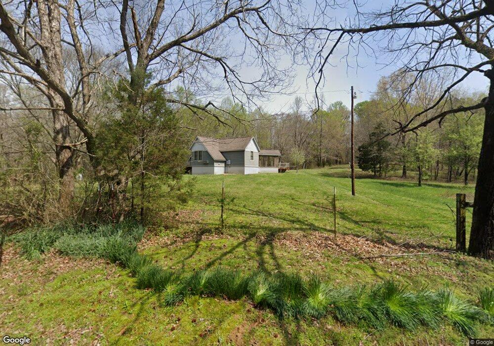
1790 Porter Norwood Rd Mansfield, TN 38236
Estimated Value: $230,000
--
Bed
1
Bath
968
Sq Ft
$238/Sq Ft
Est. Value
About This Home
This home is located at 1790 Porter Norwood Rd, Mansfield, TN 38236 and is currently estimated at $230,000, approximately $237 per square foot. 1790 Porter Norwood Rd is a home located in Henry County.
Ownership History
Date
Name
Owned For
Owner Type
Purchase Details
Closed on
Nov 30, 2016
Sold by
Roach Sawmill & Lumber Co
Bought by
Trophy Management Llc
Current Estimated Value
Purchase Details
Closed on
Jul 11, 2014
Sold by
Crowe Thomas B
Bought by
Trophy Management Llc
Purchase Details
Closed on
Feb 18, 2011
Bought by
Trophy Management Llc
Purchase Details
Closed on
Dec 7, 2000
Sold by
Edward Valentine and Edward Kaye K
Bought by
Edward Valentine and Edward Kaye K
Create a Home Valuation Report for This Property
The Home Valuation Report is an in-depth analysis detailing your home's value as well as a comparison with similar homes in the area
Home Values in the Area
Average Home Value in this Area
Purchase History
| Date | Buyer | Sale Price | Title Company |
|---|---|---|---|
| Trophy Management Llc | $26,000 | -- | |
| Trophy Management Llc | $75,000 | -- | |
| Trophy Management Llc | $170,000 | -- | |
| Edward Valentine | -- | -- | |
| Edward Valentine | $82,500 | -- |
Source: Public Records
Tax History Compared to Growth
Tax History
| Year | Tax Paid | Tax Assessment Tax Assessment Total Assessment is a certain percentage of the fair market value that is determined by local assessors to be the total taxable value of land and additions on the property. | Land | Improvement |
|---|---|---|---|---|
| 2024 | $869 | $44,950 | $30,375 | $14,575 |
| 2023 | $851 | $44,950 | $30,375 | $14,575 |
| 2022 | $851 | $44,950 | $30,375 | $14,575 |
| 2021 | $805 | $42,500 | $30,375 | $12,125 |
| 2020 | $805 | $42,500 | $30,375 | $12,125 |
| 2019 | $763 | $36,450 | $25,625 | $10,825 |
| 2018 | $763 | $36,450 | $25,625 | $10,825 |
| 2017 | $763 | $36,450 | $25,625 | $10,825 |
| 2016 | $746 | $36,200 | $25,625 | $10,575 |
| 2015 | $795 | $36,200 | $25,625 | $10,575 |
| 2014 | $343 | $36,200 | $25,625 | $10,575 |
| 2013 | $343 | $15,597 | $0 | $0 |
Source: Public Records
Map
Nearby Homes
- 365 Little Benton Rd
- 8225 Reynoldsburg Rd
- 0 Travis Boyd Rd
- 000 Williams Grove Rd
- 2982 Harvey Bowden Rd
- 628 Shiloh Church Rd
- 2226 Swor Rd
- 0 Ephesus Church Rd Unit RTC2982194
- 0 Ephesus Church Rd Unit 24353747
- 0 Ephesus Church Rd Unit 134529
- 0 Copper Spring Rd
- 32 Copper Spring Rd
- 00 Liberty Rd
- 4820 Highway 641 N
- 24885 Tennessee 114
- 0 Hwy 641 N Unit 134811
- 0 Hwy 641 N Unit RTC2699308
- 0 Hwy 641 N Unit 124817
- 0 Hwy 641 N Unit 131394
- 1645 Liberty Rd