17903 Highway 134 Enterprise, AL 36330
Estimated payment $116/month
Total Views
5,858
3.68
Acres
$5,435
Price per Acre
160,301
Sq Ft Lot
Highlights
- Hilly Lot
- Wooded Lot
- Lot Has A Rolling Slope
- Hillcrest Elementary School Rated A-
About This Lot
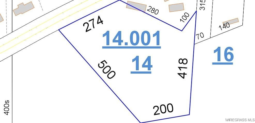
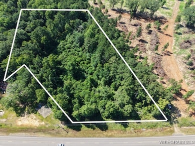
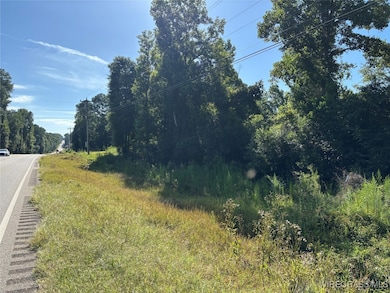
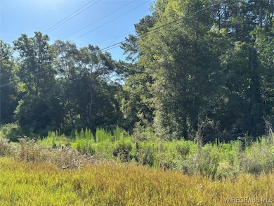
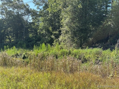
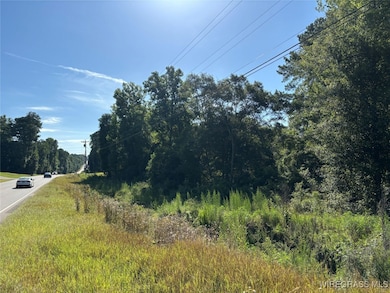
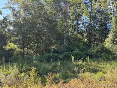
Approximately 3.68 acres of land with approx. 274 ft of frontage on Highway 134. Just 2 miles from Boll Weevil Circle, it is the perfect location for your dream home. The property is wooded with various trees...clear as much or as little as you like. Plus, there is a creek running through the property. On the West side of the property, the adjacent land has been cleared for a new development. This property could be yours! Let your dreams become a reality! (Note: property outline on picture is approximate only.)
Property Details
Property Type
- Land
Est. Annual Taxes
- $129
Lot Details
- 3.68 Acre Lot
- Lot Has A Rolling Slope
- Hilly Lot
- Wooded Lot
- Zoning described as Not Zoned
Location
- Outside City Limits
Listing and Financial Details
- Assessor Parcel Number 15-06-14-0-000-014.000
Map
Create a Home Valuation Report for This Property
The Home Valuation Report is an in-depth analysis detailing your home's value as well as a comparison with similar homes in the area
Home Values in the Area
Average Home Value in this Area
Tax History
| Year | Tax Paid | Tax Assessment Tax Assessment Total Assessment is a certain percentage of the fair market value that is determined by local assessors to be the total taxable value of land and additions on the property. | Land | Improvement |
|---|---|---|---|---|
| 2024 | $1,009 | $28,800 | $2,184 | $26,616 |
| 2023 | $928 | $11,792 | $1,071 | $10,721 |
| 2022 | $833 | $23,620 | $0 | $0 |
| 2021 | $749 | $21,140 | $0 | $0 |
| 2020 | $741 | $20,900 | $0 | $0 |
| 2019 | $747 | $21,080 | $0 | $0 |
| 2018 | $716 | $20,180 | $0 | $0 |
| 2017 | $328 | $10,160 | $0 | $0 |
| 2016 | $0 | $9,860 | $0 | $0 |
| 2015 | -- | $9,860 | $0 | $0 |
| 2014 | -- | $9,860 | $0 | $0 |
| 2013 | -- | $0 | $0 | $0 |
Source: Public Records
Property History
| Date | Event | Price | List to Sale | Price per Sq Ft |
|---|---|---|---|---|
| 08/18/2025 08/18/25 | Price Changed | $20,000 | -50.0% | -- |
| 07/15/2025 07/15/25 | For Sale | $40,000 | -- | -- |
Source: Wiregrass REALTORS®
Purchase History
| Date | Type | Sale Price | Title Company |
|---|---|---|---|
| Quit Claim Deed | $98,000 | -- |
Source: Public Records
Source: Wiregrass REALTORS®
MLS Number: 554231
APN: 15-06-14-0-000-009.000
Nearby Homes
- 40
- 397 County Road 600
- 72 County Road 563 Rd
- 35 County Road 550
- TBD County Road 537
- 19249 Highway 134
- 116 County Road 558
- 418 County Road 556
- TBD County Road 619
- 2318 County Road 622
- 119 Kitty Hawk Loop
- 115 Kitty Hawk Loop
- 200 Kitty Hawk Loop
- 124 Kitty Hawk Loop
- 117 Kitty Hawk Loop
- 118 Kitty Hawk Loop
- 116 Kitty Hawk Loop
- 126 Kitty Hawk Loop
- 203 Conneway Ct
- 110 Byrd St
- 1570 Parker Ln
- 218 S Main St
- 1500 Shellfield Rd
- 100 Farm Creek Rd
- 200A Heron Cove Dr
- 120 Cody Dr
- 103 Apache Dr
- 110 Chapelwood Dr
- 607 Melbourne Dr
- 401 Wildwood Dr
- 505 Briarwood Dr
- 153 Candlebrook Dr
- 229 Charleston Dr
- 225 Charleston Dr
- 25 Courtyard Way
- 231 Wakefield Way
- 430 Co Rd 445
- 628 Joe Bruer Rd
- 21903 County Road 189
