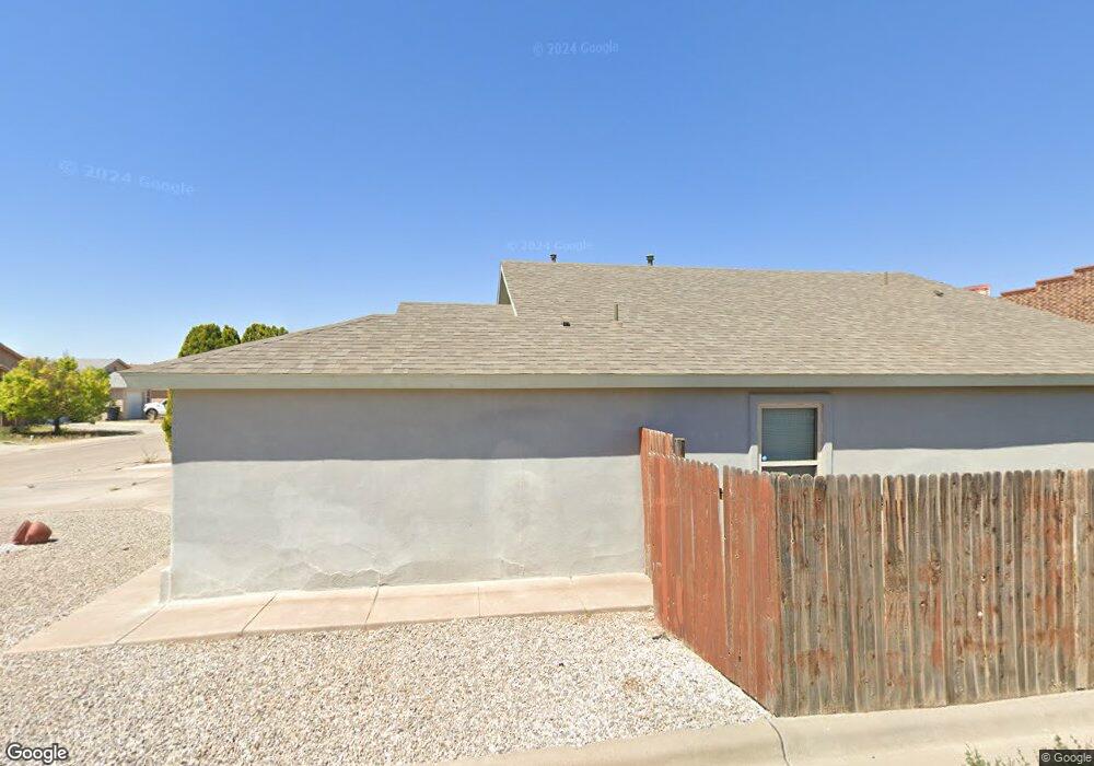
1793 Margarita Loop Alamogordo, NM 88310
Estimated Value: $188,000 - $222,000
3
Beds
2
Baths
1,360
Sq Ft
$147/Sq Ft
Est. Value
About This Home
This home is located at 1793 Margarita Loop, Alamogordo, NM 88310 and is currently estimated at $200,559, approximately $147 per square foot. 1793 Margarita Loop is a home located in Otero County with nearby schools including Mountain View Middle School, Alamogordo High School, and Father James B. Hay School.
Ownership History
Date
Name
Owned For
Owner Type
Purchase Details
Closed on
Dec 18, 2019
Sold by
Hardy Nathaniel I
Bought by
Robinson William A
Current Estimated Value
Home Financials for this Owner
Home Financials are based on the most recent Mortgage that was taken out on this home.
Original Mortgage
$140,967
Outstanding Balance
$124,526
Interest Rate
3.7%
Mortgage Type
VA
Estimated Equity
$76,033
Purchase Details
Closed on
Aug 4, 2006
Sold by
Karma Jks Properties Inc
Bought by
Hardy Nathaniel I
Home Financials for this Owner
Home Financials are based on the most recent Mortgage that was taken out on this home.
Original Mortgage
$140,711
Interest Rate
6.66%
Mortgage Type
VA
Create a Home Valuation Report for This Property
The Home Valuation Report is an in-depth analysis detailing your home's value as well as a comparison with similar homes in the area
Home Values in the Area
Average Home Value in this Area
Purchase History
| Date | Buyer | Sale Price | Title Company |
|---|---|---|---|
| Robinson William A | -- | None Available | |
| Hardy Nathaniel I | -- | None Available |
Source: Public Records
Mortgage History
| Date | Status | Borrower | Loan Amount |
|---|---|---|---|
| Open | Robinson William A | $140,967 | |
| Previous Owner | Hardy Nathaniel I | $140,711 |
Source: Public Records
Tax History Compared to Growth
Tax History
| Year | Tax Paid | Tax Assessment Tax Assessment Total Assessment is a certain percentage of the fair market value that is determined by local assessors to be the total taxable value of land and additions on the property. | Land | Improvement |
|---|---|---|---|---|
| 2025 | $1,235 | $48,396 | $7,611 | $40,785 |
| 2024 | $1,193 | $46,987 | $7,417 | $39,570 |
| 2023 | $1,179 | $45,619 | $7,215 | $38,404 |
| 2022 | $1,153 | $44,290 | $7,215 | $37,075 |
| 2021 | $1,133 | $43,000 | $7,215 | $35,785 |
| 2020 | $1,133 | $43,000 | $7,215 | $35,785 |
| 2019 | $1,268 | $47,825 | $7,215 | $40,610 |
| 2018 | $1,234 | $47,352 | $7,143 | $40,204 |
| 2017 | $1,135 | $46,424 | $7,003 | $39,416 |
| 2016 | $1,105 | $45,513 | $0 | $0 |
| 2015 | $1,082 | $44,621 | $0 | $0 |
| 2014 | -- | $43,745 | $6,600 | $37,145 |
Source: Public Records
Map
Nearby Homes
- 2100 Stardust Ct
- 1603 Bellamah Ave
- 403 Spruce Ave
- 1702 Mountain View Ave
- 1503 Wilson Ave
- 1708 Mountain View Ave
- 600 Adams Ave
- 405 Utah Ave
- 1113 San Miguel
- 2314 Rolland Ave
- 305 Santa fe Dr
- 500 Cuba Ave
- 600 Boyce Ave
- 309 Santa fe Dr
- 510 Plainview Dr
- 1804 E 8th St
- 00 S Scenic Dr
- 1076 San Cristo St
- 607 Coronado Dr
- 713 Montwood Ct
- 1791 Margarita Loop
- 1789 Margarita Loop
- 1792 Margarita Loop
- 1790 Margarita Loop
- 1788 Margarita Loop
- 1785 Margarita Loop
- 1786 Margarita Loop
- 1783 Margarita Lp
- 1783 Margarita Loop
- 1784 Margarita Loop
- 107 Sierra Blanca Dr
- 1776 1st St
- 1781 Margarita Loop
- 1780 Margarita Loop
- 1779 Margarita Loop
- 1778 Margarita Loop
- 1709 Palo Verde Dr
- 1711 Palo Verde Dr
- 1718 Loma Vista Dr
- 409 S Canyon Rd