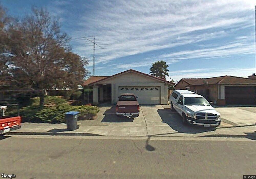
1794 Enterprise Dr Fairfield, CA 94533
Estimated Value: $485,817 - $526,000
4
Beds
2
Baths
1,405
Sq Ft
$365/Sq Ft
Est. Value
About This Home
This home is located at 1794 Enterprise Dr, Fairfield, CA 94533 and is currently estimated at $512,704, approximately $364 per square foot. 1794 Enterprise Dr is a home located in Solano County with nearby schools including Crystal Middle School, Armijo High School, and We R Family Christian School.
Ownership History
Date
Name
Owned For
Owner Type
Purchase Details
Closed on
Aug 13, 2015
Sold by
Liberty Irma J
Bought by
Turner Dormesha
Current Estimated Value
Home Financials for this Owner
Home Financials are based on the most recent Mortgage that was taken out on this home.
Original Mortgage
$279,837
Outstanding Balance
$221,722
Interest Rate
4.25%
Mortgage Type
FHA
Estimated Equity
$290,982
Purchase Details
Closed on
Apr 2, 2002
Sold by
Liberty Iii Frank Charles
Bought by
Liberty Irma J
Home Financials for this Owner
Home Financials are based on the most recent Mortgage that was taken out on this home.
Original Mortgage
$153,000
Interest Rate
6.87%
Create a Home Valuation Report for This Property
The Home Valuation Report is an in-depth analysis detailing your home's value as well as a comparison with similar homes in the area
Home Values in the Area
Average Home Value in this Area
Purchase History
| Date | Buyer | Sale Price | Title Company |
|---|---|---|---|
| Turner Dormesha | $285,000 | First American Title Company | |
| Liberty Irma J | -- | Bridgespan Title Company |
Source: Public Records
Mortgage History
| Date | Status | Borrower | Loan Amount |
|---|---|---|---|
| Open | Turner Dormesha | $279,837 | |
| Previous Owner | Liberty Irma J | $153,000 |
Source: Public Records
Tax History Compared to Growth
Tax History
| Year | Tax Paid | Tax Assessment Tax Assessment Total Assessment is a certain percentage of the fair market value that is determined by local assessors to be the total taxable value of land and additions on the property. | Land | Improvement |
|---|---|---|---|---|
| 2025 | $3,699 | $337,373 | $94,699 | $242,674 |
| 2024 | $3,699 | $330,759 | $92,843 | $237,916 |
| 2023 | $3,584 | $324,274 | $91,023 | $233,251 |
| 2022 | $3,539 | $317,917 | $89,239 | $228,678 |
| 2021 | $3,502 | $311,685 | $87,490 | $224,195 |
| 2020 | $3,420 | $308,490 | $86,593 | $221,897 |
| 2019 | $3,334 | $302,443 | $84,896 | $217,547 |
| 2018 | $3,440 | $296,514 | $83,232 | $213,282 |
| 2017 | $3,280 | $290,700 | $81,600 | $209,100 |
| 2016 | $3,252 | $285,000 | $80,000 | $205,000 |
| 2015 | $1,743 | $163,420 | $21,539 | $141,881 |
| 2014 | $1,725 | $160,220 | $21,118 | $139,102 |
Source: Public Records
Map
Nearby Homes
- 109 Creek View Cir
- 113 Creek View Cir
- 1625 Park Ln Unit 11
- 435 Hamilton Dr
- 266 De Soto Dr
- 1842 Minnesota St
- 2537 Woolner Ave
- 1007 4th St
- 1661 Minnesota St
- 225 Pennsylvania Ave Unit B5
- 1042 Hayes St
- 1200 Truman St
- 1731 Michigan St
- 527 Great Jones St
- 1201 Missouri St
- 1137 Ohio St
- 1443 Minnesota St
- 1047 Ohio St
- 0 Illinois St Unit 325091474
- 1032 Tyler St
- 1796 Enterprise Dr
- 1792 Enterprise Dr
- 1798 Enterprise Dr
- 1790 Enterprise Dr
- 1800 Enterprise Dr
- 1788 Enterprise Dr
- 1901 Enterprise Ct
- 1900 Enterprise Ct
- 1786 Enterprise Dr
- 2008 Woolner Ave
- 1801 Rhine Ct
- 1905 Enterprise Ct
- 1904 Enterprise Ct
- 1784 Enterprise Dr
- 2012 Woolner Ave
- 1805 Rhine Ct
- 1900 Vine Dr
- 2001 Woolner Ave
- 1782 Enterprise Dr
- 2016 Woolner Ave