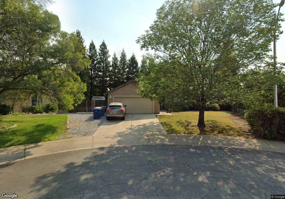
1795 Record Ln Redding, CA 96001
Mary Lake NeighborhoodEstimated Value: $353,491 - $384,000
3
Beds
2
Baths
1,410
Sq Ft
$265/Sq Ft
Est. Value
About This Home
This home is located at 1795 Record Ln, Redding, CA 96001 and is currently estimated at $373,123, approximately $264 per square foot. 1795 Record Ln is a home located in Shasta County with nearby schools including Manzanita Elementary School, Sequoia Middle School, and Shasta High School.
Ownership History
Date
Name
Owned For
Owner Type
Purchase Details
Closed on
Apr 9, 1997
Sold by
Allen Jeb and Tsai Sue
Bought by
Nye Glenn N and Fiorella Nye Molly E
Current Estimated Value
Home Financials for this Owner
Home Financials are based on the most recent Mortgage that was taken out on this home.
Original Mortgage
$109,369
Outstanding Balance
$14,104
Interest Rate
7.86%
Mortgage Type
FHA
Estimated Equity
$359,019
Create a Home Valuation Report for This Property
The Home Valuation Report is an in-depth analysis detailing your home's value as well as a comparison with similar homes in the area
Home Values in the Area
Average Home Value in this Area
Purchase History
| Date | Buyer | Sale Price | Title Company |
|---|---|---|---|
| Nye Glenn N | $110,000 | Placer Title Company |
Source: Public Records
Mortgage History
| Date | Status | Borrower | Loan Amount |
|---|---|---|---|
| Open | Nye Glenn N | $109,369 |
Source: Public Records
Tax History
| Year | Tax Paid | Tax Assessment Tax Assessment Total Assessment is a certain percentage of the fair market value that is determined by local assessors to be the total taxable value of land and additions on the property. | Land | Improvement |
|---|---|---|---|---|
| 2025 | $1,852 | $177,125 | $43,882 | $133,243 |
| 2024 | $1,823 | $173,653 | $43,022 | $130,631 |
| 2023 | $1,823 | $170,249 | $42,179 | $128,070 |
| 2022 | $1,793 | $166,911 | $41,352 | $125,559 |
| 2021 | $1,784 | $163,640 | $40,542 | $123,098 |
| 2020 | $1,807 | $161,963 | $40,127 | $121,836 |
| 2019 | $1,716 | $158,789 | $39,341 | $119,448 |
| 2018 | $1,731 | $155,676 | $38,570 | $117,106 |
| 2017 | $1,722 | $152,624 | $37,814 | $114,810 |
| 2016 | $1,667 | $149,632 | $37,073 | $112,559 |
| 2015 | $1,646 | $147,386 | $36,517 | $110,869 |
| 2014 | $1,635 | $144,500 | $35,802 | $108,698 |
Source: Public Records
Map
Nearby Homes
- 1783 Record Ln
- 1974 Kildare Dr
- 4519 Nantucket Dr
- 4125 Oro St
- 1846 Kildare Dr
- 4395 Carlow Way
- 1756 Mary Lake Dr
- 4065 Meander Dr
- 4160 Travona Ct
- 1695 Kildare Dr
- 1692 Kildare Dr
- 4746 Tralee Ln
- 3882 Fujiyama Way
- 2242 Everest Dr
- 16928 Campo Calle
- 0 Thompson Ln
- 2358 Cumberland Dr
- 1513 Brinn Dr
- 1426 Gladstone Ct
- 2135 Adirondack Dr
- 1996 Mary Lake Dr
- 1988 Mary Lake Dr
- 1988 Mary Lake
- 1788 Record Ln
- 1771 Record Ln
- 1776 Record Ln
- 1980 Mary Lake Dr
- 4296 Hazelwood Ct
- 4288 Hazelwood Ct
- 1764 Record Ln
- 1759 Record Ln
- 1974 Mary Lake Dr
- 2063 Wicklow St
- 2047 Wicklow St Unit 1
- 2047 Wicklow St
- 1985 Mary Lake Dr
- 4280 Hazelwood Ct
- 2075 Wicklow St
- 1752 Record Ln
- 4295 Hazelwood Ct
Your Personal Tour Guide
Ask me questions while you tour the home.