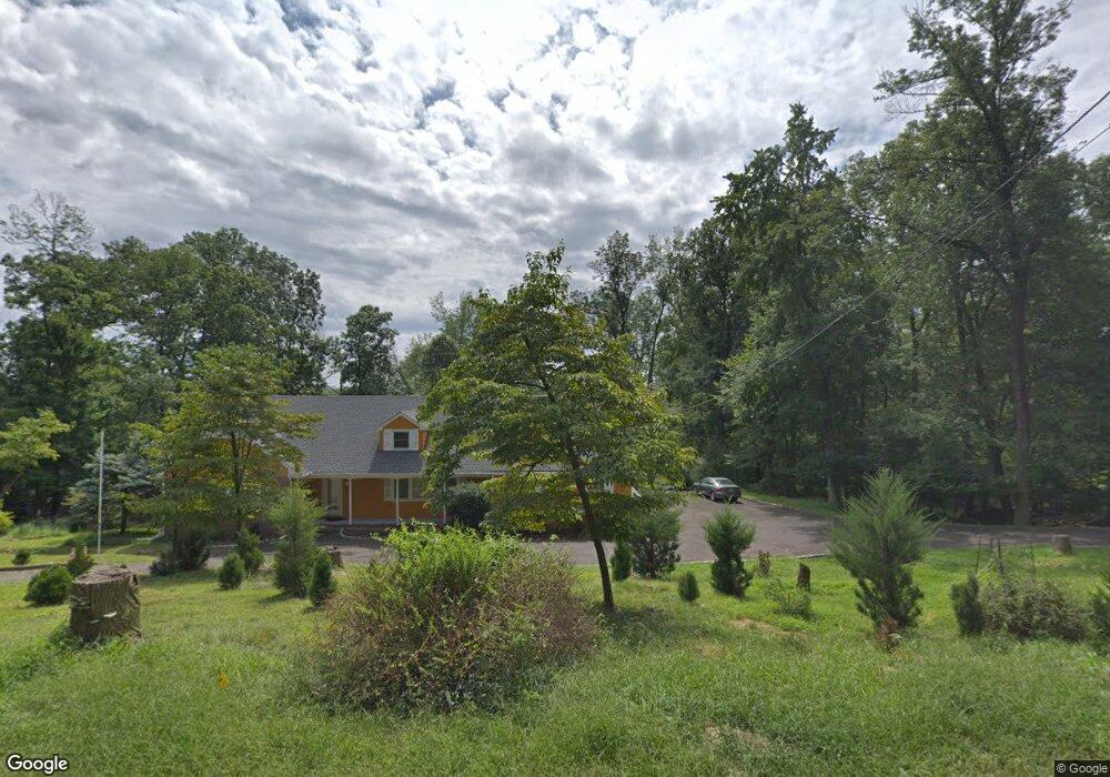
1796 Middlebrook Rd Bound Brook, NJ 08805
Estimated Value: $717,184 - $1,043,000
Studio
--
Bath
2,924
Sq Ft
$290/Sq Ft
Est. Value
About This Home
This home is located at 1796 Middlebrook Rd, Bound Brook, NJ 08805 and is currently estimated at $849,296, approximately $290 per square foot. 1796 Middlebrook Rd is a home with nearby schools including Crim Primary School, Bridgewater-Raritan Middle School, and Hillside Intermediate School.
Ownership History
Date
Name
Owned For
Owner Type
Purchase Details
Closed on
Jun 29, 2001
Sold by
Kuhl William
Bought by
Lyons Stacey
Current Estimated Value
Home Financials for this Owner
Home Financials are based on the most recent Mortgage that was taken out on this home.
Original Mortgage
$274,950
Outstanding Balance
$106,421
Interest Rate
7.2%
Estimated Equity
$742,875
Create a Home Valuation Report for This Property
The Home Valuation Report is an in-depth analysis detailing your home's value as well as a comparison with similar homes in the area
Home Values in the Area
Average Home Value in this Area
Purchase History
| Date | Buyer | Sale Price | Title Company |
|---|---|---|---|
| Lyons Stacey | $365,000 | -- |
Source: Public Records
Mortgage History
| Date | Status | Borrower | Loan Amount |
|---|---|---|---|
| Open | Lyons Stacey | $274,950 |
Source: Public Records
Tax History
| Year | Tax Paid | Tax Assessment Tax Assessment Total Assessment is a certain percentage of the fair market value that is determined by local assessors to be the total taxable value of land and additions on the property. | Land | Improvement |
|---|---|---|---|---|
| 2025 | $12,675 | $587,200 | $241,500 | $345,700 |
| 2024 | $12,675 | $558,600 | $222,500 | $336,100 |
| 2023 | $12,537 | $531,700 | $203,500 | $328,200 |
| 2022 | $12,363 | $496,900 | $184,500 | $312,400 |
| 2021 | $13,401 | $456,100 | $160,800 | $295,300 |
| 2020 | $12,632 | $409,200 | $141,800 | $267,400 |
| 2019 | $13,401 | $414,000 | $141,800 | $272,200 |
| 2018 | $15,710 | $471,200 | $141,800 | $329,400 |
| 2017 | $14,173 | $415,500 | $141,800 | $273,700 |
| 2016 | $15,345 | $459,000 | $122,800 | $336,200 |
| 2015 | $13,724 | $420,300 | $122,800 | $297,500 |
| 2014 | $13,883 | $410,800 | $113,300 | $297,500 |
Source: Public Records
Map
Nearby Homes
- 44 Hillcrest Rd
- 811 Mountain Ave
- 730 Park Ave
- 650 Central Ave
- 610 Watchung Rd
- 589 Mountain Ave
- 24 Dudley Ct
- 1058 Shadowlawn Dr Unit 1258
- 1108 Shadowlawn Dr Unit 701
- 1108 Shadowlawn Dr
- 212 Vesper Ave
- 112 Wallace Ct Unit 612
- 20 Hayward St
- 3038 King Ct
- 151 Beechwood Ave
- 520 Winsor St
- 8 Juniper Pointe Trail
- 408 E Union Ave
- 3 Brookside Dr
- 5 Brookside Dr
- 1798 Middlebrook Rd
- 1794 Middlebrook Rd
- 1045 N Mountain Ave
- 1901 Middlebrook Rd
- 1881 Middlebrook Rd
- 1800 Middlebrook Rd
- 1890 Woodland Terrace
- 1792 Middlebrook Rd
- 1896 Woodland Terrace
- 1907 Middlebrook Rd
- 1911 Middle Brook
- 1861 Middlebrook Rd
- 1786 Middlebrook Rd
- 1911 Middlebrook Rd
- 1881 Woodland Terrace
- 1911 Middlebrook Rd
- 1861 Woodland Terrace
- 1790 Middlebrook Rd
- 1901 Woodland Terrace
- 1931 Route 22 W
Your Personal Tour Guide
Ask me questions while you tour the home.