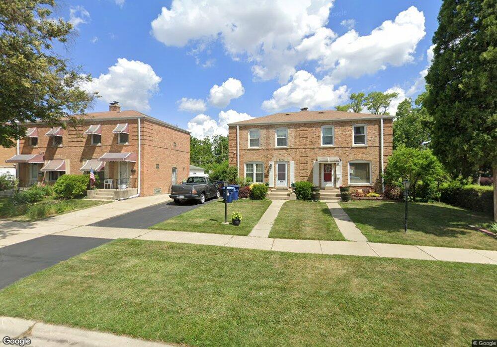
1796 Stockton Ave Des Plaines, IL 60018
Estimated Value: $250,000 - $320,000
3
Beds
1
Bath
1,003
Sq Ft
$280/Sq Ft
Est. Value
About This Home
This home is located at 1796 Stockton Ave, Des Plaines, IL 60018 and is currently estimated at $280,682, approximately $279 per square foot. 1796 Stockton Ave is a home located in Cook County with nearby schools including South Elementary School, Algonquin Middle School, and Maine West High School.
Ownership History
Date
Name
Owned For
Owner Type
Purchase Details
Closed on
Jul 28, 2006
Sold by
Klein Steve L and Zavarello Tracy A
Bought by
Wilkens Diane
Current Estimated Value
Home Financials for this Owner
Home Financials are based on the most recent Mortgage that was taken out on this home.
Original Mortgage
$90,000
Outstanding Balance
$54,298
Interest Rate
6.85%
Mortgage Type
Unknown
Estimated Equity
$226,384
Purchase Details
Closed on
Aug 23, 1994
Sold by
Goldman Gary H and Goldman Gail L
Bought by
Klein Steve L and Zavarello Tracy A
Home Financials for this Owner
Home Financials are based on the most recent Mortgage that was taken out on this home.
Original Mortgage
$121,933
Interest Rate
8.59%
Mortgage Type
FHA
Create a Home Valuation Report for This Property
The Home Valuation Report is an in-depth analysis detailing your home's value as well as a comparison with similar homes in the area
Home Values in the Area
Average Home Value in this Area
Purchase History
| Date | Buyer | Sale Price | Title Company |
|---|---|---|---|
| Wilkens Diane | $225,000 | Multiple | |
| Klein Steve L | $124,000 | -- |
Source: Public Records
Mortgage History
| Date | Status | Borrower | Loan Amount |
|---|---|---|---|
| Open | Wilkens Diane | $90,000 | |
| Previous Owner | Klein Steve L | $121,933 |
Source: Public Records
Tax History Compared to Growth
Tax History
| Year | Tax Paid | Tax Assessment Tax Assessment Total Assessment is a certain percentage of the fair market value that is determined by local assessors to be the total taxable value of land and additions on the property. | Land | Improvement |
|---|---|---|---|---|
| 2024 | $4,663 | $21,000 | $3,500 | $17,500 |
| 2023 | $4,524 | $21,000 | $3,500 | $17,500 |
| 2022 | $4,524 | $21,000 | $3,500 | $17,500 |
| 2021 | $4,062 | $16,546 | $2,398 | $14,148 |
| 2020 | $4,063 | $16,546 | $2,398 | $14,148 |
| 2019 | $4,080 | $18,591 | $2,398 | $16,193 |
| 2018 | $4,126 | $17,230 | $2,110 | $15,120 |
| 2017 | $4,070 | $17,230 | $2,110 | $15,120 |
| 2016 | $4,094 | $17,230 | $2,110 | $15,120 |
| 2015 | $3,163 | $13,087 | $1,823 | $11,264 |
| 2014 | $3,113 | $13,087 | $1,823 | $11,264 |
| 2013 | $3,018 | $13,087 | $1,823 | $11,264 |
Source: Public Records
Map
Nearby Homes
- 1721 Linden St
- 1928 Kennicott Ct
- 1640 S River Rd
- 1724 Illinois St
- 1689 S Elm St
- 2017 Pine St Unit B
- 1536 Orchard St
- 1706 Buckingham Dr
- 1632 S Elm St
- 1641 E Touhy Ave
- 1629 E Touhy Ave
- 2500 Maple St
- 38 E Touhy Ave
- 1783 Lee St
- 1700 E Forest Ave
- 1966 Laura Ln
- 2609 Eisenhower Dr
- 2646 Maple St
- 1278 E River Dr
- 2126 David Dr
- 1798 Stockton Ave
- 1786 Stockton Ave
- 1784 Stockton Ave
- 1774 Stockton Ave
- 1766 Stockton Ave
- 1912 Maple St
- 1797 Stockton Ave
- 1783 Stockton Ave
- 1800 Stockton Ave
- 1779 Prospect Ave
- 1764 Stockton Ave
- 1795 Stockton Ave
- 1775 Stockton Ave
- 1785 Stockton Ave
- 1773 Prospect Ave
- 1921 Maple St
- 1959 Maple St
- 1756 Stockton Ave
- 1765 Stockton Ave
- 1773 Stockton Ave