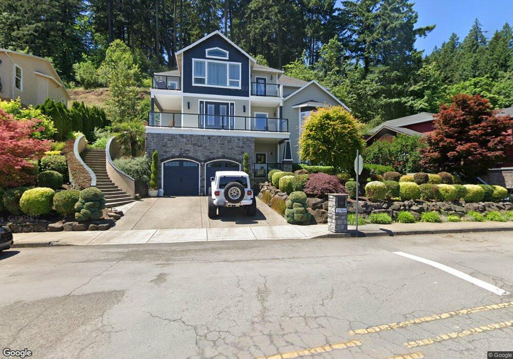
17964 Hillside Dr West Linn, OR 97068
Robinwood NeighborhoodEstimated Value: $885,000 - $1,035,283
4
Beds
3
Baths
4,055
Sq Ft
$238/Sq Ft
Est. Value
About This Home
This home is located at 17964 Hillside Dr, West Linn, OR 97068 and is currently estimated at $965,571, approximately $238 per square foot. 17964 Hillside Dr is a home located in Clackamas County with nearby schools including Cedaroak Park Primary School, West Linn High School, and Harmony Academy.
Ownership History
Date
Name
Owned For
Owner Type
Purchase Details
Closed on
Mar 7, 2012
Sold by
Pnc Mortgage
Bought by
Kekhia Majd Al
Current Estimated Value
Home Financials for this Owner
Home Financials are based on the most recent Mortgage that was taken out on this home.
Original Mortgage
$399,000
Interest Rate
3.74%
Mortgage Type
New Conventional
Purchase Details
Closed on
Jul 27, 2010
Sold by
Potts Joseph C and National City Mortgage
Bought by
Pnc Mortgage
Purchase Details
Closed on
Mar 16, 2007
Sold by
Ahmed Kazi I
Bought by
Potts Joseph C
Home Financials for this Owner
Home Financials are based on the most recent Mortgage that was taken out on this home.
Original Mortgage
$828,000
Interest Rate
7.25%
Mortgage Type
Construction
Create a Home Valuation Report for This Property
The Home Valuation Report is an in-depth analysis detailing your home's value as well as a comparison with similar homes in the area
Home Values in the Area
Average Home Value in this Area
Purchase History
| Date | Buyer | Sale Price | Title Company |
|---|---|---|---|
| Kekhia Majd Al | $280,000 | Fidelity Natl Title Co Of Or | |
| Pnc Mortgage | $558,000 | None Available | |
| Potts Joseph C | $202,620 | Chicago Title Insurance Co |
Source: Public Records
Mortgage History
| Date | Status | Borrower | Loan Amount |
|---|---|---|---|
| Previous Owner | Kekhia Majd Al | $399,000 | |
| Previous Owner | Potts Joseph C | $828,000 |
Source: Public Records
Tax History Compared to Growth
Tax History
| Year | Tax Paid | Tax Assessment Tax Assessment Total Assessment is a certain percentage of the fair market value that is determined by local assessors to be the total taxable value of land and additions on the property. | Land | Improvement |
|---|---|---|---|---|
| 2025 | $10,465 | $543,036 | -- | -- |
| 2024 | $10,073 | $527,220 | -- | -- |
| 2023 | $10,073 | $511,865 | $0 | $0 |
| 2022 | $9,508 | $496,957 | $0 | $0 |
| 2021 | $9,026 | $482,483 | $0 | $0 |
| 2020 | $9,087 | $468,431 | $0 | $0 |
| 2019 | $8,666 | $454,788 | $0 | $0 |
| 2018 | $8,279 | $441,542 | $0 | $0 |
| 2017 | $7,957 | $428,682 | $0 | $0 |
| 2016 | $7,645 | $416,196 | $0 | $0 |
| 2015 | $7,322 | $404,074 | $0 | $0 |
| 2014 | $6,339 | $358,722 | $0 | $0 |
Source: Public Records
Map
Nearby Homes
- 1354 Skye Pkwy
- 2455 College Hill Place
- 17833 Marylcreek Dr
- 1384 Celtic Ct
- 2167 Marylwood Ct
- 1397 Skye Pkwy
- 1777 Skyland Dr
- 17634 Brookhurst Dr
- 17623 Brookhurst Dr
- 2041 Marylhurst Dr
- 17514 Brookhurst Dr
- 2636 Maria Ct
- 1611 Arran Ct
- 18194 Shady Hollow Way
- 1321 Troon Dr
- 3340 Arbor Dr
- 17900 Crestline Dr
- 18711 Willamette Dr
- 19661 Sun Cir
- 18649 Old River Dr
- 18000 Hillside Ct
- 17922 Hillside Dr
- 17892 Hillside Dr
- 2010 College Hill Place
- 17957 Hillside Dr
- 18100 Hillside Ct
- 2060 College Hill Place
- 17887 Hillside Dr
- 1377 Skye Pkwy
- 2120 College Hill Place
- 18136 Hillside Ct
- 18220 Upper Midhill Dr
- 17821 Hillside Dr
- 18097 Hillside Ct
- 1358 Skye Pkwy
- 18180 Upper Midhill Dr
- 18150 Upper Midhill Dr
- 1362 Skye Pkwy
- 18250 Upper Midhill Dr
- 17795 Hillside Dr