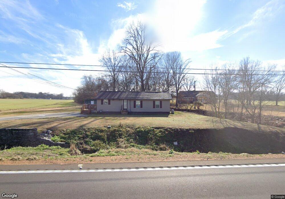
1797 Highway 59 W Covington, TN 38019
Estimated Value: $75,130 - $166,000
--
Bed
1
Bath
996
Sq Ft
$125/Sq Ft
Est. Value
About This Home
This home is located at 1797 Highway 59 W, Covington, TN 38019 and is currently estimated at $124,283, approximately $124 per square foot. 1797 Highway 59 W is a home located in Tipton County with nearby schools including Crestview Elementary School, Crestview Middle School, and Brighton High School.
Ownership History
Date
Name
Owned For
Owner Type
Purchase Details
Closed on
Oct 23, 2014
Sold by
Bank Of Ripley
Bought by
Davis Donald and Davis Billie
Current Estimated Value
Purchase Details
Closed on
Jul 28, 2014
Sold by
Senecal Gerald J
Bought by
The Bank Of Ripley
Purchase Details
Closed on
Feb 19, 2002
Sold by
Biggs Roy E and Biggs Gail Beverly
Bought by
Senecal Gerald J
Purchase Details
Closed on
Dec 15, 1997
Sold by
Gail Cox Beverly
Bought by
Gail Cox Beverly
Purchase Details
Closed on
Jun 7, 1971
Bought by
Daniel Bruce L and Daniel Lois K
Create a Home Valuation Report for This Property
The Home Valuation Report is an in-depth analysis detailing your home's value as well as a comparison with similar homes in the area
Home Values in the Area
Average Home Value in this Area
Purchase History
| Date | Buyer | Sale Price | Title Company |
|---|---|---|---|
| Davis Donald | $6,500 | -- | |
| The Bank Of Ripley | $16,000 | -- | |
| Senecal Gerald J | $21,016 | -- | |
| Gail Cox Beverly | -- | -- | |
| Daniel Bruce L | -- | -- |
Source: Public Records
Tax History Compared to Growth
Tax History
| Year | Tax Paid | Tax Assessment Tax Assessment Total Assessment is a certain percentage of the fair market value that is determined by local assessors to be the total taxable value of land and additions on the property. | Land | Improvement |
|---|---|---|---|---|
| 2024 | $174 | $11,450 | $4,400 | $7,050 |
| 2023 | $174 | $11,450 | $4,400 | $7,050 |
| 2022 | $167 | $8,200 | $3,225 | $4,975 |
| 2021 | $167 | $8,200 | $3,225 | $4,975 |
| 2020 | $167 | $8,200 | $3,225 | $4,975 |
| 2019 | $168 | $6,950 | $2,825 | $4,125 |
| 2018 | $168 | $6,950 | $2,825 | $4,125 |
| 2017 | $168 | $6,950 | $2,825 | $4,125 |
| 2016 | $168 | $6,950 | $2,825 | $4,125 |
| 2015 | $168 | $6,950 | $2,825 | $4,125 |
| 2014 | $168 | $6,963 | $0 | $0 |
Source: Public Records
Map
Nearby Homes
- 1364 Tennessee 59
- 1679 Walton Loop
- 513 Garland Ave
- 902 Hatchie Ave
- 1329 Herring Dr
- 900 Peete St
- 65 Paulette Cir
- 714 W Sherrod Ave
- 202 Holly Grove Rd
- 600 W Sherrod Ave
- 000 Davis St
- 509 S College St
- 1202 Bucksnort Rd
- 0 Holly Grove Rd
- 0 N Munford St Unit 10156264
- 0 N Munford St Unit 10156263
- 133 W Washington Ave
- 518 James St
- 104 Russwood Dr
- 502 James Ave
- 1821 Highway 59 W
- 1742 Tennessee 59
- 1742 Highway 59 W
- 1790 Highway 59 W
- 1860 Highway 59 W
- 1709 Highway 59 W
- 1720 Highway 59 W
- 1688 Highway 59 W
- 1671 Highway 59 W
- 1645 Tennessee 59
- 1645 Highway 59 W
- 1622 Highway 59 W
- 2006 Highway 59 W
- 1555 Highway 59 W
- 1517 Highway 59 W
- 127 Walton Loop
- 69 Walton Loop
- 95 Walton Loop
- 59 Walton Loop
- 1495 Highway 59 W