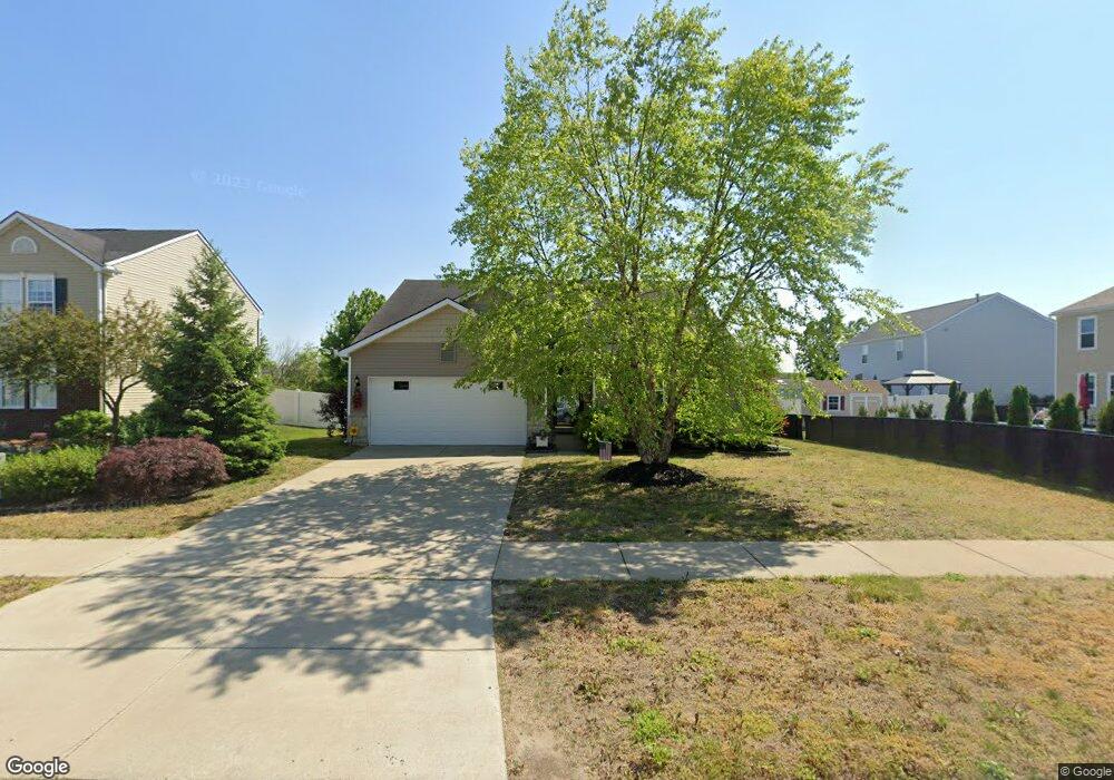
1799 Cardston Dr Monroe, MI 48162
Estimated Value: $278,588 - $318,000
3
Beds
2
Baths
1,380
Sq Ft
$213/Sq Ft
Est. Value
About This Home
This home is located at 1799 Cardston Dr, Monroe, MI 48162 and is currently estimated at $294,397, approximately $213 per square foot. 1799 Cardston Dr is a home located in Monroe County with nearby schools including Monroe High School, Zion Lutheran School, and St Mary's Catholic Elementary School.
Ownership History
Date
Name
Owned For
Owner Type
Purchase Details
Closed on
May 19, 2021
Sold by
Keck Merel F and Merel F Keck Jr Revocable Trus
Bought by
Drew James Edward
Current Estimated Value
Home Financials for this Owner
Home Financials are based on the most recent Mortgage that was taken out on this home.
Original Mortgage
$181,500
Outstanding Balance
$164,227
Interest Rate
3%
Mortgage Type
New Conventional
Estimated Equity
$130,170
Create a Home Valuation Report for This Property
The Home Valuation Report is an in-depth analysis detailing your home's value as well as a comparison with similar homes in the area
Home Values in the Area
Average Home Value in this Area
Purchase History
| Date | Buyer | Sale Price | Title Company |
|---|---|---|---|
| Drew James Edward | $242,000 | Lawyers Title Agcy Of Monroe |
Source: Public Records
Mortgage History
| Date | Status | Borrower | Loan Amount |
|---|---|---|---|
| Open | Drew James Edward | $181,500 |
Source: Public Records
Tax History Compared to Growth
Tax History
| Year | Tax Paid | Tax Assessment Tax Assessment Total Assessment is a certain percentage of the fair market value that is determined by local assessors to be the total taxable value of land and additions on the property. | Land | Improvement |
|---|---|---|---|---|
| 2025 | $3,531 | $124,500 | $124,500 | $0 |
| 2024 | $1,238 | $119,100 | $0 | $0 |
| 2023 | $1,179 | $104,000 | $0 | $0 |
| 2022 | $3,277 | $104,000 | $0 | $0 |
| 2021 | $2,480 | $97,800 | $0 | $0 |
| 2020 | $3,803 | $87,300 | $0 | $0 |
| 2019 | $3,619 | $87,300 | $0 | $0 |
| 2018 | $3,525 | $73,000 | $0 | $0 |
| 2017 | $788 | $73,000 | $0 | $0 |
| 2016 | $0 | $78,600 | $0 | $0 |
| 2015 | $3,350 | $76,800 | $0 | $0 |
| 2014 | $3,302 | $76,800 | $0 | $0 |
| 2013 | -- | $69,900 | $0 | $0 |
Source: Public Records
Map
Nearby Homes
- 2057 Danville Dr
- 2025 Carson Ln
- 2198 Gunnison Ln
- DUPONT Plan at Forest Glen
- ESSEX Plan at Forest Glen
- 2181 Gunnison Ln
- 2236 Gunnison Ln
- 2205 Gunnison Ln
- 2248 Gunnison Ln
- 2250 Gunnison Ln
- 2231 Gunnison Ln
- 2243 Gunnison Ln
- 2255 Gunnison Ln
- 1811 N Telegraph Rd Unit Lot 42
- 2406 N Telegraph Rd
- 1969 Lasalle Rd
- 1552 Dazarow Dr
- 2496 Lasalle Rd
- 1306 John L Dr
- 1234 John L Dr
- 1787 Cardston Dr
- 1990 Arbor Creek Dr
- 2003 Monohan Dr
- 1775 Cardston Dr
- 1978 Arbor Creek Dr
- 2002 Arbor Creek Dr
- 1763 Cardston Dr
- 1763 Cardson
- 2006 Monohan Dr
- 2015 Monohan Dr Unit Lot 140
- 1964 Elkton Dr
- 2014 Arbor Creek Dr Unit Bldg-Unit
- 2014 Arbor Creek Dr
- 1981 Arbor Creek Dr
- 1751 Cardston Dr
- 1975 Arbor Creek Dr
- 1976 Elkton Dr
- 1969 Arbor Creek Dr
- 2001 Arbor Creek Dr
- 2027 Monohan Dr