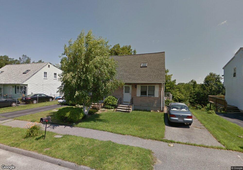
17A Timrod Dr Worcester, MA 01603
Webster Square NeighborhoodEstimated Value: $321,000 - $348,000
2
Beds
2
Baths
970
Sq Ft
$342/Sq Ft
Est. Value
About This Home
This home is located at 17A Timrod Dr, Worcester, MA 01603 and is currently estimated at $331,349, approximately $341 per square foot. 17A Timrod Dr is a home located in Worcester County with nearby schools including Chandler Magnet, Jacob Hiatt Magnet School, and Heard Street Discovery Academy.
Ownership History
Date
Name
Owned For
Owner Type
Purchase Details
Closed on
Jul 18, 2025
Sold by
Tsianco Jon C
Bought by
Ampomah Christiana A
Current Estimated Value
Home Financials for this Owner
Home Financials are based on the most recent Mortgage that was taken out on this home.
Original Mortgage
$308,500
Outstanding Balance
$306,915
Interest Rate
6.85%
Mortgage Type
New Conventional
Estimated Equity
$24,434
Create a Home Valuation Report for This Property
The Home Valuation Report is an in-depth analysis detailing your home's value as well as a comparison with similar homes in the area
Home Values in the Area
Average Home Value in this Area
Purchase History
| Date | Buyer | Sale Price | Title Company |
|---|---|---|---|
| Ampomah Christiana A | $325,000 | -- | |
| Ampomah Christiana A | $325,000 | -- |
Source: Public Records
Mortgage History
| Date | Status | Borrower | Loan Amount |
|---|---|---|---|
| Open | Ampomah Christiana A | $308,500 | |
| Closed | Ampomah Christiana A | $308,500 |
Source: Public Records
Tax History
| Year | Tax Paid | Tax Assessment Tax Assessment Total Assessment is a certain percentage of the fair market value that is determined by local assessors to be the total taxable value of land and additions on the property. | Land | Improvement |
|---|---|---|---|---|
| 2025 | $3,757 | $284,800 | $80,100 | $204,700 |
| 2024 | $3,579 | $260,300 | $80,100 | $180,200 |
| 2023 | $3,391 | $236,500 | $69,600 | $166,900 |
| 2022 | $3,047 | $200,300 | $55,700 | $144,600 |
| 2021 | $2,828 | $173,700 | $44,600 | $129,100 |
| 2020 | $2,788 | $164,000 | $44,300 | $119,700 |
| 2019 | $2,660 | $147,800 | $38,700 | $109,100 |
| 2018 | $2,576 | $136,200 | $38,700 | $97,500 |
| 2017 | $2,403 | $125,000 | $38,700 | $86,300 |
| 2016 | $2,317 | $112,400 | $27,900 | $84,500 |
| 2015 | $2,256 | $112,400 | $27,900 | $84,500 |
| 2014 | $2,196 | $112,400 | $27,900 | $84,500 |
Source: Public Records
Map
Nearby Homes
- 23B Timrod Dr
- 11 Timrod Dr
- 128 Wildwood Ave
- 76 Parsons Hill Dr Unit A
- 32 Goddard Memorial Dr
- 13 Merchant St
- 34 Scandinavia Ave
- 57 1st St
- 25 Wyola Dr
- 1511 Main St Unit C405
- 26 Sylvan St
- 55 Grandview Ave
- 31 B Gates Rd Unit 22R
- 103 Henshaw St
- 22 Outlook Dr
- 5 Swan Ave
- 2 Montague St
- 35 Genessee St Unit E
- 23 Lakewood St
- 34 Rosslare Dr Unit 108
- 17B Timrod Dr
- 17 Timrod Dr Unit B
- 19A Timrod Dr
- 19A Timrod Dr Unit A
- 19 Timrod Dr Unit A
- 19 Timrod Dr
- 19B Timrod Dr
- 21A Timrod Dr
- 15B Timrod Dr
- 15A Timrod Dr
- 21B Timrod Dr
- 21B Timrod Dr Unit 21 B
- 37B Parsons Hill Dr
- 23A Timrod Dr
- 33 Parsons Hill Dr
- 37A Parsons Hill Dr
- 31 Parsons Hill Dr
- 13B Timrod Dr
- 13A Timrod Dr
- 37-B Parsons Hill Dr
Your Personal Tour Guide
Ask me questions while you tour the home.