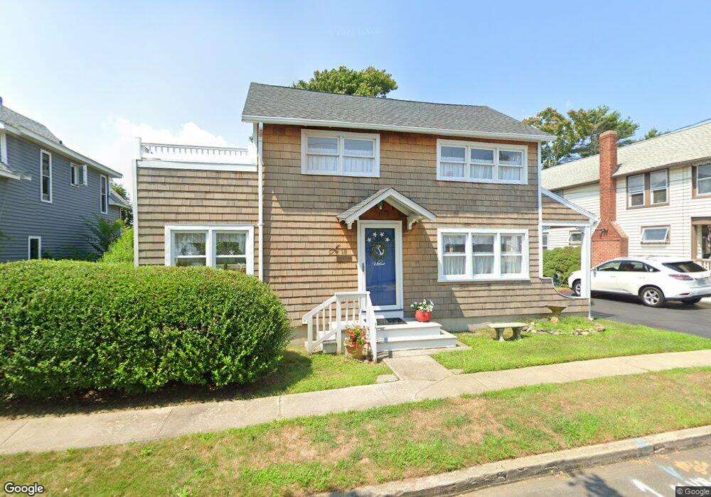
18 Blackall Rd Milford, CT 06460
Woodmont NeighborhoodEstimated Value: $513,000 - $731,000
2
Beds
1
Bath
1,810
Sq Ft
$338/Sq Ft
Est. Value
About This Home
This home is located at 18 Blackall Rd, Milford, CT 06460 and is currently estimated at $610,964, approximately $337 per square foot. 18 Blackall Rd is a home located in New Haven County with nearby schools including Live Oaks School, East Shore Middle School, and Joseph A. Foran High School.
Ownership History
Date
Name
Owned For
Owner Type
Purchase Details
Closed on
Aug 1, 2017
Sold by
Casey David B and Casey Linda M
Bought by
Casey Brendan D
Current Estimated Value
Purchase Details
Closed on
Apr 24, 1972
Bought by
Casey David B and Casey Linda M
Create a Home Valuation Report for This Property
The Home Valuation Report is an in-depth analysis detailing your home's value as well as a comparison with similar homes in the area
Home Values in the Area
Average Home Value in this Area
Purchase History
| Date | Buyer | Sale Price | Title Company |
|---|---|---|---|
| Casey Brendan D | -- | -- | |
| Casey Brendan D | -- | -- | |
| Casey David B | -- | -- |
Source: Public Records
Mortgage History
| Date | Status | Borrower | Loan Amount |
|---|---|---|---|
| Previous Owner | Casey David B | $100,000 | |
| Previous Owner | Casey David B | $110,000 | |
| Previous Owner | Casey David B | $34,000 | |
| Previous Owner | Casey David B | $70,000 |
Source: Public Records
Tax History Compared to Growth
Tax History
| Year | Tax Paid | Tax Assessment Tax Assessment Total Assessment is a certain percentage of the fair market value that is determined by local assessors to be the total taxable value of land and additions on the property. | Land | Improvement |
|---|---|---|---|---|
| 2025 | $8,324 | $281,680 | $154,330 | $127,350 |
| 2024 | $8,208 | $281,680 | $154,330 | $127,350 |
| 2023 | $7,653 | $281,680 | $154,330 | $127,350 |
| 2022 | $7,507 | $281,680 | $154,330 | $127,350 |
| 2021 | $6,541 | $236,570 | $119,950 | $116,620 |
| 2020 | $6,548 | $236,570 | $119,950 | $116,620 |
| 2019 | $6,555 | $236,570 | $119,950 | $116,620 |
| 2018 | $6,562 | $236,570 | $119,950 | $116,620 |
| 2017 | $6,574 | $236,570 | $119,950 | $116,620 |
| 2016 | $7,142 | $256,530 | $141,120 | $115,410 |
| 2015 | $7,152 | $256,530 | $141,120 | $115,410 |
| 2014 | $6,983 | $256,530 | $141,120 | $115,410 |
Source: Public Records
Map
Nearby Homes
- 25 Village Rd
- 152 Beach Ave
- 207 Merwin Ave
- 30 Salem Walk
- 40 Hawley Ave
- 49 Merwin Ave Unit 49
- 32 Wall St
- 15 Greenwich Way
- 64 Greenwich Way
- 10 Sperry St
- 6 Howe St
- 29 Meetinghouse Ln
- 29 Anderson Ave
- 26 Riverdale Rd
- 18 Riverdale Rd
- 1120 New Haven Ave Unit 148
- 1080 New Haven Ave Unit 113
- 36 Kenwood Rd
- 32 Burwell Ave
- 22 Hillside Ave
- 16 Blackall Rd
- 20 Blackall Rd
- 14 Blackall Rd
- 14 Blackall Rd Unit 1
- 14 Blackall Rd Unit 2
- 119 Hawley Ave
- 121 Hawley Ave
- 121 Hawley Ave Unit B
- 121 Hawley Ave Unit E
- 121 Hawley Ave Unit A
- 121 Hawley Ave Unit D
- 12 Blackall Rd Unit 1
- 12 Blackall Rd Unit 2
- 12 Blackall Rd
- 123 Hawley Ave
- 136 Beach Ave
- 10 Blackall Rd
- 128 Beach Ave
- 130 Beach Ave
- 134 Beach Ave