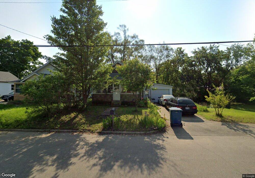
18 Bradford St Battle Creek, MI 49014
Estimated Value: $97,000 - $123,000
3
Beds
1
Bath
800
Sq Ft
$135/Sq Ft
Est. Value
About This Home
This home is located at 18 Bradford St, Battle Creek, MI 49014 and is currently estimated at $107,875, approximately $134 per square foot. 18 Bradford St is a home located in Calhoun County with nearby schools including Harper Creek Middle School, Harper Creek High School, and St. Philip Catholic Central High School.
Ownership History
Date
Name
Owned For
Owner Type
Purchase Details
Closed on
Jun 12, 2023
Sold by
Hunsicker Elaine Joyce
Bought by
Hunsicker Thomas J
Current Estimated Value
Purchase Details
Closed on
Apr 22, 2011
Sold by
Whitley Esther Louise and The Estate Of Glenn Edward Rob
Bought by
Hunsicker Elaine J
Purchase Details
Closed on
Sep 15, 2010
Sold by
Robbins Glenn Edward
Bought by
Robbins Glenn Edward and Vaxter Estella Susan
Purchase Details
Closed on
Nov 26, 1985
Sold by
Franklin Mary and Robbins Glenn
Bought by
Franklin Mary M and Robbins Glenn
Create a Home Valuation Report for This Property
The Home Valuation Report is an in-depth analysis detailing your home's value as well as a comparison with similar homes in the area
Home Values in the Area
Average Home Value in this Area
Purchase History
| Date | Buyer | Sale Price | Title Company |
|---|---|---|---|
| Hunsicker Thomas J | -- | None Listed On Document | |
| Hunsicker Elaine J | $17,500 | Chicago Title Of Michigan | |
| Robbins Glenn Edward | -- | None Available | |
| Franklin Mary M | -- | -- |
Source: Public Records
Tax History Compared to Growth
Tax History
| Year | Tax Paid | Tax Assessment Tax Assessment Total Assessment is a certain percentage of the fair market value that is determined by local assessors to be the total taxable value of land and additions on the property. | Land | Improvement |
|---|---|---|---|---|
| 2025 | $646 | $50,680 | $0 | $0 |
| 2024 | $376 | $27,810 | $0 | $0 |
| 2023 | $841 | $22,690 | $0 | $0 |
| 2022 | $604 | $15,600 | $0 | $0 |
| 2021 | $988 | $15,050 | $0 | $0 |
| 2020 | $813 | $14,650 | $0 | $0 |
| 2019 | $1,133 | $14,650 | $0 | $0 |
| 2018 | $822 | $14,600 | $1,800 | $12,800 |
| 2017 | $822 | $14,000 | $0 | $0 |
| 2016 | $822 | $13,650 | $0 | $0 |
| 2015 | $772 | $12,800 | $5,076 | $7,724 |
| 2014 | $772 | $18,100 | $5,076 | $13,024 |
Source: Public Records
Map
Nearby Homes
- 23 Bradford St
- 79 Clark St
- 138 Rook St
- 0 Rook St Unit 25019652
- 131 Academy St
- 222 Lathrop Ave
- 116 Inn Rd
- 140 Princeton St S
- 232 Cliff St
- 507 Michigan Ave E
- 501 Michigan Ave E
- 118 Nelson St
- 174 Lathrop Ave
- 155 Post Ave
- 255 Livingston St
- 0 E River Rd
- 180 Grenville St
- 250 Silver St
- 85 East Ave S
- 130 Cliff St