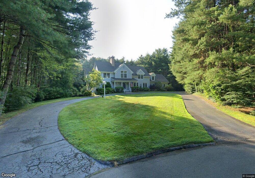
18 Brook Ridge West Simsbury, CT 06092
Estimated Value: $1,057,742 - $1,134,000
4
Beds
4
Baths
4,235
Sq Ft
$256/Sq Ft
Est. Value
About This Home
This home is located at 18 Brook Ridge, West Simsbury, CT 06092 and is currently estimated at $1,084,247, approximately $256 per square foot. 18 Brook Ridge is a home located in Hartford County with nearby schools including Tootin' Hills School, Henry James Memorial School, and Simsbury High School.
Ownership History
Date
Name
Owned For
Owner Type
Purchase Details
Closed on
Aug 16, 2016
Sold by
Shanfield Francine N
Bought by
Budzik Matthew J and Willis Kerri M
Current Estimated Value
Home Financials for this Owner
Home Financials are based on the most recent Mortgage that was taken out on this home.
Original Mortgage
$580,000
Outstanding Balance
$462,772
Interest Rate
3.48%
Mortgage Type
Purchase Money Mortgage
Estimated Equity
$621,475
Purchase Details
Closed on
Jul 30, 1998
Sold by
Hardcastle Patricia
Bought by
Shanfield Robert J and Shanfield Francine N
Purchase Details
Closed on
Apr 10, 1996
Sold by
Avonridge Inc
Bought by
Tetreault Stewart
Create a Home Valuation Report for This Property
The Home Valuation Report is an in-depth analysis detailing your home's value as well as a comparison with similar homes in the area
Home Values in the Area
Average Home Value in this Area
Purchase History
| Date | Buyer | Sale Price | Title Company |
|---|---|---|---|
| Budzik Matthew J | $725,000 | -- | |
| Shanfield Robert J | $730,000 | -- | |
| Tetreault Stewart | $691,000 | -- |
Source: Public Records
Mortgage History
| Date | Status | Borrower | Loan Amount |
|---|---|---|---|
| Open | Tetreault Stewart | $580,000 | |
| Closed | Tetreault Stewart | $50,000 | |
| Previous Owner | Tetreault Stewart | $417,000 | |
| Previous Owner | Tetreault Stewart | $555,000 |
Source: Public Records
Tax History Compared to Growth
Tax History
| Year | Tax Paid | Tax Assessment Tax Assessment Total Assessment is a certain percentage of the fair market value that is determined by local assessors to be the total taxable value of land and additions on the property. | Land | Improvement |
|---|---|---|---|---|
| 2025 | $21,243 | $621,880 | $120,400 | $501,480 |
| 2024 | $20,715 | $621,880 | $120,400 | $501,480 |
| 2023 | $19,788 | $621,880 | $120,400 | $501,480 |
| 2022 | $18,737 | $485,030 | $127,380 | $357,650 |
| 2021 | $18,737 | $485,030 | $127,380 | $357,650 |
| 2020 | $17,990 | $485,030 | $127,380 | $357,650 |
| 2019 | $18,101 | $485,030 | $127,380 | $357,650 |
| 2018 | $18,232 | $485,030 | $127,380 | $357,650 |
| 2017 | $19,904 | $513,520 | $148,380 | $365,140 |
| 2016 | $19,062 | $513,520 | $148,390 | $365,130 |
| 2015 | $19,062 | $513,520 | $148,390 | $365,130 |
| 2014 | $19,072 | $513,520 | $148,390 | $365,130 |
Source: Public Records
Map
Nearby Homes
- 24 Drumlin Rd
- 370A W Mountain Rd
- 395 Bushy Hill Rd
- 41 Applegate Ln
- 3 Applegate Ln Unit 3
- 31 Applegate Ln Unit 31
- 49 Applegate Ln Unit 49
- 121 Gracey Rd
- 6 Highwood Rd
- 19 Glenbrook Dr
- 70 Trailsend Dr
- 41 Secret Lake Rd
- 14 Nod Brook Dr
- 54 Secret Lake Rd
- 1 Alcima Dr
- 519 Dowd Ave Unit 519
- 18 Sunset Trail
- 141 Dowd Ave
- 301 Bushy Hill Rd
- 15 Red Fox Run
- 12 Brook Ridge
- 8 Brook Ridge
- 18 Old Stone Crossing
- 15 Brook Ridge
- 4 Brook Ridge
- 11 Brook Ridge
- 7 Brook Ridge
- 70 Notch Rd
- 3 Brook Ridge
- 15 Old Stone Crossing
- 21 Old Stone Crossing
- 6 Old Stone Crossing
- 5 Great Meadows
- 11 Old Stone Crossing
- 25 Old Stone Crossing
- 28 Old Stone Crossing
- 1 Great Meadows
- 2 Old Stone Crossing
- 85 Washburn Rd
- 94 Washburn Rd