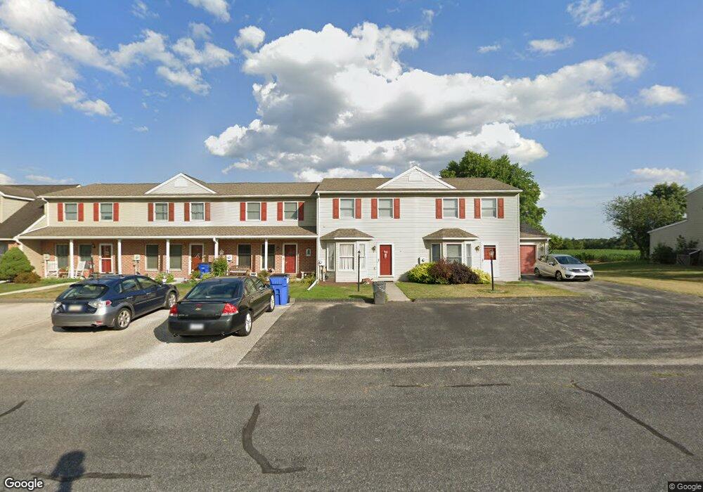
18 Cannon Ln Unit 54 Gettysburg, PA 17325
Estimated Value: $198,000 - $213,853
2
Beds
2
Baths
1,606
Sq Ft
$128/Sq Ft
Est. Value
About This Home
This home is located at 18 Cannon Ln Unit 54, Gettysburg, PA 17325 and is currently estimated at $205,963, approximately $128 per square foot. 18 Cannon Ln Unit 54 is a home located in Adams County with nearby schools including Rolling Acres El School, Maple Avenue Middle School, and Littlestown Senior High School.
Ownership History
Date
Name
Owned For
Owner Type
Purchase Details
Closed on
Oct 23, 2010
Sold by
Shutt Steven P and Shutt Julia D
Bought by
Miller Charles R and Miller Delores A
Current Estimated Value
Home Financials for this Owner
Home Financials are based on the most recent Mortgage that was taken out on this home.
Original Mortgage
$124,347
Outstanding Balance
$82,306
Interest Rate
4.41%
Mortgage Type
New Conventional
Estimated Equity
$123,657
Create a Home Valuation Report for This Property
The Home Valuation Report is an in-depth analysis detailing your home's value as well as a comparison with similar homes in the area
Home Values in the Area
Average Home Value in this Area
Purchase History
| Date | Buyer | Sale Price | Title Company |
|---|---|---|---|
| Miller Charles R | $120,000 | -- |
Source: Public Records
Mortgage History
| Date | Status | Borrower | Loan Amount |
|---|---|---|---|
| Open | Miller Charles R | $124,347 |
Source: Public Records
Tax History Compared to Growth
Tax History
| Year | Tax Paid | Tax Assessment Tax Assessment Total Assessment is a certain percentage of the fair market value that is determined by local assessors to be the total taxable value of land and additions on the property. | Land | Improvement |
|---|---|---|---|---|
| 2025 | $2,646 | $136,500 | $25,000 | $111,500 |
| 2024 | $2,532 | $136,500 | $25,000 | $111,500 |
| 2023 | $2,483 | $136,500 | $25,000 | $111,500 |
| 2022 | $2,465 | $136,500 | $25,000 | $111,500 |
| 2021 | $2,380 | $136,500 | $25,000 | $111,500 |
| 2020 | $2,346 | $136,500 | $25,000 | $111,500 |
| 2019 | $2,297 | $136,500 | $25,000 | $111,500 |
| 2018 | $2,248 | $136,500 | $25,000 | $111,500 |
| 2017 | $2,181 | $136,500 | $25,000 | $111,500 |
| 2016 | -- | $136,500 | $25,000 | $111,500 |
| 2015 | -- | $136,500 | $25,000 | $111,500 |
| 2014 | -- | $136,500 | $25,000 | $111,500 |
Source: Public Records
Map
Nearby Homes
- 48 Cannon Ln Unit 105
- 27 Maple St
- 8 Maple St
- 25 Harvest Dr
- 28 Bonniefield Cir Unit 25
- 67 Cedarfield Dr
- 13 N Pine St
- 1 Hickory Ave
- 549 Grant Dr Unit 549
- 780 White Hall Rd
- 871 Sherman Dr Unit 871
- 2746 Baltimore Pike
- 464 Locust Ln
- 948 Heritage Dr Unit 948
- 860 Bon Ox Rd
- 198 Longstreet Dr Unit 198
- 279 Longstreet Dr Unit 279
- 930 Hoffman Rd
- 1365 Hanover Rd Unit 15
- 0 Littlestown Rd
- 16 Cannon Ln Unit 53
- 20 Cannon Ln Unit 55
- 14 Cannon Ln Unit 52
- 12 Cannon Ln
- 10 Cannon Ln Unit 50
- 26 Cannon Ln Unit 56
- 8 Cannon Ln Unit 49
- 28 Cannon Ln Unit 57
- 30 Cannon Ln Unit 58
- 27 Cannon Ln Unit 67
- 32 Cannon Ln Unit 59
- 27 Colonial Dr
- 17 Cannon Ln Unit 62
- 19 Cannon Ln Unit 63
- 34 Cannon Ln Unit 60
- 21 Cannon Ln Unit 64
- 23 Cannon Ln Unit 65
- 25 Cannon Ln
- 11 Cannon Ln
- 25 Colonial Dr Unit 38