18 Capstan Cir Mashpee, MA 02649
Estimated Value: $1,714,000 - $2,914,000
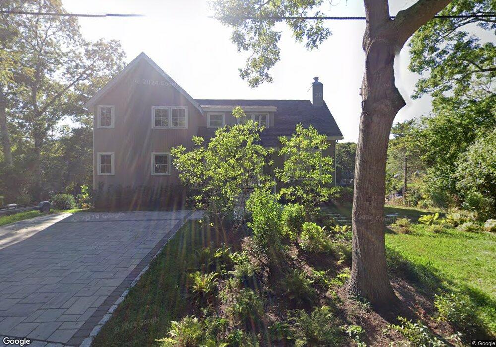
About This Home
This home is located at 18 Capstan Cir, Mashpee, MA 02649 and is currently estimated at $2,392,969, approximately $1,594 per square foot. 18 Capstan Cir is a home located in Barnstable County with nearby schools including Kenneth C. Coombs School, Quashnet School, and Mashpee Middle School.
Ownership History
We collect this data history from publicly available records. To have your information removed, we recommend requesting removal directly through your county’s website.
Purchase Details
Home Financials for this Owner
Home Financials are based on the most recent Mortgage that was taken out on this home.Purchase History
We collect this data history from publicly available records. To have your information removed, we recommend requesting removal directly through your county’s website.
| Date | Buyer | Sale Price | Title Company |
|---|---|---|---|
| $330,000 | -- | ||
| $330,000 | -- |
Mortgage History
We collect this data history from publicly available records. To have your information removed, we recommend requesting removal directly through your county’s website.
| Date | Status | Borrower | Loan Amount |
|---|---|---|---|
| Open | $215,000 | ||
| Closed | $215,000 |
Tax History
We collect this data history from publicly available records. To have your information removed, we recommend requesting removal directly through your county’s website.
| Year | Tax Paid | Tax Assessment Tax Assessment Total Assessment is a certain percentage of the fair market value that is determined by local assessors to be the total taxable value of land and additions on the property. | Land | Improvement |
|---|---|---|---|---|
| 2025 | $15,001 | $2,266,000 | $1,410,700 | $855,300 |
| 2024 | $13,544 | $2,106,300 | $1,282,700 | $823,600 |
| 2023 | $9,640 | $1,375,200 | $1,221,300 | $153,900 |
| 2022 | $9,961 | $1,219,200 | $1,058,300 | $160,900 |
| 2021 | $10,731 | $1,183,100 | $1,047,500 | $135,600 |
| 2020 | $10,346 | $1,138,200 | $1,007,400 | $130,800 |
| 2019 | $10,223 | $1,129,600 | $1,007,400 | $122,200 |
| 2018 | $9,964 | $1,117,000 | $1,007,400 | $109,600 |
| 2017 | $10,172 | $1,106,900 | $1,007,400 | $99,500 |
| 2016 | $10,166 | $1,100,200 | $1,007,400 | $92,800 |
| 2015 | $9,984 | $1,095,900 | $1,007,400 | $88,500 |
| 2014 | $10,152 | $1,081,100 | $993,700 | $87,400 |
Map
- 16 Bosun's Ln
- 16 Bosuns Ln
- 18 Spoondrift Cir
- 157 Wading Place Rd
- 35 Shore Dr
- 55 Summersea Rd
- 86 Summersea Rd
- 80 & 86 Summersea Rd
- 80 Summersea Rd
- 102 Summersea Rd
- 37 Uncle Henrys Rd
- 25 Clover Ln
- 10 Rock Landing Rd
- 14 Azalea Ln
- 26 The Morgan Cir
- 79 Cobblestone Cir
- 140 Summersea Rd
- 26 Cobblestone Cir
- 24 Cobblestone Cir
- 4 Osprey Ct
Ask me questions while you tour the home.