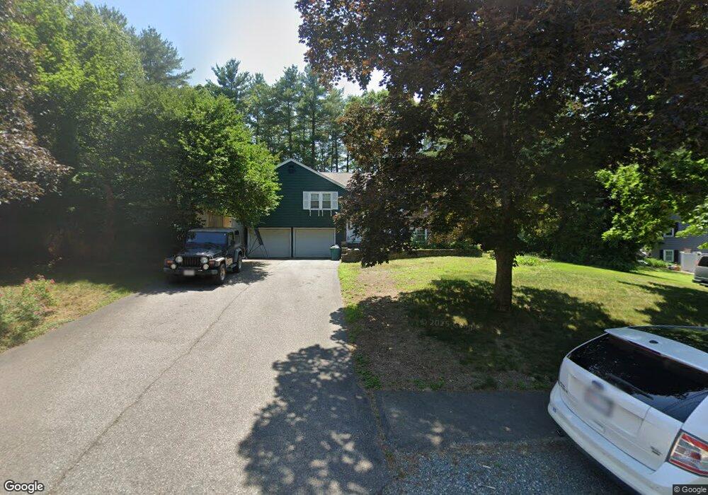
18 Clarkson Dr Walpole, MA 02081
Estimated Value: $728,000 - $822,000
3
Beds
2
Baths
1,926
Sq Ft
$405/Sq Ft
Est. Value
About This Home
This home is located at 18 Clarkson Dr, Walpole, MA 02081 and is currently estimated at $779,586, approximately $404 per square foot. 18 Clarkson Dr is a home located in Norfolk County with nearby schools including Elm Street School, Eleanor N. Johnson Middle School, and Walpole High School.
Ownership History
Date
Name
Owned For
Owner Type
Purchase Details
Closed on
Oct 30, 2009
Sold by
Delaney James F and Delaney Gail
Bought by
Walsh Thomas J and Walsh Lisa M
Current Estimated Value
Home Financials for this Owner
Home Financials are based on the most recent Mortgage that was taken out on this home.
Original Mortgage
$183,500
Outstanding Balance
$120,185
Interest Rate
5.06%
Mortgage Type
Purchase Money Mortgage
Estimated Equity
$659,401
Purchase Details
Closed on
Jan 8, 1999
Sold by
Dassow Gary D and Dassow Sharon L
Bought by
Delaney James F
Home Financials for this Owner
Home Financials are based on the most recent Mortgage that was taken out on this home.
Original Mortgage
$180,000
Interest Rate
6.8%
Mortgage Type
Purchase Money Mortgage
Purchase Details
Closed on
Jun 1, 1990
Sold by
Niland Peter J
Bought by
Dassow Gary D
Home Financials for this Owner
Home Financials are based on the most recent Mortgage that was taken out on this home.
Original Mortgage
$140,800
Interest Rate
10.25%
Mortgage Type
Purchase Money Mortgage
Create a Home Valuation Report for This Property
The Home Valuation Report is an in-depth analysis detailing your home's value as well as a comparison with similar homes in the area
Home Values in the Area
Average Home Value in this Area
Purchase History
| Date | Buyer | Sale Price | Title Company |
|---|---|---|---|
| Walsh Thomas J | $367,000 | -- | |
| Delaney James F | $236,000 | -- | |
| Dassow Gary D | $179,000 | -- |
Source: Public Records
Mortgage History
| Date | Status | Borrower | Loan Amount |
|---|---|---|---|
| Open | Walsh Thomas J | $183,500 | |
| Previous Owner | Dassow Gary D | $180,000 | |
| Previous Owner | Dassow Gary D | $135,000 | |
| Previous Owner | Dassow Gary D | $140,000 | |
| Previous Owner | Dassow Gary D | $140,800 |
Source: Public Records
Tax History
| Year | Tax Paid | Tax Assessment Tax Assessment Total Assessment is a certain percentage of the fair market value that is determined by local assessors to be the total taxable value of land and additions on the property. | Land | Improvement |
|---|---|---|---|---|
| 2025 | $8,442 | $658,000 | $339,600 | $318,400 |
| 2024 | $8,248 | $623,900 | $326,500 | $297,400 |
| 2023 | $7,792 | $561,000 | $283,900 | $277,100 |
| 2022 | $7,211 | $498,700 | $263,000 | $235,700 |
| 2021 | $6,938 | $467,500 | $248,000 | $219,500 |
| 2020 | $6,834 | $455,900 | $234,000 | $221,900 |
| 2019 | $6,606 | $437,500 | $225,000 | $212,500 |
| 2018 | $6,337 | $415,000 | $217,200 | $197,800 |
| 2017 | $6,130 | $399,900 | $208,900 | $191,000 |
| 2016 | $5,958 | $382,900 | $200,900 | $182,000 |
| 2015 | $5,570 | $354,800 | $183,200 | $171,600 |
| 2014 | $5,314 | $337,200 | $183,200 | $154,000 |
Source: Public Records
Map
Nearby Homes
- 13 Sandtrap Cir Unit 14
- 11 Sandtrap Cir Unit 15
- 20 Sandtrap Cir Unit 4
- 19 Sandtrap Cir Unit 11
- 18 Sandtrap Cir Unit 3
- 17 Sandtrap Cir Unit 12
- 15 Sandtrap Cir Unit 13
- 1391 Main St Unit 308
- 1391 Main St Unit 306
- 1391 Main St Unit 304
- 25 Sandtrap Cir Unit 8
- 29 Sandtrap Cir Unit 6
- 27 Sandtrap Cir Unit 7
- 21 Sandtrap Cir Unit 10
- 27 Sandtrip Cir Unit 7
- 10 Sandtrap Cir Unit 2
- 31 Sandtrap Cir Unit 500
- 20 Forrest Rd
- 127 Clear Pond Dr
- 137 Clear Pond Dr
- 20 Clarkson Dr
- 16 Clarkson Dr
- 31 Hitching Post Dr
- 27 Hitching Post Dr
- 17 Clarkson Dr
- 35 Hitching Post Dr
- 19 Clarkson Dr
- 22 Clarkson Dr
- 15 Clarkson Dr
- 14 Clarkson Dr
- 23 Hitching Post Dr
- 39 Hitching Post Dr
- 21 Clarkson Dr
- 4 Cypress Ln
- 13 Clarkson Dr
- 24 Clarkson Dr
- 28 Hitching Post Dr
- 32 Hitching Post Dr
- 0 Lot 42 Cypress Ln
- 0 Lot 41 Cypress Ln